
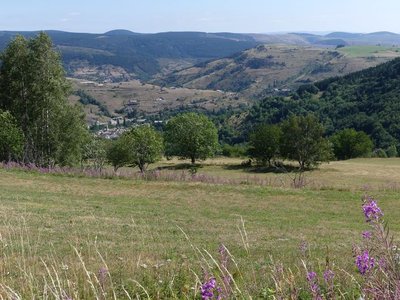
Village on Mont Lozère’s northern slope, Trail #16
A runnable trail that goes down to Cubières from the Station and back up to the Col de Finiels pass.
8 points of interest
Cubières depuis le Causse - nathalie.thomas  History
Cubières
This village, which was founded long ago, owes its name (cubereis) to the copper that the Gallo-Romans mined here. In the Middle Ages, under the protection of the local lord, villagers had to mill flour and then bake their bread in the shared bread oven, which was the property of the Seigneur du Tournel. Whenever they did so, he received a tax called the ban. This feudal right was abolished during the French Revolution, and the oven simply became the village oven.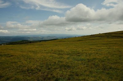
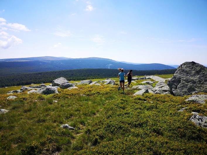
Paysage - © Brigitte Mathieu  Flora
FloraSubalpine short-grass prairie
Marker 1
Like garden or sports pitches, short-grass prairies are shaped by mankind. Grazing and controlled burns are the tools for their maintenance here. The main plants are nard and fescue, perennial grasses related to wheat. If you cut (graze) one of their stalks, five more will soon form; if you trample them, they multiply and become very dense. This kind of “torture” creates a thick plant cover that stabilises the sparse dark soil, which is derived from erosion of the ever-present granite. Here, then, are some clues for the appropriate management of this environment, which becomes weakened if neglected.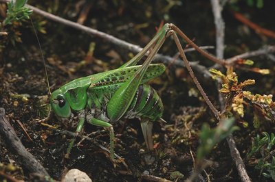
Dectique verrucivore (Decticus verrucivorus) - © Bruno Descaves  Fauna
FaunaSmall grassland creatures
Marker 2
Each spring, a demographic explosion of fauna prepares itself to burst forth in the summer. Earlier in the year, the thousands of small creatures to be seen here have not yet finished their metamorphoses, and the various species are difficult to recognise as larvae. Subalpine short-grass prairies attract a specific mountain fauna that is getting rarer everywhere else in Europe, such as the Stauroderus scalaris cricket, which tirelessly enlivens the pastures with its summer concerts. Crickets only eat plant matter whereas grasshoppers, such as the wart-biter, tend to be carnivorous. Many butterflies visit the flowers.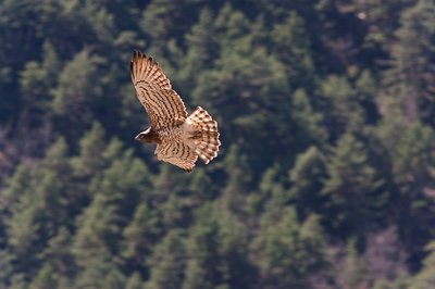
Circaète Jean le Blanc - © Jean-Pierre Malafosse FaunaBirds
Vertebrates benefit from the plants or from small prey, especially hares or the common lizards with its thick tail, which is coveted by the reptile-eating short-toed snake eagle. Among the birds of prey, you may spot the characteristic silhouette of a Montagu’s harrier or hen harrier, with their low contour-hugging flight. Among the many passerines, you may spot the Northern wheatear, a summer guest, sitting on a stone, or more rarely a grey partridge. If you listen, you may well hear larks singing.
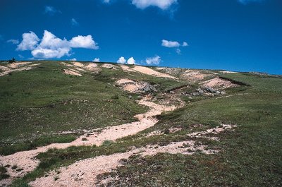
Érosion, passage des transhumants - © Parc national des Cévennes  Landscape
An endangered landscape
Marker 3
This vast expanse of short-grass prairie, an area of historical and natural heritage, is endangered today. The surface area of this relic has been much reduced over the past few decades. While the summits are made stable by the prairie, the mountain side presents evidence of erosion (denuded rocks) that is the result of foresters’ attempts at reforestation. On the ledge, pines are starting to establish themselves at the expense of the prairie. These zones have become fragile and need better management of all the territory’s elements. Shepherds will have to guide their flocks carefully here, so as to avoid making erosion worse but also to eliminate pine seedlings. Flora
FloraThe prairie's botanical rivals
Marker 4.
Below you, vast areas have been planted with pines and other conifers. The interest and regional and European rarity of short-grass prairies mean that they must be clearly demarcated from the forest. In fact, natural seeding of pines, carried onto the prairie by the south wind, has created a new forest. This plant dynamic, which is entirely logical at the altitude, gives the forest the upper hand over the prairie. The European Union is currently helping local participants to fell these new trees so as to protect the prairie. On your return leg, you will see other indigenous tree species which could encroach on the prairie in the same way (beech, birch).- Flora
Low-growing plants and shrubs
A large amount of sunshine encourages many low-growing grasses from other botanical families to appear among the fescue and nard. They are almost all perennial. They form a veritable tangle of plants. Among the pretty alpine flowers are the spring pasque flower and the blue dwarf spring gentian in summer. Other, smaller plants are perfectly capable of “making holes” in a short-grass prairie that is less intensely grazed than before. Grass networks that lose in density develop weak points that shrubs exploit to grow at the very heart of the prairie: blueberries, which are here associated with lingonberries (cowberries) and calluna, a type of heather.
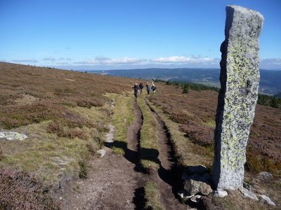
Les montjoies - Nathalie Thomas HistoryThe montjoies (cairns)
The "small menhirs" called montjoies that mark out the path did not grow by themselves.... Or rather, their origins were so long ago that nobody remembers. No matter! Look at these boundary markers and imagine for a moment that you are a giant who, after reading Hansel and Gretel, finds himself caught in a tourmente (heavy snowstorm and fog). Wouldn’t you have had the idea of planting a few pointed pebbles two-and-a-half metres high to be able to find your way back?
Description
After the first kilometre, which is identical to trail #15, this trail forks east onto the path that goes downhill to Lozeret. From there, a pleasant path between forest and pasture takes you the rest of the way down to Cubières. You then start to climb through the forest, on a path for the first 3 kilometres and then on a track for the next 5. These 8 km of continuous uphill with 650 m of elevation gain take you to the Col de Finiels pass. The magnificent views are ample reward for your efforts. You climb a few more metres towards the summit so as to enjoy the panoramic views, then fork onto the GR®70, which leads back to the Station.
Follow the waymarks for trail #16.
Signposts will guide you all along this route, as well as yellow painted waymarks. In the description below, the signposted place names and/or directions are given in bold italics between quotation marks:
From the "Station du mont-Lozère", go down to "Cubières" via :
- "La Massola",
- "Le Bois de Neyrac",
- "Lozeret",
- "Le Réservoir".
- At “Cubières” go down to
- “Village”, then go up to “Col de Finiels” via :
- “Pelloufet”,
- “Bois du Mathieu”,
- “Louzero de Broussoux”,
- “Ancienne Voie Romaine”.
- At the “Col de Finiels” return to the “Station du mont-Lozère” via :
- “Col de Finiels”,
- “Sous le Col de Finiels”,
- “Col de la Draille” (2),
- “Parking des Chômeurs”,
- “La Chapelle du Mont Lozère”.
This trail is taken from the guidebook Mont Lozère – Pays des sources, published by the Pôle de pleine nature du mont Lozère.
- Departure : Station du Mont-Lozère (ski and outdoor resort)
- Arrival : Station du Mont-Lozère
- Towns crossed : Cubières, Mont Lozère et Goulet, Cubiérettes, and Pont de Montvert - Sud Mont Lozère
Forecast
Altimetric profile
Recommandations
The summit is often windy – don’t forget your windcheater. Do not attempt this trail during dense fog or strong winds. Be particularly vigilant when there is snow and/or fog.
Caution: patous (livestock guard dogs) around Finiels! Seek advice on how to behave near these dogs from tourist offices and National Park information centres.
If you are starting this trail at the Station, the entire first stretch is downhill. Make sure you are sufficiently fit to come back uphill.
Before committing yourself to a circuit, ensure that it is suitable for your activity level and ability. Remember that the weather changes quickly in the mountains. Please close all gates and barriers behind you. Stay on the marked path.
Information desks
Tourism office Coeur de Lozère, Mende
BP 83, place du Foirail, 48000 Mende
This office is part of the National Park's associated tourist-information network, whose mission is to provide information on, and raise awareness of, the sites and events as well as the rules that must be observed in the National Park's central zone.
Open year-round

Office de tourisme Des Cévennes au mont Lozère
le Quai, 48220 Le Pont de Montvert sud mont-Lozère

Tourism office Mont-Lozère, Villefort
43, Place du Bosquet, 48800 Villefort
This office is part of the National Park's associated tourist-information network, whose mission is to provide information on, and raise awareness of, the sites and events as well as the rules that must be observed in the National Park's central zone.
Open year-round

Le Mas de la Barque outdoor centre
48800 Villefort
This centre is part of the National Park's associated tourist-information network, whose mission is to provide information on, and raise awareness of, the sites and events as well as the rules that must be observed in the National Park's central zone.
Transport
Ligne 253 (Mende)
https://ww.mestrajets.lio.laregion.fr
Access and parking
From Le Pont-de-Montvert, to Station du Mont-Lozère on the D 20 via the Col de Finiels pass.
From Le Bleymard, to Station du Mont-Lozère on the D 20.
Parking :
Calculateur d'itinéraire Lio
Utilisez le calculateur liO pour organiser votre trajet en région Occitanie.
Autres régions
Calculez votre itinéraire en Auvergne Rhône Alpes sur Oùra
Biodiversité autour de l'itinéraire
Source


Report a problem or an error
If you have found an error on this page or if you have noticed any problems during your hike, please report them to us here: