
The north slope of Mont Lozère #9
An itinerary without any tar for those who love great escapes !
5 points of interest
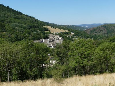
Bagnols-les-Bains - © Nathalie Thomas  History
Bagnols-les-Bains
Located close to the springs of the Lot, Bagnols-les-Bains has been favoured since Roman times for relaxing and getting back in shape. At an altitude of 900 m, this people-friendly health and spa resort has a hot spring, which gushes out of the mountain at a temperature of 41.5°C. It is a place for recharging your batteries surrounded by a protected natural environment, alternating outdoor activities and wellness treatments.
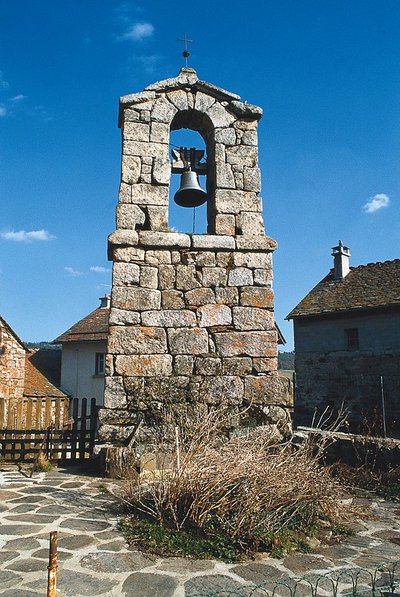
locher de tourmente des Sagnes - © Guy Grégoire HistoryBlizzard belltowers
Caught in a violent storm, peddlers, farmers or the local abbot might hesitate over which track to take in the fog. Perhaps they missed a turning. Then they would hear the tolling of the invisible but reassuring bell, signalling the right way. The Serviès belltower is unique in having a shelter, which kept the bell ringer dry and comforted the passer-by. These small belltowers were also used to ring the Angelus bell in the morning and evening. It was also said that, as well as saving lost travellers, their sound waves kept hail away. The bishop of Mende prohibited this practice which, he declared, had more to do with superstition than observation. (B. Mathieu)
Tourbière des Sagnes - © Guy Grégoire  Flora
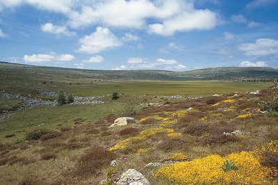
FloraLes Sagnes peatbog
Peatbogs are magnificent relics of post-glacial lakes that slowly filled with decomposing plant matter. They form an eco-system that is specific to cold climates and acid soils. In their secret depths, partly rotted substances or pollen might tell us that a forest of hazelnut trees grew here 9,000 years ago, ousted first by an oak grove and then, 4,000 years later, by a beech forest. Another two millennia later, humans burnt the beech grove to grow cereals and graze livestock. Today, peatbogs are protected at the European level. (B. Mathieu)
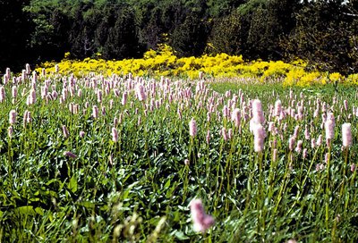
Renouée bistorte - © Yves Maccagno FloraA riot of colours
In the damp prairies of this immense plateau, riots of colour occur every year. Marsh marigold disguises itself as buttercups; yellow gentian sits on its fever-reducing root also used to make an aperitif; bistort with its soft pink flowers is disdained by the cows. In the Carex (sedge) family, the most striking plant is star sedge. As for the sundew, or drosera rotundifolia: the spectacle of an insect being absorbed by the glandular hairs on its leaves is reserved for advanced botanists! After this session at ground level of the marsh, raise your eyes to the horizon to admire the two unchanging, face-to-face profiles: the Roc de Serviès and the Roc des Laubies. (B. Mathieu)
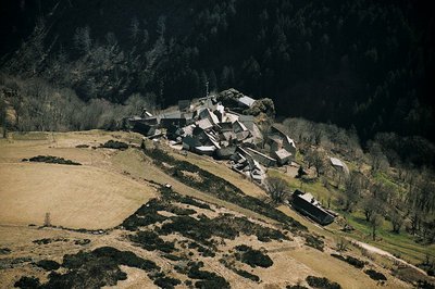
Serviès - © Pierre Lahoud HistoryServiès
Not even memories remain of the inaccessible castle built on the rock south of the village of Serviès. And yet its lords – subjects of the lords of Tournel – had many vassals whose ground rents they collected. But living conditions were too harsh, and access was too difficult. The lords left ages ago, abandoning the hamlet to its winter isolation, thick fogs and changing winds, which can disorientate walkers so much that they die of exposure. (B. Mathieu)
Description
Signposts will guide you all along this route: follow the waymarks for trail #9.
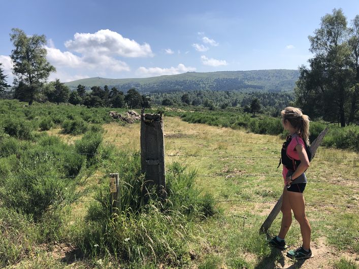
Your adventure starts with a rather steep climb on a pleasant little path. The slope becomes gentler, and you enter a pretty area of undergrowth. A small bridge takes you across the stream, then you start the climb to L’Oultet. Cross the hamlet and take the GR® (long-distance hiking path) towards Lozerette. You will cross rivers several times (some crossings are muddy, be careful) before starting a climb of five kilometres on a nice singletrack. There are magnificent views of Mont Lozère all along – don’t forget to take a breather and admire the view!
Your reward for this handsome climb? The incredible village of Lozerette, worth seeing so you can talk about it… You then take a small track to the hamlet of Serviès, then another to Les Sagnes. Go slightly uphill before going downhill to the magnificent hamlet of Auriac. Join the GR® again, to the Menhir de la Felgère. From this standing stone, after a short section on a track, the descent is on a wooded path. Cross the stream one last time, and you’ve arrived !
Signposts will guide you all along this route, as well as yellow painted waymarks. In the description below, the signposted place names and/or directions are given in bold italics between quotation marks:
From « Bagnols-les-Bains » , go to « Auriac » via :
- « Avenue de la Gare »,
- « Route de la Loubière »,
- « La Destourbe »,
- " La Montagnac",
- « Lou Peyrou ».
- At « Auriac » go to « Serviès » via :
- « Croix du Peyrou », then through the village Les Sagnes.
- At « Serviès » go to
- « Lozerette » then
- « Oultet ». Then go down to
- « La Dabalade ». Return to « Bagnols-les-Bains » via
- « Lou Mapas »,
- « La Destourbe », « Route de la Loubière », « Avenue de la Gare ».
This hike is taken from the guidebook Mont Lozère – Pays des sources, de la montagne du Goulet aux gorges du Bramont, published by the Pôle de pleine nature du Mont Lozère.
- Departure : Bagnols-les-Bains
- Arrival : Bagnols-les-Bains
- Towns crossed : Mont Lozère et Goulet
Forecast
Altimetric profile
Recommandations
Before committing yourself to a circuit, ensure that it is suitable for your activity level and ability. Remember that the weather changes quickly in the mountains. Please close all gates and barriers behind you. Stay on the marked path.
Information desks

Tourism office Coeur de Lozère, Mende
BP 83, place du Foirail, 48000 Mende
This office is part of the National Park's associated tourist-information network, whose mission is to provide information on, and raise awareness of, the sites and events as well as the rules that must be observed in the National Park's central zone.
Open year-round

Office de tourisme Des Cévennes au mont Lozère
le Quai, 48220 Le Pont de Montvert sud mont-Lozère

Tourism office Mont-Lozère, Bagnols-les-Bains
avenue de la gare, 48190 Bagnols-les-Bains Mont-Lozere et Goulet
This office is part of the National Park's associated tourist-information network, whose mission is to provide information on, and raise awareness of, the sites and events as well as the rules that must be observed in the National Park's central zone. Open from mid-April to late September
Access and parking
From Le Bleymard, on the D 901.
From Mende, towards Badaroux on the RN 88, then to Ste-Hélène / Bagnols-les-Bains on the D 901.
Parking :
Calculateur d'itinéraire Lio
Utilisez le calculateur liO pour organiser votre trajet en région Occitanie.
Autres régions
Calculez votre itinéraire en Auvergne Rhône Alpes sur Oùra
Biodiversité autour de l'itinéraire
Source


Report a problem or an error
If you have found an error on this page or if you have noticed any problems during your hike, please report them to us here: