
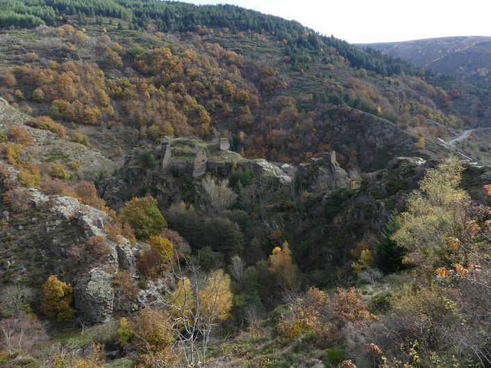
Le Fossat
As you gain height, you get open views onto the north slope of Mont Lozère. The donwhill section is in the valat (valley) of the Rouvière, one of the tributaries of the Altier river. Take the time to visit the fortress on its rocky spur.
Description
Signposts will guide you all along this route, as well as yellow painted waymarks. In the description below, the signposted place names and/or directions are given in bold italics between quotation marks :
Starting at “Altier”, walk uphill to :
- “Roche Crouzet”, then :
- “Le Fossat” then turn right to « Le Grand Altier » via :
- “Racouse”.
- Then “Le Grand Altier”. Return to “Altier” via :
- “Roche Crouzet”.
This hike is taken from the guidebook Mont Lozère - Pays des sources de la Margeride au lac de Villefort en Cévennes published by the Pôle de pleine nature du Mont Lozère.
- Departure : Altier
- Arrival : Altier
- Towns crossed : Altier
Forecast
Altimetric profile
Recommandations
Make sure your equipment is appropriate for the day’s weather conditions. Remember that the weather changes quickly in the mountains. Take enough water, wear sturdy shoes and put on a hat. Please close any gates and barriers behind you.
Information desks

Tourism'house and national Parc at Florac
Place de l'ancienne gare, N106, 48400 Florac-trois-rivières
This office is part of the National Park's associated tourist-information network, whose mission is to provide information on, and raise awareness of, the sites and events as well as the rules that must be observed in the National Park's central zone.
On site: exhibitions, video projections, events and shop Open year-round

Tourism office Mont-Lozère, Villefort
43, Place du Bosquet, 48800 Villefort
This office is part of the National Park's associated tourist-information network, whose mission is to provide information on, and raise awareness of, the sites and events as well as the rules that must be observed in the National Park's central zone.
Open year-round
Transport
This hike is accessible by public transport only in summer.
To consult the updated schedules and plan your trip, use the route calculator below by entering the arrival stop : ALTIER - Biscuiterie Chataigne
Access and parking
From Villefort towards Lac de Villefort, then on the D901 to Altier
Parking :
Calculateur d'itinéraire Lio
Utilisez le calculateur liO pour organiser votre trajet en région Occitanie.
Autres régions
Calculez votre itinéraire en Auvergne Rhône Alpes sur Oùra
Biodiversité autour de l'itinéraire
Source


Report a problem or an error
If you have found an error on this page or if you have noticed any problems during your hike, please report them to us here: