
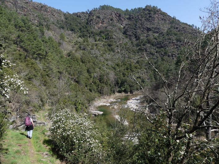
The Luech valley
3 points of interest
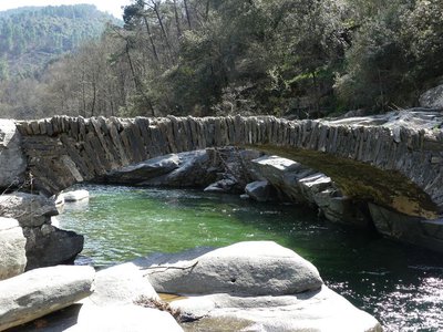
La pontière de Vildou - Nathalie Thomas  Architecture
Stone bridges over the Vildou.
The small stone bridges have long replaced the wooden footbridges, which the floods invariably carried off every year. Mostly built in the 18th century, these modest but astonishingly resistant structures are true artistic and technical masterpieces. Inspired by a Roman model, they consist of a single arch that straddles the waterway and sits on bedrock at each end. No central pillar blocks the flow of the river.
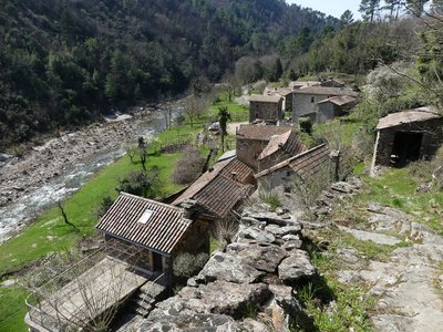
Chareneuve - Nathalie Thomas  Water
WaterThe hamlet of Chareneuve
The charm of these handsome village houses invites us to slow down. Our eye is drawn to the wide, white-water béal (irrigation channel). This very old and still maintained channel takes the water to the gardens, which are said to have the canton’s earliest harvests! The channel empties into a basin of calm water. Behind it, the mill with its admirable roof ridge consisting of crossed lauzes (tilestones) had a system of wheels placed horizontally and driven by a vertical shaft, which enabled them to function even in times of low water. The water stored in the basin could also compensate for low flow.
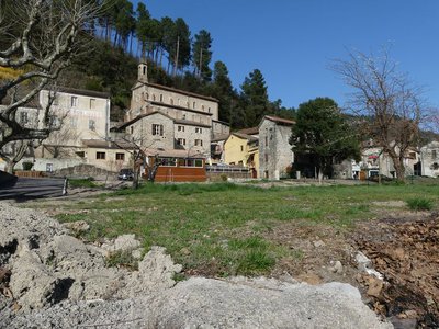
Le Chambon - Nathalie Thomas  History
Le Chambon
The history of Le Chambon is turbulent and set to the rhythm of its successive owners: feudal lords, the parish, the school authorities and the village council.
The oldest parchment dates to 17 April 1295. It refers to the sale of the fiefdom of Le Chambon to the Lord of Portes, whose property it remained until the 17th century, when it was bought by Mr Roussel. It later became part of Sénéchas. Le Chambon did not become its own municipality until 1839, when it had around 800 inhabitants.
After endless debates about how far away the surrounding churches were, le Chambon built its own in 1889. At the time, its lanes were animated by two schools, six cafés, many artisans and miners. When the coal mines closed in the 1950s, the village began to empty. Today, green tourism is reviving it.
Description
Signposts will guide you all along this route. In the description below, the signposted place names and/or directions are given in bold italics between quotation marks:
Starting at “Le Chambon” :
- Direction “Chambon - Eglise”,
- Then “Chareneuve”,
- “Mas du Pellet”,
- “Le Recul”. Return to “Le Chambon”.
This hike is taken from the guidebook Mont Lozère – Pays des sources, Sommet des Cévennes, published by the Pôle de pleine nature du Mont Lozère.
- Departure : Le Chambon
- Arrival : Le Chambon
- Towns crossed : Chambon
Forecast
Altimetric profile
Recommandations
Make sure your equipment is appropriate for the day’s weather conditions. Remember that the weather changes quickly in the mountains. Take enough water, wear sturdy shoes and put on a hat.
Information desks

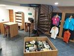
Tourism'house and national Parc at Florac
Place de l'ancienne gare, N106, 48400 Florac-trois-rivières
This office is part of the National Park's associated tourist-information network, whose mission is to provide information on, and raise awareness of, the sites and events as well as the rules that must be observed in the National Park's central zone.
On site: exhibitions, video projections, events and shop Open year-round
Tourism'house and national parc, Génolhac
Place du Colombier, 30450 Génolhac
This office is part of the National Park's associated tourist-information network, whose mission is to provide information on, and raise awareness of, the sites and events as well as the rules that must be observed in the National Park's central zone.
Open from april to october

Tourism office Mont-Lozère, Villefort
43, Place du Bosquet, 48800 Villefort
This office is part of the National Park's associated tourist-information network, whose mission is to provide information on, and raise awareness of, the sites and events as well as the rules that must be observed in the National Park's central zone.
Open year-round
Access and parking
From Chamborigaud, take the D29 to Le Chambon.
Parking :
Calculateur d'itinéraire Lio
Utilisez le calculateur liO pour organiser votre trajet en région Occitanie.
Autres régions
Calculez votre itinéraire en Auvergne Rhône Alpes sur Oùra
Biodiversité autour de l'itinéraire
Source


Report a problem or an error
If you have found an error on this page or if you have noticed any problems during your hike, please report them to us here: