
Mazel, Station du Mont Lozère
3 points of interest
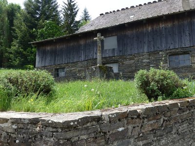
La croix des missions - Nathalie Thomas  History
The “mission” cross
In the municipality of Le Bleymard, there is a large number of crosses and other small religious heritage elements, which bear witness to inhabitants’ fervour in the old days. You will see them as you enter villages, on main squares and at crossroads, to protect the walker and ploughman. Offerings sometimes took the form of crosses, which were then called “mission” crosses.
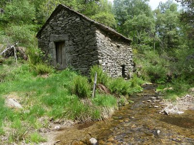
Le moulin de Malavieille - Nathalie Thomas HistoryMalavieille mill
This mill with its vertical axle has a horizontal water wheel directly linked to the axle of the millstone, which is also horizontal. The water arrives on the wheel, known as coupo (spoon in Occitan), via the canélou or millrace (canelon in Occitan). The vertical axle transmits the motion, turning the runner stone (the upper millstone), which is supported by the bedstone, the immobile lower millstone. The grain falls through the hopper into the bucket. The centrifugal force pushes the grain from the centre towards the outside; it is gradually crushed, and the flour and bran are expelled into the mill chest.
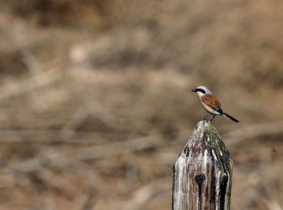
Pie-grièche écorcheur - Régis Descamps  Fauna
FaunaPasserine birds
Open spaces with a few trees and bushes favour passerine birds. Passerines are the largest and most varied order of birds, containing over half of all bird species. The red-backed shrike in particular likes this environment, which abounds in the large insects that constitute its main food source. The shrike is strictly migratory and hibernates in eastern Africa.
Description
Signposts will guide you all along this route. In the description below, the signposted place names and/or directions are given in bold italics between quotation marks:
Starting from "Le Bleymard", walk towards "Station du Mont Lozère" via :
- "La Remise",
- “Croix de la Mission”,
- "Eglise du Bleymard"
- “Le Cayre” (GR®43),
- “La Cham”.
- Then direction "Station du Mont Lozère". Go downhill to :
- “La Massola”,
- “Col Santel”.
This hike is taken from the guidebook Mont Lozère – Pays des sources, de la montagne du Goulet aux gorges du Bramont, published by the Pôle de pleine nature du Mont Lozère.
- Departure : Le Bleymard
- Arrival : Le Bleymard
- Towns crossed : Mont Lozère et Goulet and Cubières
Forecast
Altimetric profile
Recommandations
Make sure your equipment is appropriate for the day’s weather conditions. Remember that the weather changes quickly in the mountains. Take enough water, wear sturdy shoes and put on a hat. Please close any gates and barriers behind you.
Information desks

Tourism'house and national Parc at Florac
Place de l'ancienne gare, N106, 48400 Florac-trois-rivières
This office is part of the National Park's associated tourist-information network, whose mission is to provide information on, and raise awareness of, the sites and events as well as the rules that must be observed in the National Park's central zone.
On site: exhibitions, video projections, events and shop Open year-round

Tourism office Mont-Lozère, Villefort
43, Place du Bosquet, 48800 Villefort
This office is part of the National Park's associated tourist-information network, whose mission is to provide information on, and raise awareness of, the sites and events as well as the rules that must be observed in the National Park's central zone.
Open year-round
Transport
This hike is accessible by public transport only in summer.
To consult the updated schedules and plan your trip, use the route calculator below by entering the arrival stop: MONT LOZÈRE ET GOULET - LE BLEYMARD - Remise
Access and parking
From Mende towards Badaroux on the N88, then on the D901 Bagnols-les-Bains to Le Bleymard.
From Le Pont de Montvert-Sud-Mont-Lozère towards the Col de Finiels pass, then to Le Bleymard on the D20.
Parking :
Calculateur d'itinéraire Lio
Utilisez le calculateur liO pour organiser votre trajet en région Occitanie.
Autres régions
Calculez votre itinéraire en Auvergne Rhône Alpes sur Oùra
Biodiversité autour de l'itinéraire
Source


Report a problem or an error
If you have found an error on this page or if you have noticed any problems during your hike, please report them to us here: