
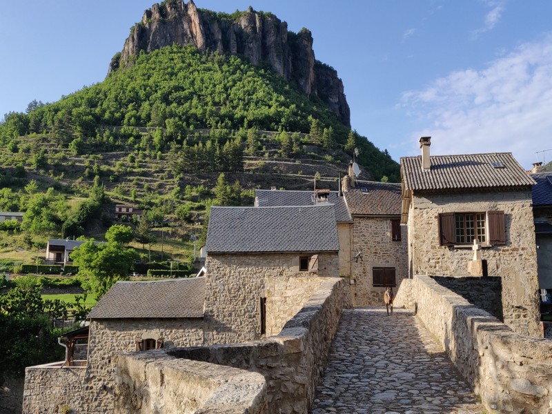
One foot in the Dourbie valley, the other in the Trévezel
Fall under the spell of the northernmost small villages in the Gard department… Trèves, on the Trévezel river, has been carefully restored. On the ridge, views open up over the Dourbie river valley and its village. In the distance, you can make out Mont Aigoual.
2 steps
6 points of interest
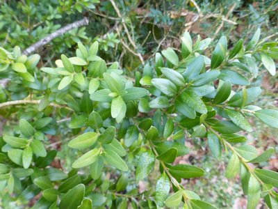
Buis - © Nathalie Thomas  Know-how
Box (Buxus)
Boxwood and humans: a long relationship! When livestock farming increased, the primeval oak forest opened up and box – which is too hard for sheep's teeth – took hold everywhere. Humans discovered one of its major qualities: broken up and scattered over the ground as a litter, it protects vegetable seedlings from drought and frost. Its leaves can make up for a lack of straw for fertilising arable land. In 1818, a decree issued by the prefect of the Gard department worried about the excessive clearing of box groves and the messy manner in which they were being uprooted, without adequate tools. Until about 1910, you might see mules laden with enormous bundles of box; then chemistry took over. (B. Mathieu)
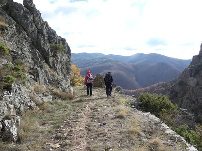
Vue sur le Lingas - nathalie.thomas  Landscape
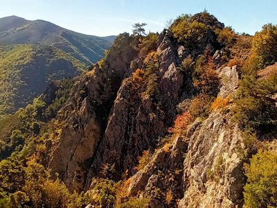
The Dourbies gorge
The path comes out on the Dourbie gorge. Opposite you, the western part of the high granite plateau of the Lingas joins up on its right with the limestone plateau called Causse de Larzac. On your right, you can see the granite dome of Saint-Guiral. Closer to you, in the vales that converge on the Dourbie, are the former crop terraces, pastureland, the village built on the riverbank at the valley’s widest point and finally the chestnut orchard. You are seeing the upper limit of its range, which corresponds to it maximum altitude in this zone (800 m).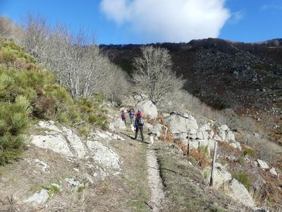
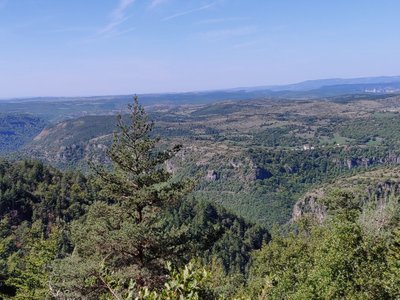
Montée au col du Suquet - nathalie.thomas LandscapeCol du Suquet pass
You are at the highest point of the hike. On the right bank of the Dourbie, the path crosses a sheer slope that is alternatively made up of zones of solid granite and other zones where it has decomposed due to weathering into coarse granitic sand. To the south, the views encompass the entire Lingas massif, a high wooded plateau overlooking, further south, the region around Le Vigan and the Languedocian plain.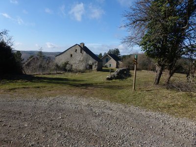
Canayère - nathalie.thomas  History
Canayère
A former farm turned forester's house in 1880. In the early days of the Mont Aiguoal reforestation, forestry officers lived here year-round during their missions. Forestry workers working on the replanting were allowed to use the outbuildings. Later, only one official resided here. Since 1967, no official has permanently lived here. (B. Mathieu)
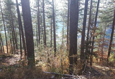
pins noirs - © Sud Cévennes HistoryA recent forest
The stands that were planted during the large reforestation programmes of the late 19th century onwards consist of black pines, a rustic species that is well-adapted to dry limestone soils. Underground, the Causses plateaux are characterised by networks of tunnels and cavities that have been created by water movement over millions of years. Subterranean rivers are blocked by the impermeable layers of the valley floor and flow into the Trévezel instead.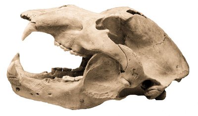
Crâne d'ours - © M. Delor  Archaeology
Joulie Cave
In March 1952, Jolly, a forestry official, showed his friend Frayssignes this cave. Deposited in it they discovered the remains of 300 humans from the Neolithic, who had been carefully laid out side by side. The cave was rapidly declared a historical monument. In the depths of the cave, a great number of bear bones was also found. This cave bear, the ancestor of our brown bear (Ursus spelaeus), had a skull 50 cm long! In the winter, groups of these bears would have huddled together in clay wallows at the rear of the caves. Ursus artos succeeded the cave bear and was succeeded in turn by the brown bear, which was hunted to extinction in the 15th century. (B. Mathieu)
Description
- Day 1 : 9 km from Trèves to Dourbies via Le Serre de Cade – waymarked yellow (PR). Climbs +587 m / descents -274 m;
- Day 2 : 15 km from Dourbies to Trèves via the Col du Suquet pass – waymarked yellow (PR) and white/red (GR® 66). Climbs +641 m / descents -954 m.
- Departure : Trèves
- Arrival : Trèves
- Towns crossed : Trèves, Dourbies, Saint-Sauveur-Camprieu, and Lanuéjols
Forecast
Altimetric profile
Recommandations
Make sure your equipment is appropriate for the day’s weather conditions. Remember that the weather changes quickly in the mountains. Take enough water, wear sturdy shoes and put on a hat. Please close any gates and barriers behind you.
Where to spend the night :
Trèves :
village campsite: 04 67 82 72 90.
Dourbies :
Village stopover gîte and restaurant: 06 28 72 12 56.
Multi-service centre: 07 88 85 89 35.
Good shoes, hat and water
Information desks

Tourism & national parc'house
Col de la Serreyrède, 30570 Val d'Aigoual
The Maison de l'Aigoual houses the tourism office Mont Aigoual Causses Cévennes and the Maison du Parc national. This visitor centre provides information on and raises awareness of the Cévennes National Park, its sites and events as well as the rules that must be observed in the National Park's central zone.
On site: changing exhibitions, video projections, Festival Nature events and shop Open year-round

Tourism'house and national Parc at Florac
Place de l'ancienne gare, N106, 48400 Florac-trois-rivières
This office is part of the National Park's associated tourist-information network, whose mission is to provide information on, and raise awareness of, the sites and events as well as the rules that must be observed in the National Park's central zone.
On site: exhibitions, video projections, events and shop Open year-round
Transport
This hike is accessible by public transport.
To consult the updated schedules and plan your trip, use the route calculator below by entering the arrival stop : TRÈVES - Ecole Place Neuve
Access and parking
From Nant take the D341, then the D47 to Trèves.
From Meyrueis take the D986, then the D157 through the Trévezel gorge.
Parking :
Calculateur d'itinéraire Lio
Utilisez le calculateur liO pour organiser votre trajet en région Occitanie.
Autres régions
Calculez votre itinéraire en Auvergne Rhône Alpes sur Oùra
Biodiversité autour de l'itinéraire
Source

Report a problem or an error
If you have found an error on this page or if you have noticed any problems during your hike, please report them to us here: