
One foot in the Dourbie valley, the other in the Trévezel (day 1)
As you leave the peaceful village of Trèves, you start the steep climb to Le Pas du Coulet. Here, mines were dug all around you for minerals such as galena (silver-bearing lead). This industrial exploitation was ephemeral but it provided a living for foreign and local families for several years.
2 points of interest
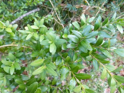
Buis - © Nathalie Thomas  Know-how
Box (Buxus)
Boxwood and humans: a long relationship! When livestock farming increased, the primeval oak forest opened up and box – which is too hard for sheep's teeth – took hold everywhere. Humans discovered one of its major qualities: broken up and scattered over the ground as a litter, it protects vegetable seedlings from drought and frost. Its leaves can make up for a lack of straw for fertilising arable land. In 1818, a decree issued by the prefect of the Gard department worried about the excessive clearing of box groves and the messy manner in which they were being uprooted, without adequate tools. Until about 1910, you might see mules laden with enormous bundles of box; then chemistry took over. (B. Mathieu)
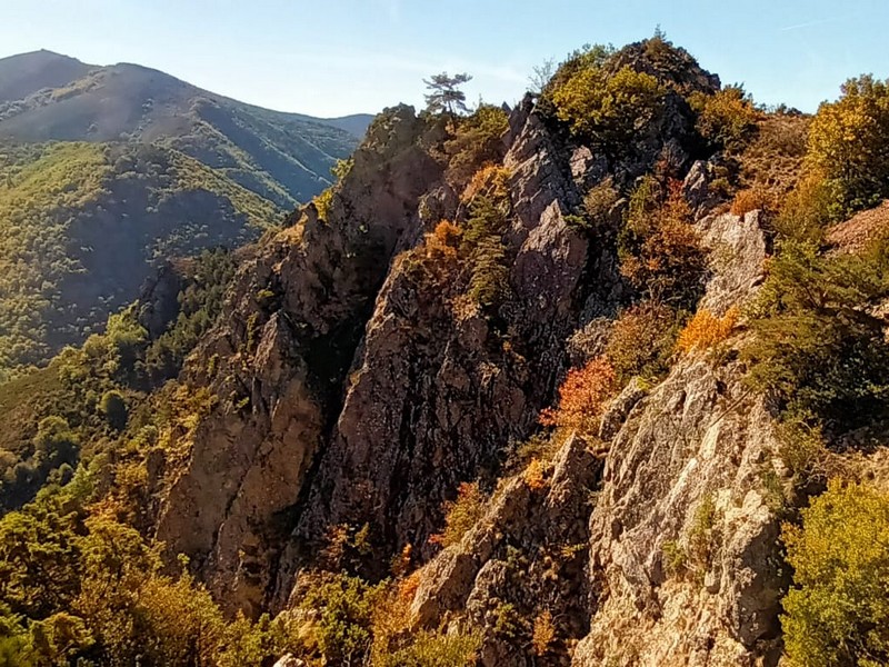
Vue sur le Lingas - nathalie.thomas  Landscape
The Dourbies gorge
The path comes out on the Dourbie gorge. Opposite you, the western part of the high granite plateau of the Lingas joins up on its right with the limestone plateau called Causse de Larzac. On your right, you can see the granite dome of Saint-Guiral. Closer to you, in the vales that converge on the Dourbie, are the former crop terraces, pastureland, the village built on the riverbank at the valley’s widest point and finally the chestnut orchard. You are seeing the upper limit of its range, which corresponds to it maximum altitude in this zone (800 m).
Description
Starting from “Trèves”, take the path on the left after the bridge to “La Vierge”.
- Take the path on the right to “Pas du Coulet”.
- At “Pas du Coulet”, follow the track on your right to “Sous le Col des Rhodes”.
- Then take on your left the D710 road for 900 m, then the path on the right to “Serre de Cade”, then to “Combe étroite”.
- Go downhill to “Dourbies” via “Roucabie”, “La Bourelle”, “Las Costes”, “La Combe”.
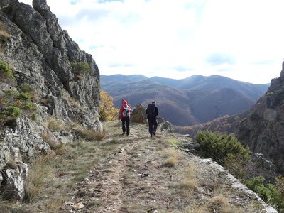
Explore the village, which is part of the “characterful village” network.
- Departure : Trèves
- Arrival : Dourbies
- Towns crossed : Trèves and Dourbies
Forecast
Altimetric profile
Recommandations
Make sure your equipment is appropriate for the day’s weather conditions. Remember that the weather changes quickly in the mountains. Take enough water, wear sturdy shoes and put on a hat. Please close any gates and barriers behind you.
Information desks

Tourism & national parc'house
Col de la Serreyrède, 30570 Val d'Aigoual
The Maison de l'Aigoual houses the tourism office Mont Aigoual Causses Cévennes and the Maison du Parc national. This visitor centre provides information on and raises awareness of the Cévennes National Park, its sites and events as well as the rules that must be observed in the National Park's central zone.
On site: changing exhibitions, video projections, Festival Nature events and shop Open year-round

Tourism'house and national Parc at Florac
Place de l'ancienne gare, N106, 48400 Florac-trois-rivières
This office is part of the National Park's associated tourist-information network, whose mission is to provide information on, and raise awareness of, the sites and events as well as the rules that must be observed in the National Park's central zone.
On site: exhibitions, video projections, events and shop Open year-round
Access and parking
From Nant take the D341, then the D151 to the village of Dourbies.
From Meyrueis take the D986, then the D157 through the Trévezel gorge and Trèves, then the D151 to the village of Dourbies.
Parking :
Calculateur d'itinéraire Lio
Utilisez le calculateur liO pour organiser votre trajet en région Occitanie.
Autres régions
Calculez votre itinéraire en Auvergne Rhône Alpes sur Oùra
Biodiversité autour de l'itinéraire
Source

Report a problem or an error
If you have found an error on this page or if you have noticed any problems during your hike, please report them to us here: