
La boucle découverte du col de Faubel
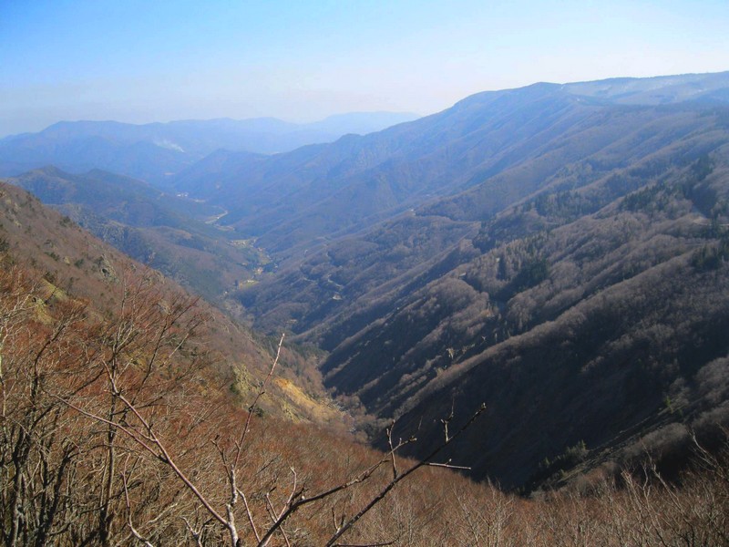
Three valleys open up before you: the Hérault valley, the Dourbie valley and the Bonheur valley. The first looks towards the Mediterranean and the Cévennes, the other two towards the Atlantic and the gentle slopes leading to the villages of Camprieu and Dourbies.
Just to whet your appetite for further exploration…
3 points of interest
La Serreyrède - nathalie.thomas  Water
WaterClimate frontier
The pass is also a climate frontier. The Atlantic side is predominantly exposed to the west wind and receives rainfall that is fairly regularly spread over the year. The Mediterranean side, however, is drier and hotter and constitutes a massive barrier to the occasional southeast wind (the marin), thus forcing its humid air to rise suddenly. This makes the clouds’ water content condense, which can give rise to so-called Cevenol episodes: heavy rainfall (600 mm in 24 hrs) causing catastrophic floods. The Aigoual, Mount Aigualis the rainy (A. Bernard), is well-named! After Savoie, it is the rainiest place in France.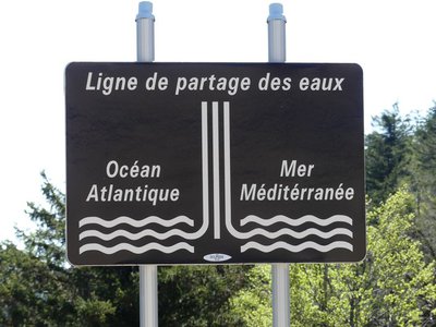
Ligne de partage des eaux - nathalie.thomas  Geology
The watershed
The current relief creates a frontier between the Atlantic and the Mediterranean: depending on the slope, water runs towards either the Ocean or the Sea. This is due to the uplift of the Cevenol sill, brought about by geological activity along the Cévennes fault, which borders draw the northern limit of the Languedoc region. This natural sill marks the geographical border between the northwest slope – verdant, not too steep – and the southeast slope, which falls away abruptly in the Languedoc and continues to be subject to powerful erosion.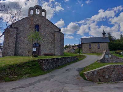
Village de l'Espérou - Béatrice Galzin  History
The village of L’Espérou
The village of L’Espérou lies on the border of Dourbies and Valleraugue local councils. A draille (track for livestock to migrate to summer pastures with their shepherds) crosses the village. As in many villages in the Gard, the two places of worship – one Catholic, the other Protestant – are opposite each other. The village is located in a varied environment that is suitable for outdoor activities and sports.
Description
From the activity centre at Prat-Peyrot, bike downhill to reach the D269.
- Turn right onto the D269 to reach the Col de La Serreyrède pass.
- At the pass, turn right onto the D986 towards Camprieu.
- Before you reach Camprieu, turn left onto the D986a towards the Col de Faubel pass and L’Espérou.
- At L’Espérou, go back uphill on the D986 to the Col de La Serreyrède, then follow the D269 to return to Prat-Peyrot.
Possible start from l'Espérou and Camprieu.
- Departure : Prat-Peyrot
- Arrival : Prat-Peyrot
- Towns crossed : Val-d'Aigoual, Meyrueis, Saint-Sauveur-Camprieu, and Dourbies
Forecast
Altimetric profile
Recommandations
Before committing yourself to a circuit, ensure that it is suitable for your activity level and ability. Respect traffic laws and other road users; stay in control of your speed and trajectory. Make sure to be seen and travel in single file when in a group. Remember that the weather changes quickly in the mountains. Take enough water. Safe trip !
Information desks

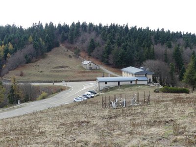
Tourism & national parc'house
Col de la Serreyrède, 30570 Val d'Aigoual
The Maison de l'Aigoual houses the tourism office Mont Aigoual Causses Cévennes and the Maison du Parc national. This visitor centre provides information on and raises awareness of the Cévennes National Park, its sites and events as well as the rules that must be observed in the National Park's central zone.
On site: changing exhibitions, video projections, Festival Nature events and shop Open year-round
Access and parking
From Valleraugue to L’Espérou and the Col de La Serreyrède pass on the D986; then to Prat Peyrot on the D269.
From Meyrueis to St-Sauveur-Camprieu and the Col de La Serreyrède pass on the D986; at the pass, head to Prat Peyrot on the D269.
Parking :
Calculateur d'itinéraire Lio
Utilisez le calculateur liO pour organiser votre trajet en région Occitanie.
Autres régions
Calculez votre itinéraire en Auvergne Rhône Alpes sur Oùra
Biodiversité autour de l'itinéraire
Source


Report a problem or an error
If you have found an error on this page or if you have noticed any problems during your hike, please report them to us here:
