
Les terrasses de l'oignon doux - Escapades à vélo
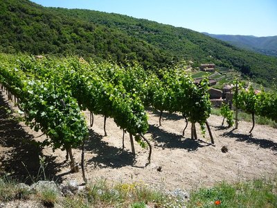
Taleyrac and the surrounding hamlets are the birthplace of the mild onion of the Cévennes. Throughout your climb, you will be able to admire this special type of farming on terraces.
1 point of interest
Les vignes - Michel Monnot  History
The Taleyrac valley
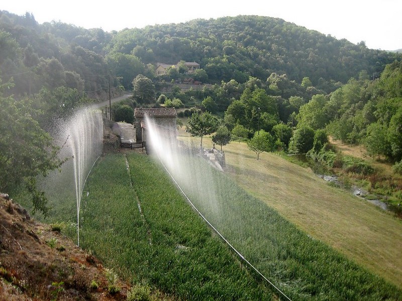
This valley consists of several hamlets that are part of the municipality of Val d’Aigoual. On the valley floor, springs are abundant; the cultivated crop terraces face south. This is good luck for diversified farming: fruit trees, grapes, mulberry trees and mild onions. Everything grows – but the onion is king!
Built on the rocks, the hamlets overlook the river with their enormous and very tall houses: any soil had to be reserved for crops!
Some flocks of sheep maintain the land behind the hamlets but most of it is done by humans, even today. The crop terraces, built out of granite, are remarkably beautiful. All of them are maintained!
Description
From Valleraugue, bike towards Le Vigan on the D986 to Le Mazel.
- At Le Mazel, take the D323 via Campredon, Taleyrac, La Valette and the Col de Peyrefiche and Col des Vieilles passes to Mandagout.
- At Mandagout, take the D170 to St-André de Majencoules.
- Go back downhill to Le Mazel, still on the D710 [D170?] via Les Pauses. Then return to Valleraugue on the D986.
Possibility of start from Saint-André de Majencoules.
- Departure : Valleraugue
- Arrival : Valleraugue
- Towns crossed : Val-d'Aigoual, Mandagout, and Saint-André-de-Majencoules
Forecast
Altimetric profile
Recommandations
Before committing yourself to a circuit, ensure that it is suitable for your activity level and ability. Respect traffic laws and other road users; stay in control of your speed and trajectory. Make sure to be seen and travel in single file when in a group. Remember that the weather changes quickly in the mountains. Take enough water. Safe trip !
Information desks

Tourism & national parc'house
Col de la Serreyrède, 30570 Val d'Aigoual
The Maison de l'Aigoual houses the tourism office Mont Aigoual Causses Cévennes and the Maison du Parc national. This visitor centre provides information on and raises awareness of the Cévennes National Park, its sites and events as well as the rules that must be observed in the National Park's central zone.
On site: changing exhibitions, video projections, Festival Nature events and shop Open year-round

Tourism office Mont Aigoual Causses Cévennes, Valleraugue
7 quartier des Horts, 30570 Valleraugue
This office is part of the National Park's associated tourist-information network, whose mission is to provide information on, and raise awareness of, the sites and events as well as the rules that must be observed in the National Park's central zone. : Open year-round
Access and parking
From Meyrueis, take the D986 to Valleraugue via Camprieu, the Col de La Serreyrède pass and L’Espérou.
Parking :
Calculateur d'itinéraire Lio
Utilisez le calculateur liO pour organiser votre trajet en région Occitanie.
Autres régions
Calculez votre itinéraire en Auvergne Rhône Alpes sur Oùra
Biodiversité autour de l'itinéraire
Source


Report a problem or an error
If you have found an error on this page or if you have noticed any problems during your hike, please report them to us here: