
Saint André par la Corniche - Road bike circuit #13
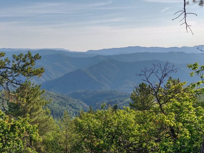
How satisfying, on arriving at Le Pompidou, to have a view over the entire Vallée Française and even further !
On this legendary road, Le Pompidou and St-Roman de Tousque have been rest stops for travellers since the days of long journeys in horse-drawn carriages.
4 points of interest
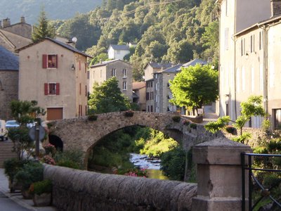
Le village de St André de Valborgne - Béatrice Galzin  Architecture
The village of St André de Valborgne
As you stroll along the quay above the river, you can still see the handsome bourgeois houses dating from the silk boom. If you look around, former spinning mills and industrial buildings dedicated to silk farming can still be seen in the landscape. A little lower down, opposite the 16th century château, you can listen to
Bernadette Lafont on the Camisard saga in and after 1702. As you reach the square again, quench your thirst at the fountain and have a look inside the Romanesque church (12th century).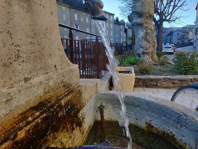
© Béatrice Galzin  Water
WaterOne spring, five fountains
This fountain is one of Saint-André’s five public fountains, all of which are supplied by the same spring (its water is thus the same as in the Fontaine du Griffon). Before houses were connected to mains water, there were many more fountains on this side of the quay.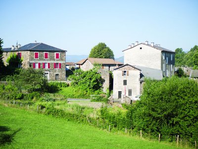
Saint-Roman de Tousque - OT des Cévennes au Mont Lozère  History
Saint-Roman de Tousque
The village of St-Roman de Tousque, which is part of the municipality of Moissac Vallée Française, owes its development to its location on the Corniche des Cévennes road, which facilitated the expansion of trade. In the 17th and 18th century, the village had a large number of artisans and shopkeepers. During the Camisard War, a company of the King’s troops was stationed here. The Camisard Lafleur came to sing psalms in front of the Catholic church, accompanied by six men. Believing themselves to be under attack, the soldiers barricaded themselves in, leaving the Camisards free to torch the church. The 19th century saw several Protestant commemorations.
It was in St-Roman de Tousque that the hymn of the Cevenol protestants, La Cévenole, was sung for the first time, during the bicentenary of the Revocation of the Edict of Nantes, in 1885.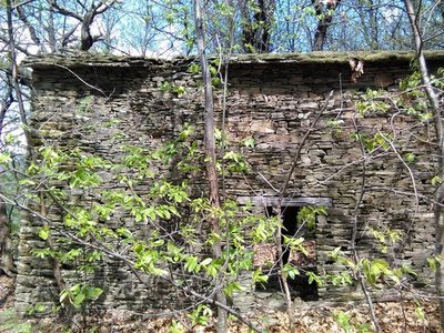
Les ruines d'Aygue Bernesse - Nathalie Thomas ArchitectureCévenol housing
Houses normally occupied the centre of the cultivated area. Built from schist, they were tall and narrow to save the level ground for crops. When houses needed expanding, people either added another storey to existing buildings or built a new wing parallel to the contour lines. Hamlets were always constructed near water sources and often at mid-slope because the valley floors are susceptible to brutal flooding as well as difficult to access. Good exposure to sunlight was not a decisive factor in choosing sites.
Description
From St-André de Valborgne, towards Le Pompidou on the D10 and D61.
- At Le Pompidou, towards St-Roman de Tousque on the D9 (Corniche des Cévennes road).
- At St-Roman de Tousque, go downhill into the Borgne valley on the D39, towards Saumane.
- In the valley, go back uphill on the D907 to return to St-André de Valborgne.
- Departure : St-André de Valborgne
- Arrival : St-André de Valborgne
- Towns crossed : Moissac-Vallée-Française, Saint-André-de-Valborgne, Saumane, Le Pompidou, Gabriac, and Sainte-Croix-Vallée-Française
Forecast
Altimetric profile
Recommandations
Before committing yourself to a circuit, ensure that it is suitable for your activity level and ability. Respect traffic laws and other road users; stay in control of your speed and trajectory. Make sure to be seen and travel in single file when in a group. Remember that the weather changes quickly in the mountains. Take enough water. Safe trip !
Information desks

Tourism & national parc'house
Col de la Serreyrède, 30570 Val d'Aigoual
The Maison de l'Aigoual houses the tourism office Mont Aigoual Causses Cévennes and the Maison du Parc national. This visitor centre provides information on and raises awareness of the Cévennes National Park, its sites and events as well as the rules that must be observed in the National Park's central zone.
On site: changing exhibitions, video projections, Festival Nature events and shop Open year-round

Tourism office Mont Aigoual Causses Cévennes, Saint-André-de-Valborgne
les quais, 30940 Saint-André-de-Valborgne
This office is part of the National Park's associated tourist-information network, whose mission is to provide information on, and raise awareness of, the sites and events as well as the rules that must be observed in the National Park's central zone.
Access and parking
From St-Jean du Gard, take the D907 to St-André de Valborgne, via L’Estréchure and Saumane.
From Florac, take the D907 towards St-Jean du Gard, through the villages of Vébron, Les Vanels and Rousses, to reach St-André de Valborgne.
Parking :
Calculateur d'itinéraire Lio
Utilisez le calculateur liO pour organiser votre trajet en région Occitanie.
Autres régions
Calculez votre itinéraire en Auvergne Rhône Alpes sur Oùra
Biodiversité autour de l'itinéraire

Report a problem or an error
If you have found an error on this page or if you have noticed any problems during your hike, please report them to us here: