
The Hérault waterfalls - long
From the spring of the river Hérault (Prat Peyrot), this path winds through the forest on the steep southern slopes of Mont Aigoual. Dotted with varied texts on fauna, flora and forest management, referred to in the leaflet, it makes its way to a spectacular viewpoint over the Hérault waterfalls.
1 point of interest
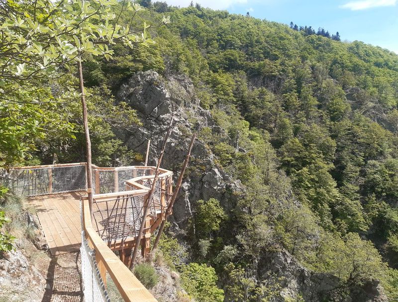
Vue plongeante sur la vallée de l'Hérault - Arnaud.Bouissou  Water
WaterRiver capture
Violent precipitation and the steep gradient of Mediterranean torrents cause regressive (i.e. upstream) erosion of the valleys through which they flow. This erosion can invert the sense of flow and thus “capture” for the Mediterranean a waterway that had, until then, flowed into the Atlantic. One example is the Hérault with its waterfalls, the capture being located at the falls. The Hérault and the Dauphine brook used to flow via L'Espérou into the Dourbie... River pebbles found around the village by geologists attest to the existence of a waterway in the past.
Forecast
Altimetric profile
Recommandations
Narrow and craggy path – firm shoes are essential.
Do not leave the path as this environment is unstable and very delicate. Horse-riding or mountain-biking are not allowed on or adapted to discovery trails.
Information desks

Tourism & national parc'house
Col de la Serreyrède, 30570 Val d'Aigoual
The Maison de l'Aigoual houses the tourism office Mont Aigoual Causses Cévennes and the Maison du Parc national. This visitor centre provides information on and raises awareness of the Cévennes National Park, its sites and events as well as the rules that must be observed in the National Park's central zone.
On site: changing exhibitions, video projections, Festival Nature events and shop Open year-round
Transport
LiO is the regional public transport service of the Occitanie/ Pyrénées – Méditerranée region. It facilitates everyone’s movements by prioritising public transport. For more information, go to www.lio.laregion.fr
Access and parking
Starting at Part Peyrot: D48 from Le Vigan via the Col de la Serreyrède pass or else D18 from Lozère via the Col du Perjuret pass
Parking :
Calculateur d'itinéraire Lio
Utilisez le calculateur liO pour organiser votre trajet en région Occitanie.
Autres régions
Calculez votre itinéraire en Auvergne Rhône Alpes sur Oùra
Biodiversité autour de l'itinéraire
Source

Report a problem or an error
If you have found an error on this page or if you have noticed any problems during your hike, please report them to us here:
