
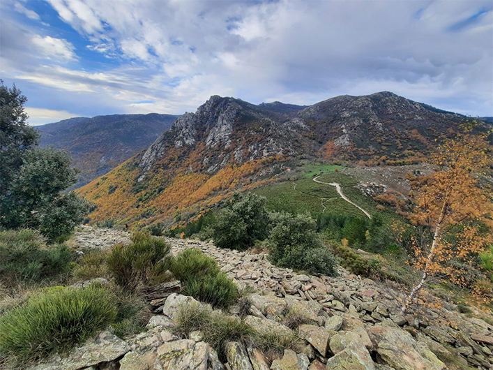
Le Chastelas
Enjoy panoramic views onto this historic site! You walk under sweet chestnut trees on paths that were once much frequented to reach the strategic Col de Montclar pass. All the land was cultivated, and there was much trade.
1 point of interest
Le Chastelas - N Thomas  History
Chastelas de Montclar
Atop this fortified rocky promotory was a fortress that was badly damaged as early as 1238, like its close neighbour, the Château de Verfeuil…
This was in the Cathar period. Records from the early 17th century say it is “in ruins”. The cistern located at the foot of the tower as well as several sections of wall are still visible. (text : Francis Tillault, from the collection of walks Autour du Parc 10)
Description
Signposts will guide you all along this route, as well as yellow painted waymarks. In the description below, the signposted place names and/or directions are given in bold italics between quotation marks :
From "Vialas", walk to :
- “Nojaret Haut”, then to "Sous le col de Montclar" via :
- "Lou Garadou",
- "Lou Pradous",
- "Les Sources".
- From "Sous le col de Montclar", go to :
- "Puecharus" via "Le Chastelas". Return to "Vialas" via :
- "Réservoir",
- "Nojaret Haut".
- Departure : Vialas, Tourism office
- Arrival : Vialas, Tourism office
- Towns crossed : Vialas
Forecast
Altimetric profile
Recommandations
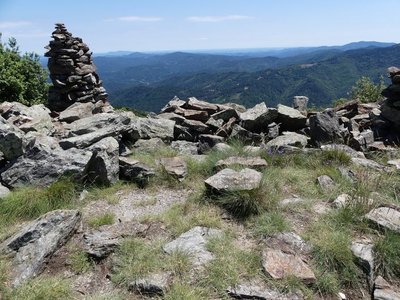
You have to cross a scree zone to reach Le Chastelas. Alternatively, take the forest track that skirts Le Chastelas.
Make sure your equipment is appropriate for the day’s weather conditions. Remember that the weather changes quickly in the mountains. Take enough water, wear sturdy shoes and put on a hat.
Information desks

Tourism'house and national parc, Génolhac
Place du Colombier, 30450 Génolhac
This office is part of the National Park's associated tourist-information network, whose mission is to provide information on, and raise awareness of, the sites and events as well as the rules that must be observed in the National Park's central zone.
Open from april to october

Tourism office Des Cévennes au mont-Lozère, Vialas
1 place de l'ancienne gendarmerie, 48220 Vialas
This office is part of the National Park's associated tourist-information network, whose mission is to provide information on, and raise awareness of, the sites and events as well as the rules that must be observed in the National Park's central zone. Open July and August
Access and parking
From Le Pont de Montvert on the D998 to Vialas.
From Génolhac, on the D17 then D998 to Vialas.
Parking :
Calculateur d'itinéraire Lio
Utilisez le calculateur liO pour organiser votre trajet en région Occitanie.
Autres régions
Calculez votre itinéraire en Auvergne Rhône Alpes sur Oùra
Biodiversité autour de l'itinéraire
Source


Report a problem or an error
If you have found an error on this page or if you have noticed any problems during your hike, please report them to us here: