
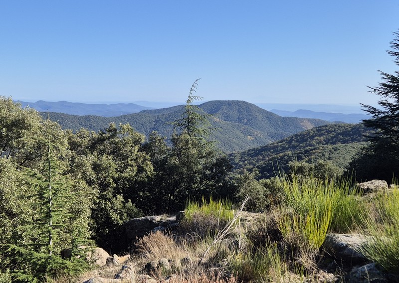
On Fageas ridge (day 3)
The climb to the Col de l’Asclier pass is steep. Walk under the bridge, built to ensure that the sheep are comfortable on their walk up to the summer pastures. You are on an ancient track, solidly constructed, which bears witness to the know-how of days past. This rocky path with its superb views could well be an old King’s road, even if time has changed it somewhat.
3 points of interest
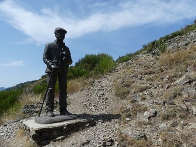
Le pastre - Nathalie Thomas AgricultureThe draille (drovers’ road) and the sheep bridge
The draille (drovers’ road) and the sheep bridge architecture The sheep bridge at the Col de l’Asclier is on an important draille (a traditional path for livestock migrating to the upland summer pastures of Mont Aigoual and Mont Lozère), which was also a King’s road during the Camisard revolt in the 18th century, a peddlers’ road and is now a long-distance hiking path. The Col de l’Asclier pass (from Occitan asclar, to split), where the road seems to go through a gap, is well-named: it lies on a fault line in the rock. But the most astonishing is the bridge, a bridge without road. It was built to help sheep flocks negotiate this difficult spot!
 Flora
FloraThe forestry track
On the first two kilometres, up to the Rocher de l'Aigle, you are on the forestry track opened in 1938. Where there are forestry tracks, there are state-owned forests, meaning forests managed by the French state and the Office National des Forêts so as to develop the area. The presence of so many beech trees and pines is a marker of the previous reforestation policy on the Aigoual massif and in the Cevenol foothills. A plaque has been erected at the Col du Fageas pass, further along this trail, in memory of Max Nègre (1880 – 1960), one of the project managers of this collective undertaking. From 1935 to 1939, he thinned out the forests planted since the end of the 19th century and opened up forestry tracks.
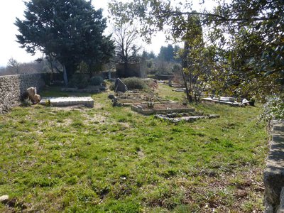
Cimetière communal - © Nathalie Thomas  History
Cemetery history
The walk leads you past the village cemetery, which was in fact the Protestant cemetery. Soudorgues also has a Catholic cemetery, another particularity brought about by the turbulent history of the Reformation. Catholic cemeteries did not accept “non-Christians” or “heretic Christians”. There were countless exhumations of Protestant bodies in the 16th century. To put an end to this injustice, the Edict of Nantes ordered that “convenient” cemeteries be built for those who followed the so-called reformed religion. When the Edict was revoked, the order was also dropped. Huguenots had to renounce their religion to be buried in 'family” cemeteries in the countryside. Today, only the owners of these on-site cemeteries still have the right to be buried in them.
Description
Starting at "Mas Corbière" go back up to the sheep bridge on the track that you took last night, towards “Pont Moutonnier”. Walk under the bridge.
- Then walk towards “Col du Mercou” via “la Cale” (GR®61 long-distance hiking path).
- Turn left towards "Col de Piécamp" and "col de la Mortière".
- From "Col de la Mortière" head to "Col de la cabane vieille".
- At “Col de la cabane vieille” go downhill on the GR®63 long-distance path to reach “Pierre Plantée”.
- Continue to “Quatre Chemins” and go left to reach “Soudorgues" village.
- Departure : Mas Corbière
- Arrival : Soudorgues
- Towns crossed : Val-d'Aigoual, Les Plantiers, L'Estréchure, and Soudorgues
Forecast
Altimetric profile
Recommandations
Make sure your equipment is appropriate for the day’s weather conditions. Remember that the weather changes quickly in the mountains. Take enough water, wear sturdy shoes and put on a hat. Please close any gates and barriers behind you.
Information desks

Tourism & national parc'house
Col de la Serreyrède, 30570 Val d'Aigoual
The Maison de l'Aigoual houses the tourism office Mont Aigoual Causses Cévennes and the Maison du Parc national. This visitor centre provides information on and raises awareness of the Cévennes National Park, its sites and events as well as the rules that must be observed in the National Park's central zone.
On site: changing exhibitions, video projections, Festival Nature events and shop Open year-round

Tourism office Mont Aigoual Causses Cévennes, Lassale
Centre Viala, rue de la Place, 30460 Lasalle
This office is part of the National Park's associated tourist-information network, whose mission is to provide information on, and raise awareness of, the sites and events as well as the rules that must be observed in the National Park's central zone. : Open year-round

Tourism office Mont Aigoual Causses Cévennes, Saint-André-de-Valborgne
les quais, 30940 Saint-André-de-Valborgne
This office is part of the National Park's associated tourist-information network, whose mission is to provide information on, and raise awareness of, the sites and events as well as the rules that must be observed in the National Park's central zone.
Tourism office Mont Aigoual Causses Cévennes, Valleraugue
7 quartier des Horts, 30570 Valleraugue
This office is part of the National Park's associated tourist-information network, whose mission is to provide information on, and raise awareness of, the sites and events as well as the rules that must be observed in the National Park's central zone. : Open year-round
Calculateur d'itinéraire Lio
Utilisez le calculateur liO pour organiser votre trajet en région Occitanie.
Autres régions
Calculez votre itinéraire en Auvergne Rhône Alpes sur Oùra
Biodiversité autour de l'itinéraire
Report a problem or an error
If you have found an error on this page or if you have noticed any problems during your hike, please report them to us here: