
Around Lake Barrandon
Nestling at the foot of Mont Lozère, Lake Barrandon and its surroundings offer a mosaic of natural environments, from the very dry (on the steep slopes) to the wetter (by the crystal-clear waters). Leave the fishing zone to meander gently through the tranquil landscape around this timeless peat lake.
6 points of interest
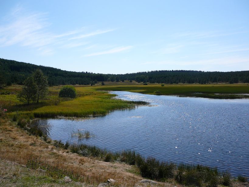
Etang de Barrandon - © E. Balaye  Natural environment
A changing landscape
In the lake and all around it, each natural environment has its own colour depending on the season. In the foreground is purple-flowering heather and golden broom. As you approach the lake, different shades of green turn into a bluish patch of open water. In the distance, pine-green forest forms the horizon.
Etang de Barrandon - © Etienne Jammes  Pastoralism
Traces of Humanity
Nowadays, Barrandon is a lake open to fishermen and women. But its past has left traces in today’s landscape.
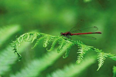
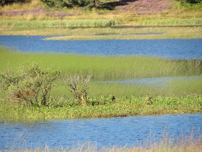
Petite nymphe à corps de feu - © Emilien Herault  Flora
FloraThe shallow bog
This is the lowest point of the walk: the shallow bog or wetland. This configuration allows plants to have their roots underwater, fixed to the lake bed, and their flowers in the open air. These are semi-aquatic plants. Shallow bog is a rich environment where food is abundant. This benefits all sorts of animals, such as insects. Look at the dragonflies !
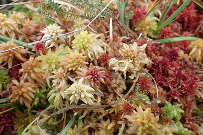
Sphaigne - © Regis Descamps Natural environmentA sphagnum moss peatbog
A peatbog is a strange place unlike anywhere else. Gardeners know that decay enriches the soil. In a peatbog, the water is so acidic and so low in oxygen that decomposition does not take place. Pretty mosses called sphagnum pile up without rotting after their death, creating a mattress of thick and supple peat. Only very specialised plants manage to survive, as well as animals that are well adapted to the cold.
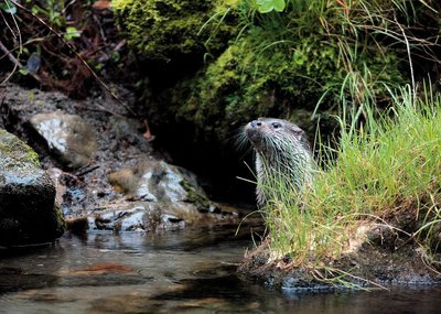
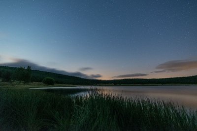
Loutre d'Europe - © Regis Descamps  Water
WaterThe crystal-clear spring
The lake is fed by brooks from springs; the main spring is here. It crosses an open environment without trees. Protecting biodiversity brings results: the Eurasian otter, a discreet semi-aquatic mammal, is making tangible progress in local waterways and in Lake Barrandon, where it is regularly spotted.
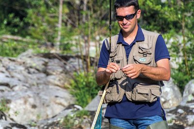
Pêcheur - © Y. Manche  Landscape
Lake life
You can enjoy recreational fishing here and explore a natural environment that each of us must help to preserve. Close to the lake, Aubrac cows graze in the summer. All around, the forest plantations of the 20th century are exploited commercially. The lake is emptied of water periodically to prevent vegetation from filling it. Every year, it then has to be stocked again with trout raised in Lozère.
Description
From the path’s first post in the car park, follow the first section back up the track so as not to miss out on the viewpoint over the lake. The path then goes downhill and around the lake. From the sign “source cristalline [crystal-clear spring]” onwards, the path is dotted with markers. Remember you are responsible for the tranquillity of the site and its inhabitants.
- Departure : Car park at Lake Barrandon
- Arrival : Car park at Lake Barrandon
- Towns crossed : Saint-Étienne-du-Valdonnez
Forecast
Altimetric profile
Recommandations
For your safety and to preserve the site, you must stay on the laid-out path. Horse-riding and mountain-biking are not allowed because discovery trails are not adapted for them.
Information desks

Office de tourisme Des Cévennes au mont Lozère
le Quai, 48220 Le Pont de Montvert sud mont-Lozère

Tourism office Mont-Lozère, Bagnols-les-Bains
avenue de la gare, 48190 Bagnols-les-Bains Mont-Lozere et Goulet
This office is part of the National Park's associated tourist-information network, whose mission is to provide information on, and raise awareness of, the sites and events as well as the rules that must be observed in the National Park's central zone. Open from mid-April to late September
Access and parking
D35 Col de Montmirat (Saint Etienne du Valdonnez – Pont de Montvert – Hameau des Laubies), then a track accessible for motorised vehicles to the lake
Parking :
Calculateur d'itinéraire Lio
Utilisez le calculateur liO pour organiser votre trajet en région Occitanie.
Autres régions
Calculez votre itinéraire en Auvergne Rhône Alpes sur Oùra
Biodiversité autour de l'itinéraire
Source

Report a problem or an error
If you have found an error on this page or if you have noticed any problems during your hike, please report them to us here: