
The paths of Mont Lozère
3 points of interest

 History
The Régordane Way
The Régordane Way, a transport and pilgrims’ route as early as the 12th century, linked Le Puy-en-Velay with Saint-Gilles. It runs alongside many villages with characteristic architecture (Romanesque churches, the arrangement of the houses, the door and window frames, etc.).
Note the Reboulet cross on the façade of the last-but-one house on the left before the second fountain.
- History
Forestry
The path has two small brook crossings. You walk along a tall wall that is over 250 m long. This curved structure is a reminder of the days before 1914, when tannin factories exploited the forest on the slopes of Rabuzats. The prepared wood was transported to this place, which was called “the station”. The many constructions around the Bois de Longues Feuilles brook evoke the temporary dwellings and working conditions of labourers at the time. (Text by Francis Tillault, from the collection of walks Autour du Parc 10).

Chevreuil - Emilien Hérault  Fauna
FaunaMany species...
This prospering and diverse forest boasts many ground animal species, such as large mammals, especially deer. Its trees play host to numerous birds, including diurnal and nocturnal birds of prey: buzzards, sparrowhawks and owls. Woodpeckers and passerine birds live on the edge of the forest. Some species are uncommon and even threatened, such as the Eurasian goshawk.
Description
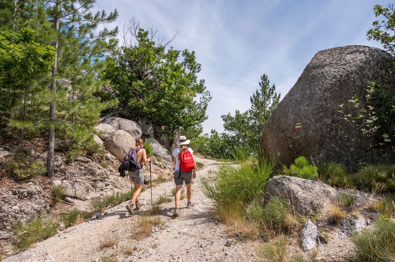
Signposts will guide you all along this route. In the description below, the signposted place names and/or directions are given in bold italics between quotation marks :
From "Concoules", go to :
- “Cimetière”,
- “Lavoir”,
- “Le rocher des Fées”, go right to “Rocher Communal” via :
- “La Lozère”,
- "Longuefeuille",
- “Rocher Communal”. Then return to “Concoules” via :
- “Les Besses”, then “Le rocher des Fées”, “Lavoir”, “Cimetière”.
This hike is taken from the guidebook Mont Lozère – Pays des sources, Sommet des Cévennes, published by the Pôle de pleine nature du Mont Lozère.
- Departure : Concoules
- Arrival : Concoules
- Towns crossed : Concoules and Ponteils-et-Brésis
Forecast
Altimetric profile
Recommandations
Make sure your equipment is appropriate for the day’s weather conditions. Remember that the weather changes quickly in the mountains. Take enough water, wear sturdy shoes and put on a hat. Please close any gates and barriers behind you.
Information desks

Tourism'house and national parc, Génolhac
Place du Colombier, 30450 Génolhac
This office is part of the National Park's associated tourist-information network, whose mission is to provide information on, and raise awareness of, the sites and events as well as the rules that must be observed in the National Park's central zone.
Open from april to october
Transport
LiO is the regional public transport service of the Occitanie/ Pyrénées – Méditerranée region. It facilitates everyone’s movements by prioritising public transport. For more information, go to the lio Occitanie app or visit https://www.lio-occitanie.fr/
Access and parking
From Alès take the D906 to Chamborigaud, Génolhac, Col de l’Ancise, Concoules.
Parking :
Calculateur d'itinéraire Lio
Utilisez le calculateur liO pour organiser votre trajet en région Occitanie.
Autres régions
Calculez votre itinéraire en Auvergne Rhône Alpes sur Oùra
Biodiversité autour de l'itinéraire
Source


Report a problem or an error
If you have found an error on this page or if you have noticed any problems during your hike, please report them to us here: