
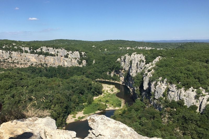
The cliff walk
The Bois de Païolive wood hides a landscape consisting of limestone rocks with dissolved contours, which are the foundation for a Mediterranean forest.
Description
Signposts will guide you all along this route. In the description below, the signposted place names and/or directions are given in bold italics between quotation marks :
From L'Estong car park, follow the yellow paint waymarks.
- At L’Estong car park, follow “La corniche 0,5 km”,
- At “La Corniche”, follow “La Gleysasse 0,8 km”.
- At “La Gleysasse”, follow “Parking de l'Estong 2,3 km”.
- Return via “Parking de l’Estong 1,2 km”.
Caution ! Do not appraoch the cliff edge. The rocks can be slippery.
- Departure : Berrias et Casteljau
- Arrival : Berrias et Casteljau
- Towns crossed : Berrias-et-Casteljau and Les Vans
Forecast
Altimetric profile
Recommandations
This walk, while in the “easy” category, is rocky and steep in parts and slippery when wet. You must have appropriate footwear.
Make sure your equipment is appropriate for the day’s weather conditions. Remember that the weather changes quickly in the mountains. Take enough water, wear sturdy shoes and put on a hat. Please close any gates and barriers behind you.
You must stay on the waymarked paths to preserve this fragile environment, which is a protected site of the European network Natura 2000 and a sensitive natural space.
Information desks

Tourism office Cévennes d'Ardèche, Les Vans
Place Ollier, 07140 Les Vans
This office is part of the National Park's associated tourist-information network, whose mission is to provide information on, and raise awareness of, the sites and events as well as the rules that must be observed in the National Park's central zone.
Open year-round
Transport
Please limit car use. Think public transport and car-sharing instead. All public transport can be found at https://www.laregionvoustransporte.fr/
Access and parking
From Les Vans (6 km), drive towards Alès on the D901, then the D252 to reach L’Estong car park.
From Joyeuse (16 km), drive towards Alès on the D104, then turn right onto the D252 to reach L’Estong car park.
Parking :
Calculateur d'itinéraire Lio
Utilisez le calculateur liO pour organiser votre trajet en région Occitanie.
Autres régions
Calculez votre itinéraire en Auvergne Rhône Alpes sur Oùra
Biodiversité autour de l'itinéraire
Source

Report a problem or an error
If you have found an error on this page or if you have noticed any problems during your hike, please report them to us here: