
Around Les Aigladines
2 points of interest
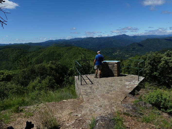
Aigladines - N Thomas AgricultureAigladines
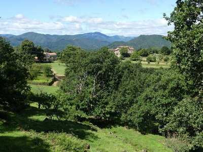
The first written traces of Aigladines, which is the collective name for all of the plateau’s hamlets, date from the 13th century. In 1560-1561 ot was the site of the first synod of the Protestant churches of Southern France. The one-street hamlet grew up along the draille (drovers’ road) of Jalcreste. Herds of sheep left the plains at Tornac, headed due north to the ridges of the La Vieille Morte and used the Col de Jalcreste pass to reach the Margeride plateau in Lozère.
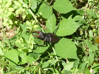
Lucane Cerf-volant - N Thomas  Fauna
FaunaGuests of the holm oak grove
This oak forest is home to great capricorn beetles and European stag beetles, which can be spotted in June and July.
The great capricorne is the largest member of the longhorn family. It can be identified by its antennae, which, in males, are almost twice as long as the body. They serve as stabilisers during flight.
The stag beetle is attracted by oak sap. In its brown shell, it is nearly nine centimetres long and has impressive mandibles, which it uses as a weapon during combat.
Both beetles have a strong connection with old oak forests, where their larvae complete their life cycles ranging from two to six years. Once they have reached maturity, they only have two to three months to reproduce – their days are counted.
Description
Signposts will guide you all along this route. In the description below, the signposted place names and/or directions are given in bold italics between quotation marks :
Starting from “ Mialet-Aigladines ”, walk uphill to “ Col d’Uglas ”.
From “ Col d’Uglas ”, go to “ Mas Raymond ”, then climb to “ Combe Male ”.
Here, take the track on the left that returns to “ Col d’Uglas ”; halfway there, enjoy the views onto L’Hortus and Mont Aigoual.
At “ Col d’Uglas ”, return to “ Mialet-Aigladines ” via “ Camp Redonel ”.
This walk is taken from the guidebook Cévennes et vallées du Gardon – autour d’Anduze et Saint-Jean-du-Gard, published by the Agglomération d’Alès as part of the collection Espaces Naturels Gardois and the label Gard Pleine Nature.
- Departure : Les Aigladines (Mialet)
- Arrival : Les Aigladines (Mialet)
- Towns crossed : Mialet, Saint-Paul-la-Coste, and Saint-Étienne-Vallée-Française
Forecast
Altimetric profile
Recommandations
Make sure your equipment is appropriate for the day’s weather conditions. Remember that the weather changes quickly in the mountains. Take enough water, wear sturdy shoes and put on a hat.
Information desks

Tourism office Cévennes Tourisme, Saint-Jean-du-Gard
Maison rouge, 30270 Saint-Jean-du-Gard
This office is part of the National Park's associated tourist-information network, whose mission is to provide information on, and raise awareness of, the sites and events as well as the rules that must be observed in the National Park's central zone.
Open year-round
Access and parking
From St-Jean du Gard, take the D50 to Pont des Abarines, then the D160 to Les Aigladines.
Parking :
Calculateur d'itinéraire Lio
Utilisez le calculateur liO pour organiser votre trajet en région Occitanie.
Autres régions
Calculez votre itinéraire en Auvergne Rhône Alpes sur Oùra
Biodiversité autour de l'itinéraire
Source


Report a problem or an error
If you have found an error on this page or if you have noticed any problems during your hike, please report them to us here: