
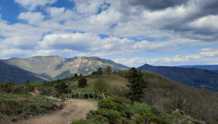
The three passes, MTB circuit #2 (red)
3 points of interest
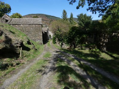
Le Massufret - © Nathalie Thomas  Architecture
Le Massufret
This hamlet was once very lively, since there was a school for a dozen children before World War Two. “It was basically a farmers' village. They weren't really looking to make money but to survive, in the tradition of farmers in the Cevennes. They lived according to the season: in summer, they prepared for winter. Chestnuts and potatoes were the staple foods, and there was soup at every meal” (Mr Velay).
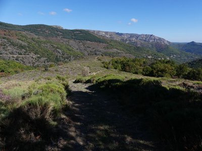
Vallée du Luech - otcevennesmontlozere  History
Path history
A network of paths linked Le Massufret with the other hamlets in the municipality. A mule track lead from Montjoie to the Le Massufret (in Montjoie, you can see a circular platform, probably a vestige of an oppidum, a pre-Roman hill-fort). One path led through the valley to Soleyrols, another went to L'Aubaret on Mont Lozère or to Le Masmin, on the other side of the Ventalon ridge. At the time of the Camisards, after the Revocation of the Edict of Nantes (1685), Protestants chose to meet clandestinely, at night, in remote locations. Their gatherings had to kept secret from the authorities. Preachers replaced the exiled pastors and recited Biblical texts. Inhabitants from all four corners of the municipality held gatherings in Le Massufret near a rock below the apiary.
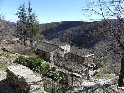
Castagnols - nathalie.thomas HistoryCastagnols
(origin of the name: chestnut orchard).
An important village long before Vialas, located close to a traffic artery on the ridge, Castagnols was the parish seat until 1684. The canons of the collegiate chapter at Bédouès benefited from the substantial revenues of its priory, founded by Guillaume de Grimoard, the future Pope Urban V. The inhabitants of Castagnols later strongly supported the Reformation. The Catholic church was burned down during the Camisard era. After 1970, Cévennes enthusiasts rebuilt it from the ruins.
Description
Follow the MTB markup n°2
Signposts will guide you all along this route, as well as yellow painted waymarks. In the description below, the signposted place names and/or directions are given in bold italics between quotation marks :
Starting from the tourist office “Vialas”, bike to “Place de l’Ancienne Gendarmerie” :
- Then continue to the brook via “La Vigne”, “Plagette”.
- Then climb to “Col de La Baraquette” via “La Tranchée”, “Légaou”, “Ruisseau du Villaret”, “Le Villaret”, “Sous le col de La Baraquette 3,5 km”.
- At “Col de la Baraquette”, take a ridge path to climb to “Col de Chalsio”.
- From there, go to “Col de Banette” via “Draille de l’Espinas”.
- From the pass, begin your descent to “Vialas” via “Le Pradet”, “Castagnols”,
- “La Tranchée”, “Plagette”, “La Vigne”, “Place de l’Ancienne Gendarmerie”.
This MTB route is taken from the guidebook Mont Lozère – Pays des sources, Sommet des Cévennes, published by the Pôle de pleine nature du Mont Lozère.
- Departure : Vialas
- Arrival : Vialas
- Towns crossed : Vialas, Pont de Montvert - Sud Mont Lozère, and Ventalon en Cévennes
Forecast
Altimetric profile
Recommandations
No off-roading. You are strongly encouraged to wear a helmet. Do not forget your repair kit and a small tool kit. Close barriers and gates behind you. Slow down in farms and hamlets.
Information desks

Tourism'house and national Parc at Florac
Place de l'ancienne gare, N106, 48400 Florac-trois-rivières
This office is part of the National Park's associated tourist-information network, whose mission is to provide information on, and raise awareness of, the sites and events as well as the rules that must be observed in the National Park's central zone.
On site: exhibitions, video projections, events and shop Open year-round

Office de tourisme Des Cévennes au mont Lozère
le Quai, 48220 Le Pont de Montvert sud mont-Lozère
Access and parking
From Génolhac or from Le Pont-de-Montvert-Sud-Mont-Lozère
Parking :
Calculateur d'itinéraire Lio
Utilisez le calculateur liO pour organiser votre trajet en région Occitanie.
Autres régions
Calculez votre itinéraire en Auvergne Rhône Alpes sur Oùra
Biodiversité autour de l'itinéraire
Source


Report a problem or an error
If you have found an error on this page or if you have noticed any problems during your hike, please report them to us here: