
La Flandonenque
4 points of interest
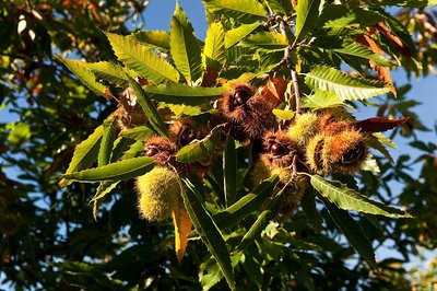
Bogue de châtaigne - © Bruno Daversin Agriculture“The chestnut tree” anecdote
“The main harvest was chestnuts. People stopped doing it because it was no longer profitable... We sold them, and with the little pieces we fattened up the lambs and also the pigs. We ate chestnuts till spring: at four in the afternoon with our bread instead of chocolate, and in the evening we had a bowl of boiled chestnuts. In August, the leaf has more flavour, we made bundles to feed the goats and sheep. We dried them, we put them up in sheaves like wheat, then we brought them in. For animal litter, we gathered chestnut leaves.”
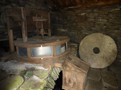
Mécanisme du moulin de Flandres - © Nathalie Thomas AgricultureThe mill at Flandres
The mill was used to grind grains during the famine that affected the inhabitants of Flandres in the Second World War. It stopped work in 1950. In 1994 and 1995, the roof, walls and mill mechanism were restored, with the support of the National Park, by a farmer who had used the mill. On the lower level, you can see the room that houses the horizontal wheel. Water that has gone through the mill flows back into the river. From the pond that served to regulate water flow, you follow the béal (channel) which brought water to the mill.
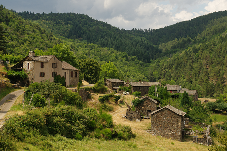
Village de La Fare - © OTI Cévennes Gorges du Tarn  History
The hamlet of La Fare
In 1944 a group of resistance fighters, made up of German and Spanish anti-fascists and a few Frenchmen refusing to be drafted into the STO (forced labour in Germany), settled at La Fare. Eight days later, on 12 February, the militia blew up the buildings using dynamite. The maquisards, who had been warned in time, had already left.
Since 1990, the hamlet has been repopulated, and its new inhabitants are restoring it. Today, some 30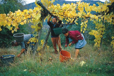
Ramassage du raisins en Cévennes - © Michelle Sabatier AgricultureVernet
"In around 1850, Vernet had 82 inhabitants. In '39, there was a little old man who lent us his house for dancing, we drank the wine he made.” “There were climbing vines and even wild vines that were left to climb into the holm oaks, clinton vines. They had very small bunches, sometimes you needed half a day to pick a bucketful. There were also iron wires stretched across rivers, you had to unhook the wire to pick while standing in the riverbed. We made wine for the family to drink.” (Patricia Grime)
Description
Start by following the dirt track (and stay on this main track). Then leave the track by heading right on L'Escaillou, a skidding track that goes uphill into the woods. At the second road, turn right to reach the hamlet of Flandres. As you leave Flandres, a path goes downhill on the right towards a mill, then joins up with the main track again, which takes you to Nozières. As you leave Nozières, go right at the last house and head for La Fare. The footpath becomes narrower for about 1.5 km. In a sharp bend, it meets a larger track. Turn left and enter La Fare by following the path between the houses. As you leave the hamlet, turn right. Follow the lane for about 100 m and turn left. In another small valley, the path curves to reach Le Vernet on the opposite slope. At Le Vernet, walk below the first house on the right, fork left and go through a barrier and then downhill through the meadow to a sheepfold. The path then joins a trincat (channel for diverting water) to reach a bridge. From the bridge, go up the slope in front of you to return to the starting-point.
- Departure : Le Cros
- Arrival : Le Cros
- Towns crossed : Saint-Germain-de-Calberte
Forecast
Altimetric profile
Recommandations
Make sure your equipment is appropriate for the day's weather conditions. Remember that the weather changes quickly in the mountains. Take enough water, wear good shoes and put on a hat. Please close all gates and barriers after yourself.
Information desks

Tourism office Des Cévennes au mont-Lozère, Saint-Germain-de-Calberte
Village, 48370 Saint-Germain-de-Calberte
This office is part of the National Park's associated tourist-information network, whose mission is to provide information on, and raise awareness of, the sites and events as well as the rules that must be observed in the National Park's central zone.
Open year-round, except for 2 weeks at Christmas
Access and parking
In Saint-Germain-de-Calberte, take the road towards Lou Serre de la Can. After about 2 km, take the first turning on the right towards La Bernadelle / Le Cros.
Parking :
Calculateur d'itinéraire Lio
Utilisez le calculateur liO pour organiser votre trajet en région Occitanie.
Autres régions
Calculez votre itinéraire en Auvergne Rhône Alpes sur Oùra
Biodiversité autour de l'itinéraire
Source

Report a problem or an error
If you have found an error on this page or if you have noticed any problems during your hike, please report them to us here: