
Ventalon
This walk at the foot of the Bougès mountain range takes you onto the Languedoc draille (drovers' road) and over the watershed between the Atlantic and Mediterranean. It has beautiful views onto the Cevennes, the Aigoual massif and Mont Lozère.
3 points of interest
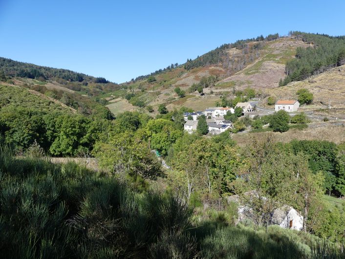
Vue sur Saint Maurice de Ventalon - © Nathalie Thomas  Architecture
Saint Maurice de Ventalon
Saint-Maurice-de-Ventalon is the canton's most centrally located village, at the crossroads of Mont Lozère and the Cevennes. To reach the hamlets of Le Tronc and Le Masmin, you have to cross over the Ventalon ridge. The village's families are mostly multiple job holders, living partly on farming, bee-keeping (restored trunk-hive at the entrance to the village), livestock rearing and renting out horses for hikes. The village was once a very convivial place, with a post office, school, shop and cafe that drew the inhabitants of this vastly spread out village. “In Saint-Maurice-de-Ventalon, an accordion-player was hired for the ball on the saint's name day. This took place in July on the little square. The organisers went around the village to sell the “fougasse de Paillasse” (a Provencal bread made by Mr Durand, the baker in Vialas, nicknamed Paillasse). People played skittles. Many came – the inhabitants of Saint-Frézal, Soleyrols, etc.” (Léa Carrière. Vent des Bancels. issue 31)
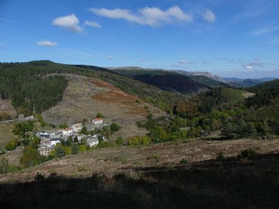
Le Luech - © Yannick Manche  Water
WaterThe watershed
Saint-Maurice-de-Ventalon is a land of springs, located on the watershed and consisting of three catchments. The river Luech has its spring in the uplands and joins the torrents of the Rieutort and Gourdouze before flowing into the Cèze and finally the Mediterranean. The Gardon d'Alès also has its spring here, which flows through Saint- Frézal-de-Ventalon and then to the Mediterranean. On the Atlantic side, the rivers Goudesche and Alignon calmly wind their way through meadows and into the Tarn.
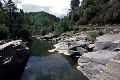
La Draille du Languedoc - otcevennesmontlozere  Pastoralism
The Languedoc draille
This draille (path for seasonal livestock migration) is known as the Languedoc draille and has seen tens of thousands of sheep pass by that have come up the many drailles from the Midi, combining into ever larger flocks before reaching the summer pastures on the Mont Lozère plateau. The plant cover, grazed and trampled by so many sheep, had no time to grow back. A few flocks and a few shepherds still keep the tradition alive. Other flocks are brought to the summer pastures by lorry.
Description
Signposts will guide you all along this route. In the description below, the signposted place names and/or directions are given in bold italics between quotation marks:
From "La Croix de Berthel”, walk to “St Maurice de Ventalon” via :
- “Les Bastides”
- “Plo de la Nassette“.
- “St Maurice de Ventalon”,
- Then “Col de Malpertus”,
- “Le Grand Cougnet”, from there go to “Signal de Ventalon” via “Sous le Signal de Ventalon” and then come back to “Le Grand Cougnet”.
- Then “Draille de Ventalon”, "La Croix de Berthel”.
This hike is taken from the guidebook Mont Lozère – Pays des sources, Sommet des Cévennes, published by the Pôle de pleine nature du Mont Lozère.
- Departure : Croix de Berthel cross
- Arrival : Croix de Berthel cross
- Towns crossed : Pont de Montvert - Sud Mont Lozère
Forecast
Altimetric profile
Recommandations
Steep path at first. Make sure your equipment is appropriate for the day's weather conditions. Remember that the weather changes quickly in the mountains. Take enough water, wear good shoes and put on a hat. Please close all gates and barriers after yourself.
Information desks

Office de tourisme Des Cévennes au mont Lozère
le Quai, 48220 Le Pont de Montvert sud mont-Lozère
Access and parking
From Alès, take the D 998 to St-Maurice-de-Ventalon
Parking :
Calculateur d'itinéraire Lio
Utilisez le calculateur liO pour organiser votre trajet en région Occitanie.
Autres régions
Calculez votre itinéraire en Auvergne Rhône Alpes sur Oùra
Biodiversité autour de l'itinéraire
Source


Report a problem or an error
If you have found an error on this page or if you have noticed any problems during your hike, please report them to us here: