
Soleyrols
A small loop around the river Luech that goes through the ore-rich fault zone between schist and granite and passes former mining sites.
2 points of interest
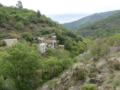
Le Hameau de Rieutort - otcevennesmontlozere  History
Rieutort mill
At Rieutort (meaning “twisted river”), there was a flour mill and a paraudier or draper's mill. In the 17th century, wool that had been carded, spun, woven and fulled in the cold waters of the mill was made into a stiff cloth called cadis. This was used to make hard-wearing bed sheets. The profession of “bed-sheet miller” disappeared in the golden age of silk.
Le Rieutort - © Nathalie Thomas  Geology
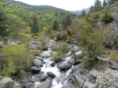
The geological fault of Vialas
A bridge crosses the Rieutort. This river, which is called Pudissine upstream from here, has its spring at an altitude of 1,425 m on Mont Lozère, near Mas de la Barque. In this valley, rounded masses of granite contrast with rectangular and fractured blocks of schist. In the Rieutort, you may see schist stuck to granite, as if they two rocks had been cut with a knife and then glued together. This is due to the fact that, in the Carboniferous (285 million years ago), the granite massif of Mont Lozère was pushed up through the schist layers, fracturing them. This path runs alongside the mining sites linked to the Vialas fault, which is perpendicular to the large Villefort fault.
Description
Signposts will guide you all along this route, as well as yellow painted waymarks. In the description below, the signposted place names and/or directions are given in bold italics between quotation marks:
Starting at “Vialas”, walk to “Soleyrols” via :
- “Place de l’Ancienne Gendarmerie”,
- “La Vigne”,
- “Maison de retraite”
- “Rieutort” (2).
- At “Soleyrols”, Walk to
- “Ruisseau du Villaret”. Return to “Vialas” via :
- “Légaou”,
- “La Tranchée”,
- “Lou Devez”,
- “Plagette”, “La vigne” and “Place de l’Ancienne Gendarmerie”.
This hike is taken from the guidebook Mont Lozère – Pays des sources, Sommet des Cévennes, published by the Pôle de pleine nature du Mont Lozère.
- Departure : As you enter Vialas on the road from Le Pont-de-Montvert
- Arrival : As you enter Vialas on the road from Le Pont-de-Montvert
- Towns crossed : Vialas and Pont de Montvert - Sud Mont Lozère
Forecast
Altimetric profile
Recommandations
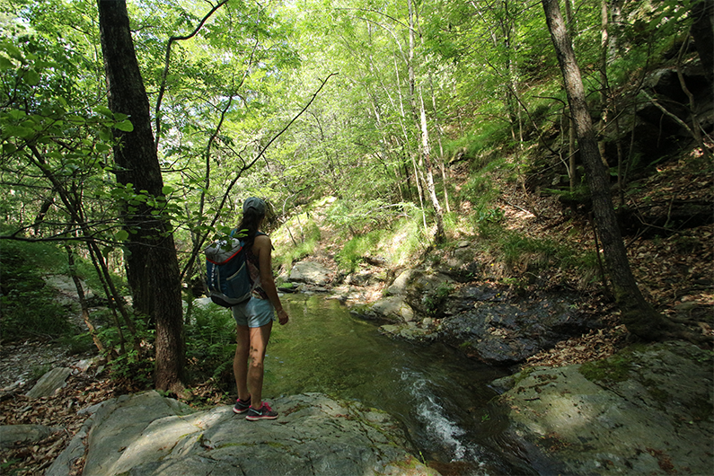
Fords: when water levels are high, please make enquiries before setting out. Make sure your equipment is appropriate for the day's weather conditions. Remember that the weather changes quickly in the mountains. Take enough water, wear good shoes and put on a hat. Please close all gates and barriers after yourself.
Information desks

Office de tourisme Des Cévennes au mont Lozère
le Quai, 48220 Le Pont de Montvert sud mont-Lozère
Access and parking
Take the D998 road towards Génolhac to Vialas
Parking :
Calculateur d'itinéraire Lio
Utilisez le calculateur liO pour organiser votre trajet en région Occitanie.
Autres régions
Calculez votre itinéraire en Auvergne Rhône Alpes sur Oùra
Biodiversité autour de l'itinéraire
Source


Report a problem or an error
If you have found an error on this page or if you have noticed any problems during your hike, please report them to us here: