
La Condamine
A walk on the Causse Méjean, an arid plateau where locals have nevertheless succeeded in making a living. They did not settle here by chance, and had to adapt their rural way of living. Every element here has a story to tell. Can you guess what it might be ?
8 points of interest
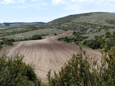
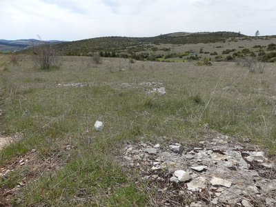
La plaine de la Condamine - nathalie.thomas AgricultureCondamine
Condamine means “collectively farmed land or sinkhole, commons”. La Condamine is a large fertile plain, sheltered from the wind, where crops used to be ready for harvest two weeks earlier. According to an old saying, “if the Causse Méjean was an egg, Condamine would be its yolk” or “its fattiest part”. Its less harsh climate than elsewhere on the Causse and its deep and fertile soil produced by the breakdown of the limestone bedrock explain why Neolithic man settled here and created the area's wealth of megalithic monuments.
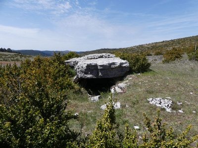
Dolmen de Combe Lebrouze - nathalie.thomas  Archaeology
Dolmen de Combe Lebrouze
The dolmen of Combe Lebrouze, which belongs to a group of dolmens of impressive sizes, is in fact the biggest on the Causse Méjean. The capstone would have been about 6 metres long before it broke into four pieces. The burial chamber is divided into two by a transversal slab. It housed 34 adults and one child as well as precious burial goods. The dolmen was probably visited for the first time in 1871 (Revue du Gévaudan des Causses et Cévennes, 1964).
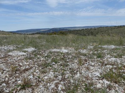
Doline - nathalie.thomas AgricultureDoline
This natural depression, known as a sotch or doline, is created by rain run-off sweeping away disintegrated limestone. Dolines are often protected from the wind by rock faces, hedges or walls that enclose them. In the old days of self-sufficiency farming, only these fertile valleys were farmed.
Parcours - nathalie.thomas  Pastoralism
Pasture
From 1970 onwards, the agro-pastoral system evolved, transforming livestock keeping. The use of fenced-in sheep pens freed up a part of the dwindling workforce for other farm activities. Pastures were broken up or abandoned and slowly invaded by boxwood, juniper and conifers.
Vue depuis Nis d'Aoucel - nathalie.thomas  Landscape
Viewpoint
Just before going downhill on the lane to Le Tomple, take the time to go up to Nis d'Acoul to admire the panoramic views: the protohistoric fortified site (cap barré) at Le Single, topped by communications masts; and to the east, the summits of Mont Lozère, the Cévennes, and on clear days the masts on Mont Aigoual (1,567 m). In the foreground is Mont Gargo, the highest point of the Causse Méjean (1,247 m), behind it the Causse Méjean plateau, and finally the cliffs of the Causse Sauveterre.
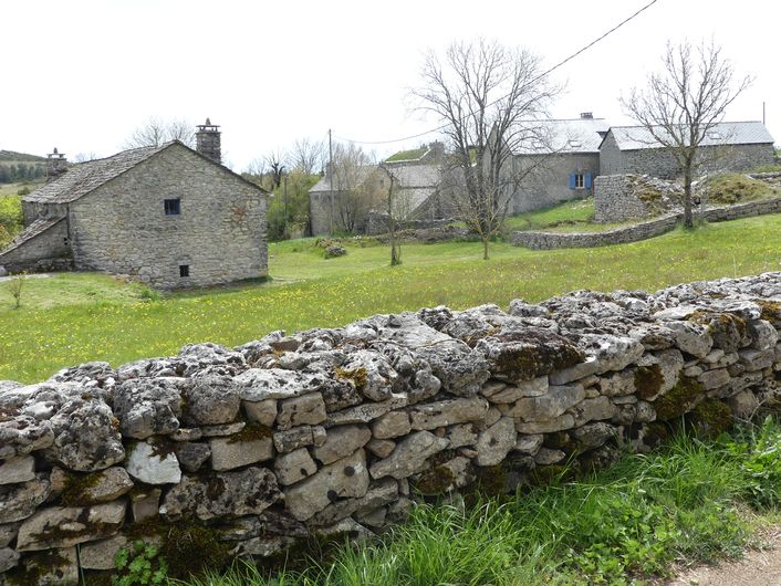
Vue depuis le Tomple - © Virginie Boucher  Architecture
Le Tomple
The houses in this hamlet (altitude 976 m) have been built from limestone blocks using a lime mortar. Some have been rendered. Such construction methods are characteristic for traditional architecture. The stones for building came from the plateau's quarries. The lack of wood forced builders to do without: no timber roof structures, just a stone vault covered by lauzes (flat stones). Traditionally made from limestone, these lauzes started to be replaced by schist lauzes a few years ago. These techniques mean that Causse houses are solidly built, with only small openings.
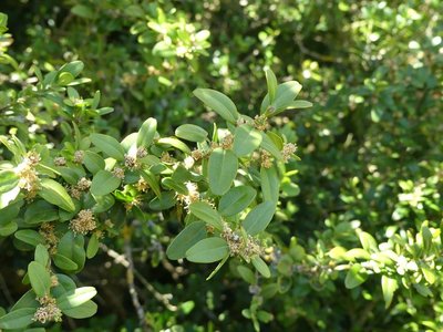
Buis - nathalie.thomas  Flora
FloraBox
Box is a symbol of immortality because it is evergreen. In the Middle Ages, it was a part of the peasants' materia medica. Its essence, wood and leaves all have the same characteristics. Dried in the shade with frequent turning, its leaves were a remarkable antipyretic and diuretic with sudorific properties. They were also used to treat chronic skin diseases, gout, rheumatism and baldness. Branches were used as litter in sheepfolds. During the summer grazing period, the shepherds turned its wood into staffs with sculpted knobs and other objects.
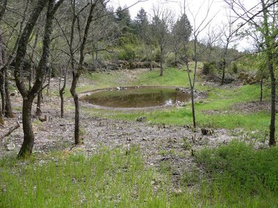
Lavogne - nathalie.thomas  Water
WaterLavogne
Water being rare on the Causse, so-called lavognes – clay basins for retaining rainwater – were created by locals for their flocks. Lavognes are a part of local agro-pastoral heritage, but they are also of undeniable ecological interest. A large number of animals (mammals, birds, insects, etc.) come to drink and hunt here, dragonflies and amphibians even to reproduce. About 200 lavognes have been identified on the Grands Causses, but only too often a lack of maintenance leads to their disappearance.
Description
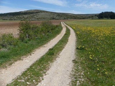
From the crossroads, do not go towards La Condamine but instead take the path that crosses the vast farmed plain. Pass in between the ruins of Combe Lebrouze and the dolmen and continue straight on a path that heads into the small valley of Mativet. At the crossing, turn left onto the track that goes into the small valley and joins up with the road to Le Tomple. Turn left onto the road, go through the hamlet of Le Tomple, and take the track downhill towards a pass (col). NB: Not long before the pass, take the path on the left to the lavogne, then take the path above the lavogne to return to the lane leading to La Condamine. Turn left, pass in front of La Condamine and continue back to the car park.
- Departure : Crossroads of the D68 and the road to La Condamine
- Arrival : Crossroads of the D68 and the road to La Condamine
- Towns crossed : Gorges du Tarn Causses
Forecast
Altimetric profile
Recommandations
Make sure your equipment is appropriate for the day's weather conditions. Remember that the weather changes quickly in the mountains. Take enough water, wear good shoes and put on a hat. Close all gates and barriers after yourself. Please do not bring dogs (presence of livestock with guard dogs).
Information desks

Tourism office Cévennes Gorges du Tarn, Ispagnac
Place de l'Église, 48320 Ispagnac
This office is part of the National Park's associated tourist-information network, whose mission is to provide information on, and raise awareness of, the sites and events as well as the rules that must be observed in the National Park's central zone.
Open year-round

Tourism'house and national Parc at Florac
Place de l'ancienne gare, N106, 48400 Florac-trois-rivières
This office is part of the National Park's associated tourist-information network, whose mission is to provide information on, and raise awareness of, the sites and events as well as the rules that must be observed in the National Park's central zone.
On site: exhibitions, video projections, events and shop Open year-round
Access and parking
From Florac, take the RD 16 road onto the Causse Méjean plateau. At Mativet, take the road going towards La Condamine/Les Champs/Montbrun
Parking :
Calculateur d'itinéraire Lio
Utilisez le calculateur liO pour organiser votre trajet en région Occitanie.
Autres régions
Calculez votre itinéraire en Auvergne Rhône Alpes sur Oùra
Biodiversité autour de l'itinéraire
Source


Report a problem or an error
If you have found an error on this page or if you have noticed any problems during your hike, please report them to us here: