La Dauphine
5 points of interest
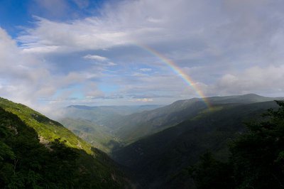
Vue plongeante sur la vallée de l'Hérault - Arnaud.Bouissou  Water
WaterRiver capture
Violent precipitation and the steep gradient of Mediterranean torrents cause regressive (i.e. upstream) erosion of the valleys through which they flow. This erosion can invert the sense of flow and thus “capture” for the Mediterranean a waterway that had, until then, flowed into the Atlantic. One example is the Hérault with its waterfalls, the capture being located at the falls. The Hérault and the Dauphine brook used to flow via L'Espérou into the Dourbie... River pebbles found around the village by geologists attest to the existence of a waterway in the past.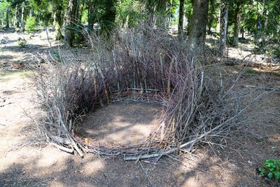
Nids (Céline Pialot) - © E. Fréget  Fauna
FaunaThe Nests (Céline Pialot)
Little by little, the bird makes its nest, its cosy nest, baby cocoon, wasps’ nest…
Like a bird, the artist has gathered materials offered by nature and has arranged them to build three nests, three refuges, three circles that reference perfection and invite meditation.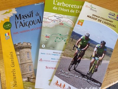
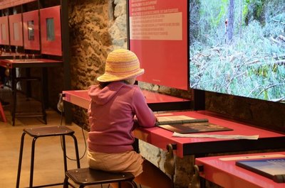
le Pole Nature de l'Aigoual - Béatrice Galzin  Natural environment
Pôle Nature 4 Saisons
The Pôle Nature 4 Saisons of the Aigoual massif offers outdoor activities in all seasons in the central zone of the Cévennes National Park, overlooked by the legendary summit of Mont Aigoual (1,570 m). Discover our network of trails on foot, on horseback, by bike, or else by mountain-bike or with a donkey, as the fancy takes you!
Children can explore the orienteering circuit or geocaching.
For the sportier among you we have laid out trail running circuits!
Prefer road biking? We have created circuits of varying difficulty levels so you can discover our villages and valleys.
Try not to make any noise! Wildlife enthusiasts can spot mouflons and other animals.
And if you would just like a gentle walk on the massif, the discovery trail “The cliffs of Mont Aigoual” is for you. There are various rest stops over its 4.5 km, with only 150 m in height difference.
We look forward to seeing you on our paths.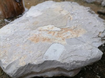
Archéosmart (Marc Limousin) - © Filature du Mazel  Archaeology
Archeosmart (Marc Limousin)
Smartphone imprints appear on the rocks: fossils of the present that will become mysterious in the future. This carved stone, like the cup-shaped marks and other rock art of the region, discloses history revealed in matter and resonates with Malraux’s phrase: “The future is a present given to us by the past”.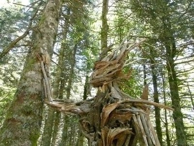
Gardien des bois (Raphaël Daynié) - © Filature du Mazel  Flora
FloraGuardian of the Woods (Raphaël Daynié)
The Guardian evokes a possible connection, a dream connection, in which humans consider themselves a part of nature, developing in close union with their environment. This Guardian of the Woods overlooking the Aigoual valley was built with natural materials found on site, and gently touches a tree that is still alive.
Description
Signposts will guide you all along this route. In the description below, the signposted place names and/or directions are given in bold italics between quotation marks:
Sarting at "Col de La Serreyrède", head towards "Point Sublime" via "Virage de Barrot", "Valat de la Dauphine", "Muraille de Volpellière". At "Point Sublime" take the track on the left towards "Coupe feu Sud", "Coupe feu", "Les plaques", "La Source". At "La Source" climb to "Sommet du Mont Aigoual" in the direction of "Le Bélvédère". Go downhill to "Prat Peyrot" via"Les Antennes", "La Drailhe". Return to "Col de La Serreyrède" via "Le Fangas".
This walk is taken from the guidebook Massif de l’Aigoual, published by the Communauté de communes Causses Aigoual Cévennes as part of the collection Espaces Naturels Gardois and the label Gard Pleine Nature.
- Departure : Col de La Serreyrède pass (Valleraugue)
- Arrival : Col de La Serreyrède pass (Valleraugue)
- Towns crossed : Val-d'Aigoual, Bassurels, and Meyrueis
Forecast
Altimetric profile
Recommandations
Make sure your equipment is appropriate for the day’s weather conditions. Remember that the weather changes quickly in the mountains. Take enough water, wear sturdy shoes and put on a hat. Please close all gates and barriers behind you.
Information desks

Tourism & national parc'house
Col de la Serreyrède, 30570 Val d'Aigoual
The Maison de l'Aigoual houses the tourism office Mont Aigoual Causses Cévennes and the Maison du Parc national. This visitor centre provides information on and raises awareness of the Cévennes National Park, its sites and events as well as the rules that must be observed in the National Park's central zone.
On site: changing exhibitions, video projections, Festival Nature events and shop Open year-round
Transport
liO is the regional public transport service of the region Occitanie/ Pyrénées - Méditerranée. It facilitates everyone’s movements by prioritising public transport. For more information, call 08 10 33 42 73 or go to www.laregion.fr
Access and parking
From L'Espérou or Camprieu on the RD 986
Parking :
Calculateur d'itinéraire Lio
Utilisez le calculateur liO pour organiser votre trajet en région Occitanie.
Autres régions
Calculez votre itinéraire en Auvergne Rhône Alpes sur Oùra
Accessibility
- Emergency number :
- 114
Biodiversité autour de l'itinéraire
Source


Report a problem or an error
If you have found an error on this page or if you have noticed any problems during your hike, please report them to us here: