Across the Massif Central by mountain-bike
You will cross breath-taking scenery, from the granite uplands of the Mont Lozère to the majestic forests of the Aigoual massif via the vast limestone plateau of the Causse Méjean, which is cut through by the spectacular Tarn and Jonte gorges ! Discover the fauna and flora of these mountain ranges and meet the men and women who live there.
40 points of interest
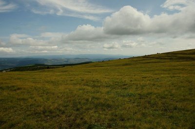
Paysage - © Brigitte Mathieu  Flora
FloraSubalpine short-grass prairie
Marker 1
Like garden or sports pitches, short-grass prairies are shaped by mankind. Grazing and controlled burns are the tools for their maintenance here. The main plants are nard and fescue, perennial grasses related to wheat. If you cut (graze) one of their stalks, five more will soon form; if you trample them, they multiply and become very dense. This kind of “torture” creates a thick plant cover that stabilises the sparse dark soil, which is derived from erosion of the ever-present granite. Here, then, are some clues for the appropriate management of this environment, which becomes weakened if neglected.
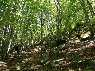
 Natural environment
Natural evolution of beech and oak groves
Marker 1
This steep terrain consists of a mass of fallen granite rocks (scree), which makes it unusable by domestic animals. The beeches and chestnuts growing here have thus evolved naturally, the only intervention being felling for timber or firewood. Other species are also associated with tree cover (hazelnuts, blueberries, ferns, etc.), as well as rocks covered in mosses, which attest to the relatively damp conditions.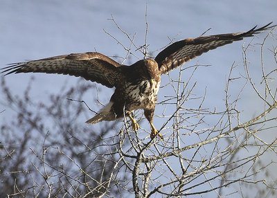
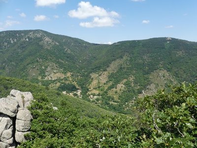
Buse variable - © Régis Descamps  Landscape
The Tarn valley and its landscapes shaped by human activity
Marker 2
The open scenery overlooking the Tarn offers a grand panorama. The landscape has been profoundly shaped by the presence of humans and their flocks. Farmers practise slash-and-burn farming to contain the spreading forest. This needs to be regularly repeated to stop Pyrenean broom from getting the upper hand. On the plateau, you will see hay meadows and, along the edges of plots, pruned ash trees (whose branches are used as animal fodder in the autumn). Some birds of prey like these open spaces, where hunting rodents is easier. Geology
Granite boulders
Marker 4
Granite, which is used for dressed stone as you saw in the hamlet, is a vulnerable rock on the geological timescale. The erosive power of water is furthered by the cracks that divide the rock. These occur because of the stresses to which granite – which rose as magma at the end of the Paleozoic – has been exposed since cooling. The speed of this erosion depends on the climate. This is why whole, undamaged granite blocks break off. They form particularly picturesque block fields (felsenmeer) once the coarse sands have disappeared.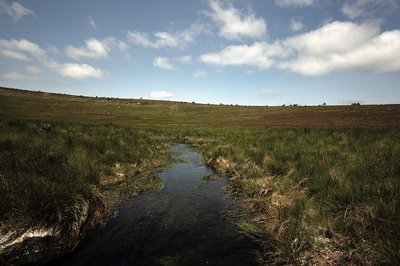
Source du Tarn - © Yannick Manche  Water
WaterThe river Tarn
The Tarn has its spring at an altitude of 1,550 m under the ridge of Mont Lozère. Having carved its way into the granite bedrock, it separates the Bougès massif from Mont Lozère. After Bédouès, it meets the river Tarnon and slowly enters the limestone region, in which its bed is increasingly deep. At its confluence with the Jonte, at Le Rozier, the Tarn leaves the department of the Lozère.
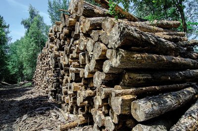
coupe de bois - © Olivier Prohin  Know-how
Fages Sawmill
Upstream from Bédouès, you will see a sawmill, which mainly produces wood to make crates and pallets. It also produces some timber. Today, local forestry companies utilise wood in a number of ways: for energy, paper pulp, timber, crate-making and construction.
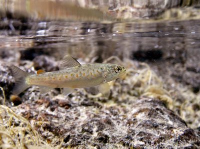
Truite fario - © Philippe Baffie  Fauna
FaunaThe brown trout (Salmo trutta fario)
This trout lives in our waterways and is an indigenous species. This stock is a part of our heritage. Its size varies with the quality of the water, fishing pressures, and the nature of the riverbed (hiding-places). In the summer, it hunts in white water and on the surface, and catches insects. In the winter, it eats larvae on the bottom. Reproduction begins in November and is staggered throughout the winter. The female lays its eggs on a gravelly stretch of the riverbed, into which it has dug a pit using its caudal fin. The male deposits its milt over the eggs. Once they are fertilised, the eggs are covered with gravel. Reproductive success depends on variations in the water flow and especially on the risk of the spawning areas drying out in dry winters.
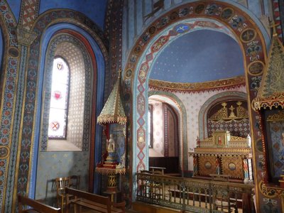
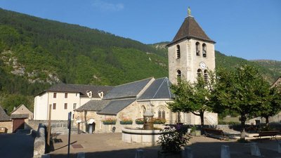
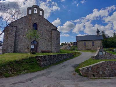
Chapelle St-Saturnin - © Nathalie Thomas  History
Saint-Saturnin chapel
Saint-Saturnin chapel stands at the heart of the village, surrounded by its cemetery. Inside every wall boasts a magnificent painted décor. It was built in the 12th century. Guillaume de Grimoard (the future Pope Urban V) was baptised here in 1309. It is next to the town hall (mairie) and is well worth a detour.
- Geology
The iron-rich water of Salce
After a small detour from the hamlet of
Salièges to the river Tarn, you will come across a spring of ferruginous water. For a long time, the ability to prevent (or cure) alcoholism was attributed to this water rich in Fe2+ ions, and made famous by a sketch by the stand-up comedian Bourvil. It supposedly supplies the iron that would normally come from regularly drinking alcohol. A small construction indicates the Salce spring (the path from Salièges is way-marked), as does the red tinting from iron oxide, which you find in many contact zones between schist and limestone. 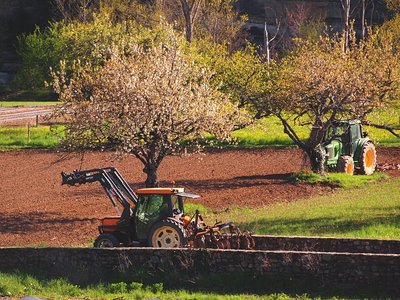
Vergers d'Ispagnac - © Francis Fayet AgricultureThe gardens of Ispagnac
Ispagnac is in the contact zone of limestone, granite and schist bedrock. The valley of Ispagnac is irrigated by the river Tarn and, being protected from the north and north-western winds, it enjoys an almost southern climate. This has earned it the nickname of “garden of the Lozère”. A market gardener and two wine-makers are based here.
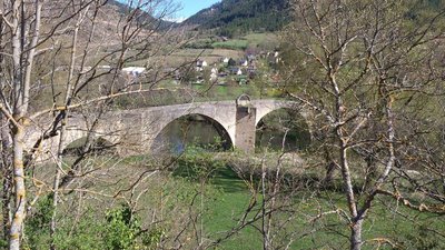
Pont de Quézac - © CC Florac Sud Lozère  Architecture
Quézac Bridge
This bridge crossing the river Tarn gives access to the village of Quézac, located on the left bank. Around 1350, Pope Urban V decided to fund its construction to facilitate pilgrims' access to the collegiate church of Notre-Dame de Quézac. It was finished in the 15th century. Its history is punctuated by partial destruction in floods, and by more or less solid rebuilding. It became a listed monument on 27 August 1931.
Source de Quézac - © Nathalie Thomas WaterQuézac mineral water
Quézac mineral water emerges naturally from the Diva spring, near the entrance to the village, in exceptional surroundings which have been naturally protected for centuries. This pleasant-tasting water is rich in mineral salts and trace elements and is also well-known to be beneficial for the stomach. The spring's water actually comes from Mont Aigoual. According to scientific studies, it takes 30 to 40 years for it to re-emerge in Quézac, after first settling in aquifers, where it acquires its effervescence naturally (rare in France).
Notre-dame de Quézac - © Nathalie Thomas HistoryNotre-Dame de Quézac
The collegiate church of Quézac – today Notre-Dame church – was fortified in the 14th century at the instigation of Pope Urban V. The first building is believed to have been erected in 1052 in honour of Our Lady of Quézac. Legend has it that a ploughman found a black Virgin while ploughing a furrow, which he brought into the church. However, it disappeared during the night, and the next day was found again in the furrow. The decision was taken to build an oratory on the spot chosen by the Virgin, and soon large numbers of pilgrims on their way to Santiago de Compostella visited Quézac. Today, a stained-glass window illustrates the dedication of the collegiate church to Our Lady.
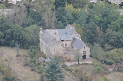
Château de Charbonnières. - © OTGCC nc ArchitectureThe Château de Charbonnières
In a bend of the Tarn downstream from the village of Montbrun stands the Château de Charbonnières. While the former castel has lost some of its defensive elements, it has nevertheless preserved a knightly characterand traces of many historical episodes of the Tarn valley. It is first recorded in the 13th century. Its defensive role was tightly linked to a whole “fortified system” downstream of Ispagnac, which consisted of Quézac, Javillet, La Roche, Rocheblave, Montbrun, Castelbouc, Prades and Sainte-Enimie.
The château has three rectangular //buildings arranged in a horseshoe shape around an internal courtyard. The facade overlooking the Tarn has a square tower that dominates the river. Access to the internal courtyard is via gates under a semi-circular arch. From the courtyard, a stone staircase leads up to the chapel, whose doorways is decorated with fleur-de-lys. The modest interior has a ribbed vault framing a keystone engraved with the arms of the Montesquiou family, lords of Charbonnières from the 13th century onwards. The other parts of the residential building have handsome fireplaces, a monumental staircase and fine vaulted halls. In the 17th and 18th centuries, the château became the property of the Volonzac Malespina family and, in the 19th century, of the Boutin family. It is not open to the public.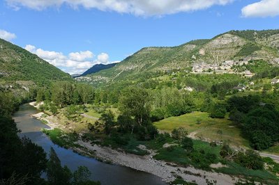
Les gorges du Tarn et le village de Montbrun - BOUISSOU Arnaud / TERRA Ministère de l'Environnement WaterNot always a docile river!
For 52 km, from the point it enters the canyon at Quézac to Le Rozier, the Tarn has no overground tributary. However, it is fed by about 170 karst springs stemming from subterranean aquifer networks. These springs release the rainwater absorbed by the avens, dolines and fissures of the Causses plateaux. When reserves are high, the water gushes with great force from the karst environment. Locals say that “the corks are popping”. In the event that the tributaries of the Tarn (the Mimente and Tarnon) rise and add to the springs, the time will have come to move the furniture upstairs.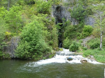
Résurgence de Castelbouc - © N Thomas WaterThe spring of Castelbouc
The vast spring as you enter the hamlet has four outlets, including one at the back. These openings, out of which water surges during heavy rain, reinforce the translation of the Occitan bouc as bouches (“mouths”). All springs are fed by a catchment area of varying size. Here, the catchment area is the sector of Aven du Pic de l’Usclat, Aven du Loup (Cros garnon) and Aven du Crapaud (Fretma) on the Causse Méjean plateau.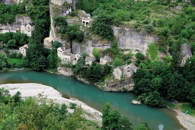
Castelbouc - B Daversin HistoryThe strange legend of Castelbouc
For you to judge…
The etymology of Castelbouc is castel blanc, meaning “perched on the rock” in Occitan.
Legend has it that during the Crusades the castle’s lord was the only man to have remained behind in this little hamlet of dwellings built against the cliff. He had many female visitors, and it was important to him to satisfy their needs. Unfortunately, the Crusade was so long that he was unable to keep going to its end. When his soul left his body, an enormous he-goat was seen hovering over the castle tower… Ever since, a bleating sound followed by strange murmurings can be heard on the summit. This is the legendary origin of the name of Castelbouc...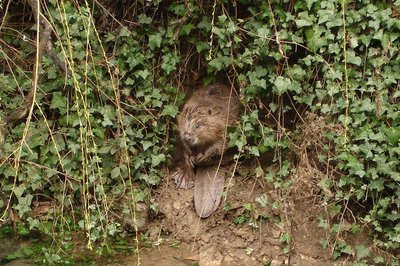
Castor - © OTGCC nc FaunaThe beaver
Proof that I have been here might be a tree carved into a pencil shape; pieces of bark; wood chips; a heap of branches in the water; back or front paw prints in the sand. I’m the Eurasian beaver. I live near water. I’m active mostly at night, and sometimes at dawn and dusk if no-one disturbs me. From the Middle Ages (11th century) to the 19th century, times were hard for us. We were hunted by humans for our flesh, fur and because we were thought a nuisance. In the early 20th century, we had disappeared from many parts of France. Today, things are better – we live alongside and in the Tarn again.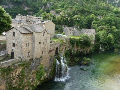
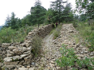
Saint-Chély du Tarn - nathalie.thomas HistorySaint-Chély du Tarn
Saint-Chély-du-Tarn benefits from the three ideal conditions for founding a village: ample springs; construction materials (tuff rock) available on site; and, above all, a track connecting it to the Causse Méjean plateau. All the gorge hamlets are linked to the Causse by a path. Over time, these connecting paths were developed to varying extents – cobbled and/or consolidated by small walls – and they facilitated trade.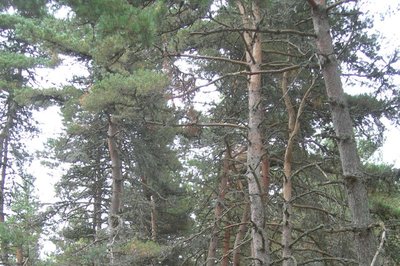
Le pin sylvestre - OT Gorges du Tarn Causses & Cévennes nc Natural environmentThe Scots pine
The Scots pine is the main natural tree variety of the Grands Causses plateaux, as it is well-adapted to poor soils. You can recognise it by it its bark, which is a reddish brown to salmon-ochre colour on the upper part of the trunk; its needles are short and paired. Being hardy, it does not fear climate change. As a pioneer species, it settles on abandoned land.
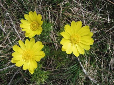
Adonis vernalis - © Bruno Descaves FloraAdonis vernalis (spring pheasant's eye)
Whilst this member of the buttercup family might seem plentiful, it has become rare and is limited to a few places in France (Causses, Alsace) and south-eastern Europe. It can be seen in April-May in the steppe flora. This plant is protected – you may take photos but under no circumstances take the plant! It secretes a substance through its roots that tends to limit the growth of plants around it, especially legumes.
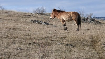
Cheval de Przewlaski - nathalie.thomas FaunaPrzewalski’s horse
Przewalski’s horses, the last wild horses in the world, are originally from Central Asia. They had been extinct in the wild for 40 years when a conservation herd was bred at Le Villaret with a view to reintroducing the species to Mongolia. Two deliveries of four families and a group of studs to Khomiin Tal, Mongolia, were organised in 2004 and 2005. There, the animals were released onto a territory of 14,000 hectares.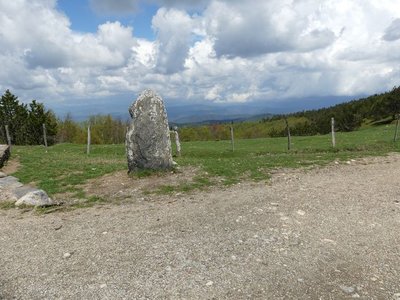
Vue depuis Font de Trépaloup - nathalie.thomas FloraThe evolution of plant life
At the pass stands a schist menhir (standing stone). To the north, in Trépaloup ravine, hewn flint implements bear witness to a human presence in the region since prehistoric times. Palynological analyses (studies of pollen fossilised in peatbogs) have allowed scientists to piece together the plant life on Mont Aigoual from 8,000 to 5,000 BC. Pine predominated, accompanied by birch and hazelnut. Then pine populations gradually diminished. The damp climate warmed up, favouring the spread of oak and hazelnut. Finally, the increased damp and cloud cover at altitude allowed fir and beech to develop. From the end of the first century BC, the substantial percentage of grasses shows that forest had receded in favour of pasture and prairies. This was the start of the great deforestation.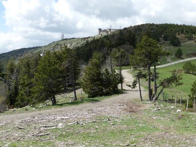
Observatoire de l'Aigoual - nathalie.thomas HistoryThe meteorological observatory
Inaugurated in 1824, the meteorological observatory was built on the initiative of Georges Fabre, one of the pioneers of the reforestation of Mont Aigoual. His work with the botanist Charles Flahault enabled the creation of the arboretum of L’Hort de Dieu. The first meteorological data were gathered by agents from the French National Water and Forestry Commission. Since 1943, the observatory has been managed by the National Meteorological Office. It is France’s last mountain weather station that is inhabited year-round.
Troupeau au sommet de l'Aigoual - © Nathalie Thomas FloraSummit of Mont Aigoual
At an altitude of 1,565 m, the climate is harsh: weather conditions are the same as they would be at 2,000 m elsewhere, with only four “frost-free” months a year. Winds of above 60 kph blow on 265 days a year, and the average annual temperature is 4.8°C. Trees do not have enough time to complete their life cycle. Local plant formations are those of the montane zone: subalpine short-grass prairies.
Archéosmart (Marc Limousin) - © Filature du Mazel  Archaeology
Archeosmart (Marc Limousin)
Smartphone imprints appear on the rocks: fossils of the present that will become mysterious in the future. This carved stone, like the cup-shaped marks and other rock art of the region, discloses history revealed in matter and resonates with Malraux’s phrase: “The future is a present given to us by the past”.
le Pole Nature de l'Aigoual - Béatrice Galzin Natural environmentPôle Nature 4 Saisons
The Pôle Nature 4 Saisons of the Aigoual massif offers outdoor activities in all seasons in the central zone of the Cévennes National Park, overlooked by the legendary summit of Mont Aigoual (1,570 m). Discover our network of trails on foot, on horseback, by bike, or else by mountain-bike or with a donkey, as the fancy takes you!
Children can explore the orienteering circuit or geocaching.
For the sportier among you we have laid out trail running circuits!
Prefer road biking? We have created circuits of varying difficulty levels so you can discover our villages and valleys.
Try not to make any noise! Wildlife enthusiasts can spot mouflons and other animals.
And if you would just like a gentle walk on the massif, the discovery trail “The cliffs of Mont Aigoual” is for you. There are various rest stops over its 4.5 km, with only 150 m in height difference.
We look forward to seeing you on our paths.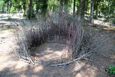
Nids (Céline Pialot) - © E. Fréget FaunaThe Nests (Céline Pialot)
Little by little, the bird makes its nest, its cosy nest, baby cocoon, wasps’ nest…
Like a bird, the artist has gathered materials offered by nature and has arranged them to build three nests, three refuges, three circles that reference perfection and invite meditation.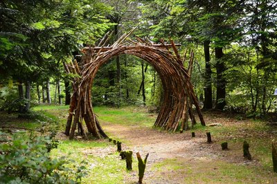
L'Orée (Yoann Crépin) - © Filature du Mazel Know-howOn the Verge (Yoann Crépin)
A doorway to a circuit of art within the natural environment.
To fuse and interact with the environment and play with the seasons, time, light and weightlessness. To let humanity express itself through nature and nature express itself through humanity – a necessary interaction, a symbiotic interaction that inspires us to discover another world.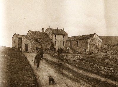
Maison forestière de la Serreyrède - © Jacques de Joly AgricultureLa Serreyrède
Before 1861, the house at the Col de la Serreyrède was inhabited by two families of farmers. They owned some livestock and had a vegetable garden, whose terraces you can still see above the La Caumette track. From 1861 on, the farm was inhabited by a forest ranger. It was only bought by the state body Eaux et Forêts in 1883, to be turned into a forester's house. It became one of Georges Fabre's headquarters during the reforestation of the Aigoual massif. The Cévennes National Park, tourism office and Terres d'Aigoual growers have now joined forces to revive La Serreyrède with the help of the Communauté de Communes Causses Aigoual Cévennes – Terres solidaires.
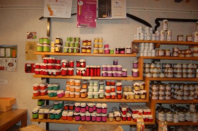
Boutique des producteurs - © Nathalie Thomas AgricultureThe association "Terres d'Aigoual"
The Cévennes National Park rents out part of the building to the association, enabling local farmers to sell their products directly to the public. The association brings together farmers who wish to promote what they produce and share their know-how. They also enjoy sharing their vision of farming- high quality produce and products,
- human-sized farms,
- mutual aid.
Come and discover their products!
- History
From beech copse to mature plantation
Marker 1
Around 1850, before reforestation began, the inhabitants of the Cevennes were using local wood resources on a massive scale for heating and in industry, especially spinning-mills. Gradually, only a few beech copses remained, which were cut every 25 to 40 years. Grazing by tens of thousands of sheep further reduced the herbaceous plant cover. Much weakened, the plant cover was then also subjected to heavy precipitation, the so-called Cevenol episodes. It is against this backdrop that the lengthy work of the foresters began. To reduce risks and establish a lasting forest cover, the first technique was to make use of what was already present by converting the disused copses into mature plantations. - Know-how
Productive forest
Marker 2
Another method of creating a durable forest cover is to plant or sow. This work is carried out either on bare soil or among existing tree stands. The Aigoual reforestation programme was a gigantic effort, requiring 900,000 days of work, the planting of 60 million conifers and 7 million deciduous trees, and sowing of 38 tonnes of seeds. Spruces and pines, which can be planted in full sunlight and grow quite quickly, were widely used. Under the forest canopy, preference was given to firs. - Natural environment
Irregular forest
This tree population consists of trees of very different diameters, ages and heights. Species are mixed: mainly pine, but also beech, rowan and whitebeam. This is an irregular mature forest, a forestry dynamic that is interesting for several reasons: it creates permanent forest cover; resistance to soil erosion; better resilience against storms or parasite attacks; regular production, etc. In the small clearing to the left of the path, the sunlight now penetrating to the forest floor has made natural regeneration of beech and fir possible, ensuring the renewal of the forest.
Village de l'Espérou - Béatrice Galzin HistoryThe village of L’Espérou
The village of L’Espérou lies on the border of Dourbies and Valleraugue local councils. A draille (track for livestock to migrate to summer pastures with their shepherds) crosses the village. As in many villages in the Gard, the two places of worship – one Catholic, the other Protestant – are opposite each other. The village is located in a varied environment that is suitable for outdoor activities and sports.
La hêtraie - N Thomas FloraAltitudinal vegetation zones
The path ranges from 700 to 1,250m in altitude and clearly shows the changes in vegetation as you climb. Vegetation zones have been defined based on altitude; they are given the name of the predominant plant species.
The first, the holm oak zone, stops at around 500m. It occurs mainly on schist or limestone. From 500 to 900m is the zone of deciduous oaks and sweet chestnut. From 1000m to 1500m is the beech zone; here you are in the Aigoual state forest. The final vegetation zone, above 1500m, is treeless and only concerns a small circle around the Aigoual summit.
Salagosse - N Thomas HistoryThe municipality of Bréau-Salagosse
The municipality of Bréau-Salagosse consists of two distinct villages. The older one of the two is Salagosse. Bréau was not founded until the 7th century when part of the population of Salagosse, feeling hemmed in, decided to settle on a sunny slope lower down in the valley. Separated in 1669, the two parishes reunited in 1818. The name of Salagosse probably comes from Feragus, the nickname of a local man-at-arms, meaning “sharp iron”. Its inhabitants are known as salabousards.
Route de Rutènes - Nathalie Thomas HistoryOn the road to Rutènes
Before Gaulle was conquered by Julius Cesar, this former track linked the territory of the Arecomici (whose capital was what is now Nîmes) and the land of the Rutènes (whose capital was first Albi, then Rodez). The Ruteni were the Gaulish people of the Aveyron department.
(see Molières-Cavaillac info sheet, available at the tourist office in Le Vigan).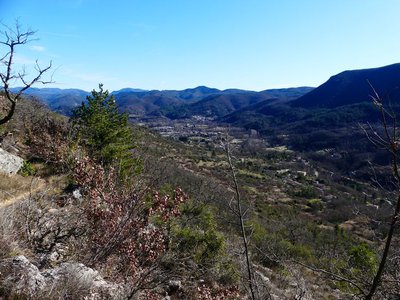
Vallée de l'Arre - Nathalie Thomas GeologyThe Arre valley
The path climbs steadily over fallow crop terraces. The higher you get, the wilder and more typical of dry limestone soils is the vegetation: white oaks, box trees, thyme, etc.
Opposite, the Causse de Blandas plateau overlooks the Arre. Following a geological incident, the river was diverted and dug its bed into the limestone, thus separating Esparon from the Causse. Halfway between Molières and Esparon, the Déroucades blockfield, created by an earthquake in 580, lies on a faultline.
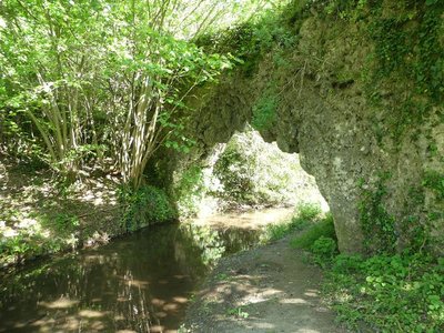
Pont de Mousse - Nathalie Thomas GeologyThe Pont de Mousse (moss bridge)
This natural tuff bridge was described by a Mr Chante in 1933: “a small path leads to the Vézénobre brook, in which blocks of tuff covered in abundant vegetation have formed the moss bridge. The arch carries an irrigation channel, and thousands of crystal-clear drops fall without cease from the vault into the brook which, 50 metres from here, produces five waterfalls”. The whole hillside is tuff rock, which was used to build the neighbouring terrace walls. In the 14th and 15th centuries, a flour mill called Moulin de la Rode stood near the bridge.
Description
Only the section of the trail which crosses the territory of the Cévennes National Park is described here, from
Bagnols-les-Bains to Le Vigan.
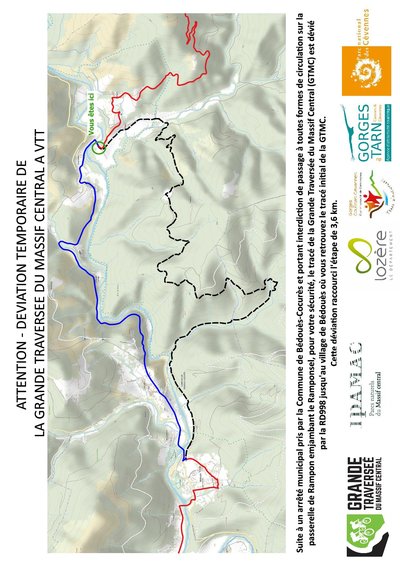
The suggested route can be covered in five stages:
1 - Bagnols-les-Bains/Pont-de-Montvert-Sud-Mont-Lozère,
2 - Pont-de-Montvert-Sud-Mont-Lozère/Sainte-Enimie:
(1) on electrically assisted MTB, take the road towards Grizac,
(2) at the activity centre, cross the Tarn and head to Sainte-Enimie on the road,
3 - Sainte-Enimie/L’Hom: (3) for a technical section on the way to St-Chély du Tarn, you can climb to the Col de Coperlac pass from Sainte-Enimie on the RD 986 road,
4 - L’Hom/l’Espérou,
5 - l’Espérou/Le Vigan.
You can find the whole route on the website: www.la-gtmc.com
- Departure : Bagnols-les-Bains
- Arrival : Le Vigan
- Towns crossed : Mont Lozère et Goulet, Chadenet, Lanuéjols, Saint-Étienne-du-Valdonnez, Les Bondons, Cubières, Pont de Montvert - Sud Mont Lozère, Bédouès-Cocurès, Florac Trois Rivières, Gorges du Tarn Causses, Ispagnac, Mas-Saint-Chély, Hures-la-Parade, Gatuzières, Vebron, Fraissinet-de-Fourques, Rousses, Bassurels, Val-d'Aigoual, Meyrueis, Saint-Sauveur-Camprieu, Dourbies, Bréau-Mars, Arphy, Molières-Cavaillac, Bez-et-Esparon, Avèze, and Le Vigan
Forecast
Altimetric profile
Recommandations
Make sure your equipment is appropriate for several days of hiking as well as the day’s weather conditions. Remember that the weather changes quickly in the mountains. Take enough water, wear sturdy shoes and put on a hat. Please close all gates and barriers behind you. Slow down in farms and hamlets. Be careful around livestock.
Information desks

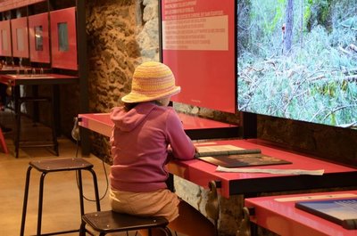
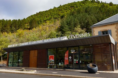
Tourism'house and national Parc at Florac
Place de l'ancienne gare, N106, 48400 Florac-trois-rivières
This office is part of the National Park's associated tourist-information network, whose mission is to provide information on, and raise awareness of, the sites and events as well as the rules that must be observed in the National Park's central zone.
On site: exhibitions, video projections, events and shop Open year-round

Tourism office Coeur de Lozère, Mende
BP 83, place du Foirail, 48000 Mende
This office is part of the National Park's associated tourist-information network, whose mission is to provide information on, and raise awareness of, the sites and events as well as the rules that must be observed in the National Park's central zone.
Open year-round

Tourism office Cévennes and Navacelles, Le Vigan
Maison de pays, place du Marché, BP 21, 30120 Le Vigan
This office is part of the National Park's associated tourist-information network, whose mission is to provide information on, and raise awareness of, the sites and events as well as the rules that must be observed in the National Park's central zone.
Open year-round
Transport
https://lio.laregion.fr/
Calculateur d'itinéraire Lio
Utilisez le calculateur liO pour organiser votre trajet en région Occitanie.
Autres régions
Calculez votre itinéraire en Auvergne Rhône Alpes sur Oùra
Biodiversité autour de l'itinéraire
Source

Report a problem or an error
If you have found an error on this page or if you have noticed any problems during your hike, please report them to us here: