
Saint-Guiral
2 points of interest
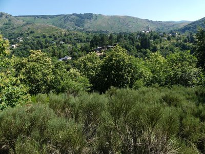
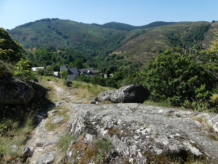
Vue sur Dourbies - nathalie.thomas  History
Dourbies
The village of Dourbies was built on a ridge to maximise the flatter soils for cultivation. Farming having declined in the valley, fields that were once cultivated have now been urbanised, and broom heath is invading more and more land.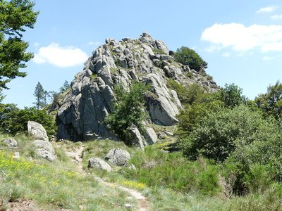
Pic de Saint-Guiral - nathalie.thomas HistorySt Guiral summitSt
Three brothers from the Roquefeuil family were in love with the same young woman. Since she was unable to choose, she bid them join the crusade, promising her heart to the bravest. The years passed, and in the songs transmitted by the troubadours there was no mention of the three knights. The young woman was slowly consumed by grief. With all hope gone, she died. In the cortège following her coffin to the cemetery, the three victorious brothers appeared. Filled with sadness and grief, they decided to live as hermits, each on a mountain top (Saint-Guiral, Saint-Loup and Saint-Alban). And each year they commemorated the cruel loss by lighting huge fires … (Isabelle Magos, Le Guide des Cévennes).
Description
Signposts will guide you all along this route. In the description below, the signposted place names and/or directions are given in bold italics between quotation marks:
Start at "Dourbies-Église". Make for "Saint-Guiral" via "La Clède", "La Croix de Lagrinier", "La Rouvière", "Ressançon", "Combe d'Ardenne". At "Combe d'Ardenne" take the track on the right towards "Le Pradarel", then climb to "Roquefeuillet" to reach the foot of Saint-Guiral. Here you can climb to the summit (there and back). Then return to "Dourbies" via "Sous St Guiral", "l'Abri de St Guiral". Just before the shelter, take the path on the right to "La Grandesc Basse", "Montredon", "la croix de Lagrinier" et "La Clède".
This walk is taken from the guidebook Massif de l’Aigoual, published by the communauté de communes Causses Aigoual Cévennes as part of the collection Espaces naturels gardois and the label Gard Pleine Nature.
- Departure : Dourbies, on the Place de l'Eglise (church square)
- Arrival : Dourbies, on the Place de l'Eglise (church square)
- Towns crossed : Dourbies, Trèves, Saint-Jean-du-Bruel, Sauclières, and Alzon
Forecast
Altimetric profile
Recommandations
Make sure your equipment is appropriate for the day’s weather conditions. Remember that the weather changes quickly in the mountains. Take enough water, wear sturdy shoes and put on a hat. Please close all gates and barriers behind you.
Information desks

Tourism & national parc'house
Col de la Serreyrède, 30570 Val d'Aigoual
The Maison de l'Aigoual houses the tourism office Mont Aigoual Causses Cévennes and the Maison du Parc national. This visitor centre provides information on and raises awareness of the Cévennes National Park, its sites and events as well as the rules that must be observed in the National Park's central zone.
On site: changing exhibitions, video projections, Festival Nature events and shop Open year-round
Transport
liO is the regional public transport service of the Occitanie/ Pyrénées – Méditerranée region. It facilitates everyone’s movements by prioritising public transport. For more information, call 08 10 33 42 73 or go to www.laregion.fr
Access and parking
From L'Espérou on the D151.
Parking :
Calculateur d'itinéraire Lio
Utilisez le calculateur liO pour organiser votre trajet en région Occitanie.
Autres régions
Calculez votre itinéraire en Auvergne Rhône Alpes sur Oùra
Biodiversité autour de l'itinéraire
Source


Report a problem or an error
If you have found an error on this page or if you have noticed any problems during your hike, please report them to us here: