
Castelviel
3 points of interest
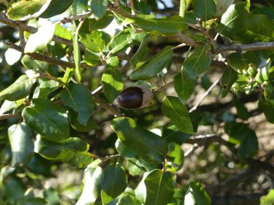
Le chêne vert - nathalie.thomas  Flora
FloraContrasting vegetation
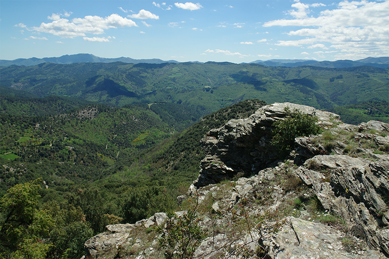
The asymmetry between the two sides of the valley is marked. On the north slope, both deciduous and coniferous trees have established themselves, while the south-west slope is covered in heath and holm oaks. The holm oaks grow in the smallest dip where a bit of soil has collected, all the way up to the ridge at an altitude of 800 m (normally they are not found above 500m). The warm microclimate of these rocky zones, together with their poor and dry soil that excludes most other trees, has enabled the holm oak to extend its natural range.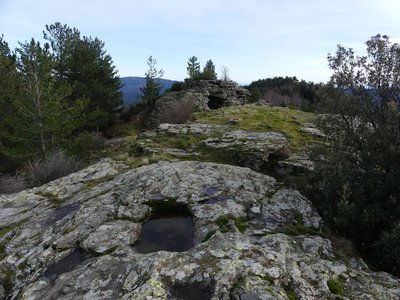
Cupule - nathalie.thomas  History
The mystery of the shaped rock
On the summit, a rectangular base carved into the rock may once have been the foundations of a structure built from perishable materials or even from stone. A similar base can be found further down the slope. Tradition dates these to the Hundred Years War (1337-1439). The insecurity that reigned at the time incited people to organise collective means of defence. The establishment of networks of (flame or smoke) signals from towers or elevated spots was encouraged. The lords of Anduze are said to have organised such a network from Anduze to Florac, with Castelviel Rock as a link in that chain.
The story also goes that these shapes are the foundations for the pillars of a bridge linking the Serre des Potences, built by fairies who were tired of having to cross the valley to meet up. However, digging soon struck them as being even more tiring than walking!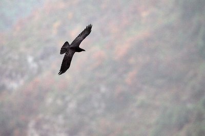
Le grand corbeau - Régis Descamps  Fauna
FaunaThe raven
You may spot a raven here. This member of the crow family, whose wing span exceeds 1 metre, is a mountain bird; its presence is linked to rocky areas. It builds its nest in a cliff that is inaccessible to predators. It hovers like birds of prey and can even fly upside down. You can recognise this carrion-eater by its black plumage and its deep call.
Description
From the parking area, cross the road and take the forestry track opposite.
- After 600 m, take the track on the right. You walk below pines and clear-cut areas.
- At the intersection, take the track on the right; at the second intersection, continue straight ahead.
- Take the leftmost track and cross over to the other side of the ridge.
- After 1.1 km, the track turns slightly left. Then it changes into a path and veers right (steep slope). Walk alongside the ridge. Be careful: some sections are vertiginous and schist bedrock might be slippery when it is raining.
- When you arrive at the highest point, take the path on the left to another high point.
- Continue for 20 metres, until you see the path again (steep section on schist).
- At the intersection, turn left. At the second intersection, continue straight ahead. Finally, at the third intersection, turn right onto the first track of this walk. You will reach the parking area after 1.4 km.
- Departure : At the pass 2km before Saint-Martin de Lansuscle (D 28)
- Arrival : At the pass 2km before Saint-Martin de Lansuscle (D 28)
- Towns crossed : Saint-Martin-de-Lansuscle, Molezon, and Sainte-Croix-Vallée-Française
Forecast
Altimetric profile
Recommandations
Make sure your equipment is appropriate for the day’s weather conditions. Remember that the weather changes quickly in the mountains. Take enough water, wear sturdy shoes and put on a hat. Please close all gates and barriers behind you.
Information desks

Tourism'house and national Parc at Florac
Place de l'ancienne gare, N106, 48400 Florac-trois-rivières
This office is part of the National Park's associated tourist-information network, whose mission is to provide information on, and raise awareness of, the sites and events as well as the rules that must be observed in the National Park's central zone.
On site: exhibitions, video projections, events and shop Open year-round

Office de tourisme Des Cévennes au mont Lozère
le Quai, 48220 Le Pont de Montvert sud mont-Lozère

Tourism office Des Cévennes au mont-Lozère, Sainte-Croix-Vallée-Française
Mairie, 48110 Sainte-Croix-Vallée-Française
This office is part of the National Park's associated tourist-information network, whose mission is to provide information on, and raise awareness of, the sites and events as well as the rules that must be observed in the National Park's central zone. :
Open year-round
Access and parking
From Sainte-Croix-Vallée-Française, take the D28 towards Saint-Martin-de-Lansuscle. After 5 km, at the pass, park in the parking area on the right.
Parking :
Calculateur d'itinéraire Lio
Utilisez le calculateur liO pour organiser votre trajet en région Occitanie.
Autres régions
Calculez votre itinéraire en Auvergne Rhône Alpes sur Oùra
Biodiversité autour de l'itinéraire
Source


Report a problem or an error
If you have found an error on this page or if you have noticed any problems during your hike, please report them to us here: