
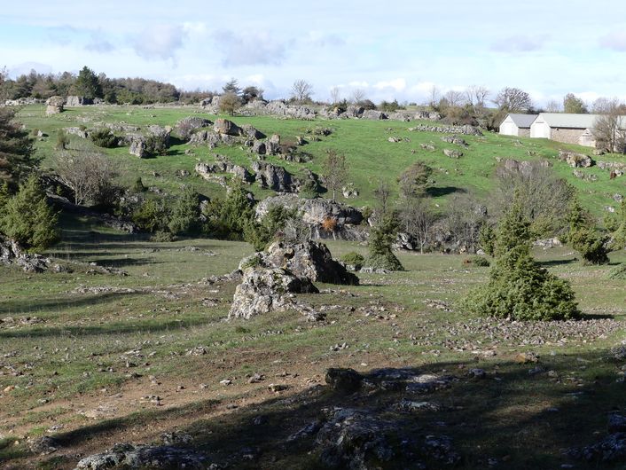
Dargilan
2 points of interest
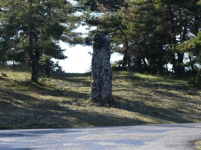
Pierre des Trois Évêques - nathalie.thomas  History
Three Bishops’ Stone
At the crossroads of the D39 and D139 is a standing stone topped by a stone cross. Today the monument symbolises the exact spot where three departments meet: Aveyron, Gard and Lozère. At the times the cross was erected, it indicated the limits of the dioceses of Vabres in the Aveyron, Nîmes in the Gard and Mende in the Lozère.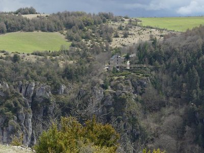
Dargilan - nathalie.thomas HistoryEdouard-Alfred Martel
The marvellous caves in this area were discovered thanks to the efforts of one man, Edouard-Alfred Martel. This caving pioneer notably discovered Dargilan Cave and the Abîme de Bramabiau in 1888, as well as Aven Armand cave in 1897. He fought to make them better known through articles and conferences. According to Jacques Fountes “Martel was a combination of tourist office and travel agency all by himself. It is not an exaggeration to say that Martel lifted Lozère out of anonymity.” He was convinced that tourism could create economic growth in the Grands Causses region.
Description
Take the road towards Dargilan for 500 m.
1) At the water reservoir, leave the road and take a track just below it, on the left. The track runs past the farm of Les Brousses.
2) Ignore the left-hand track and continue straight ahead on the track that goes through pine plantations before coming out onto the D 47c road, the border between the Gard and Lozère departments.
3) Turn right onto the road and walk to the crossroads of the Croix des Trois Evêques (Three Bishops’ Cross).
4) At the crossroads, continue straight ahead on the D139 towards Dargilan.
5) In the hamlet of Dargilan, take the track on the right for 800 m. At the bottom of the slope, leave the track and take a path on the left that runs along the ledge of the Causse Noir until Sérigas.
- Departure : Sérigas (Causse Noir plateau)
- Arrival : Sérigas (Causse Noir plateau)
- Towns crossed : Meyrueis
Forecast
Altimetric profile
Recommandations
NB: On this walk, you will need to close several barriers behind you.
Make sure your equipment is appropriate for the day’s weather conditions. Remember that the weather changes quickly in the mountains. Take enough water, wear sturdy shoes and put on a hat.
Information desks

Tourism'house and national Parc at Florac
Place de l'ancienne gare, N106, 48400 Florac-trois-rivières
This office is part of the National Park's associated tourist-information network, whose mission is to provide information on, and raise awareness of, the sites and events as well as the rules that must be observed in the National Park's central zone.
On site: exhibitions, video projections, events and shop Open year-round
Access and parking
From Meyrueis, drive onto the Causse Noir via the D 39 towards Sérigas
Parking :
Calculateur d'itinéraire Lio
Utilisez le calculateur liO pour organiser votre trajet en région Occitanie.
Autres régions
Calculez votre itinéraire en Auvergne Rhône Alpes sur Oùra
Biodiversité autour de l'itinéraire
Source


Report a problem or an error
If you have found an error on this page or if you have noticed any problems during your hike, please report them to us here: