
Puech d'Alluech
3 points of interest
Doline - © OTGCC nc  History
Woods and deforestation
Afforestation and deforestation seem to be the fate of the Causse landscape. In the Neolithic, the first farmer-shepherds settled on the fertile areas of the plateaux, which were covered by beech and oak forest at the time. This lead to the forest being cleared for sheep pasture and for farmland. With demographic expansion, deforestation accelerated and the cultivated areas expanded. Subsequently, the local potteries, lime kilns and, later, mines brought about a new wave of deforestation to satisfy their need for wood.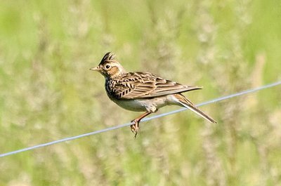
Alouette des champs - © Pixabay  Fauna
FaunaLarks !
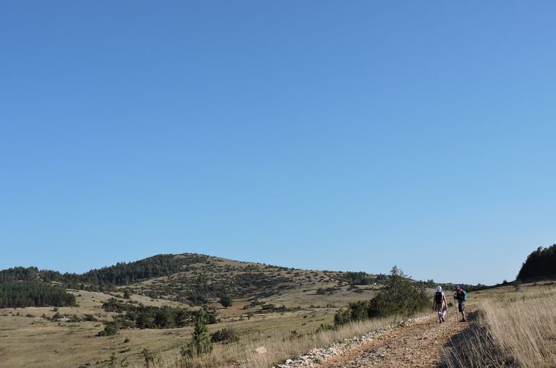
There are plenty of larks at Puech d’Alluech! Chirping away in the bushes, cheeping in the fields – real chatterboxes! The greater short-toed lark that comes back from Africa in the spring; or the sedentary woodlark; or else the skylark, which appreciates open spaces. Topped by its relay mast, the Puech d’Alluech dominates the surroundings from its 1,151 m. It is a former volcano. Climb to the top for views over the mountains of the Aubrac, the Truc de Fortunio summit in Margeride, and the Mont Lozère massif. Turn south to see Mont Aigoual crowned by its relay masts.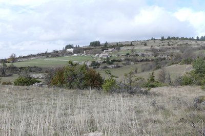
Cabrières - Nathalie Thomas HistoryCamin Ferrat
Cabrières means “place inhabited by goats”. Located on the Languedoc draille (drovers’ road) and the Camin Ferrat, Cabrières was long uninhabited but is now home to one family. Camin Ferrat comes from the Occitan camin, track, and férra, oxshoe. Paved or cobbled tracks needed draft and pack animals to be shod. This ancient path is parallel to the draille, which is even older. For safety reasons, pedestrians, flocks and carts used to use different routes. The Camin Ferrat crosses the Causse and goes down to Meyrueis.
Description
From the car park, take the track and, at the intersection, turn right. Your hike starts on the Causse Méjean circuit (yellow and red waymarks). Follow this path through the rolling countryside part to the foot of Puech d’Alluech.
- Just before you get to the road, take the track on the left that goes uphill to the top of Puech d’Alluech (there-and-back 2.6 km). On your return, take the road on the left for 150 m, then take the track on the left that cuts across and joins the road, to the hamlet of Chamblon.
- In Chamblon, pass below the sheepfold, go uphill towards the house, continue straight ahead to cut across the road and take the path opposite that joins the road to Prunets.
- In Prunets, leave the GR®60 trail that veers off to the right, and instead take the track on the left that passes below the houses. The track climbs; at the top, leave it on the right to go back down towards the trees. You are walking around the Puech.
- At the crossroads, continue straight ahead and, as you arrive in the hamlet of Cabrières, walk around it on the left instead, alongside a large basin.
- After the hamlet of Cabrières, take the road that goes uphill on the left for 700 m.
- At the crossroads, take the track that runs alongside the telephone cable to return to your starting-point.
- Departure : 1 km from Mas St-Chély
- Arrival : 1 km from Mas St-Chély
- Towns crossed : Mas-Saint-Chély and Gorges du Tarn Causses
Forecast
Altimetric profile
Recommandations
You are advised not to bring dogs (flocks with guard dogs)
A walk that is accessible for everyone but with little shade. You cross several fences (gates or stiles): close them well. . Make sure your equipment is appropriate for the day’s weather conditions. Remember that the weather changes quickly in the mountains. Take enough water, wear sturdy shoes and put on a hat. Please close all gates and barriers behind you.
Information desks

Tourism office Cévennes Gorges du Tarn, Sainte-Enimie
village, 48210 Sainte-Enimie
This office is part of the National Park's associated tourist-information network, whose mission is to provide information on, and raise awareness of, the sites and events as well as the rules that must be observed in the National Park's central zone.

Tourism'house and national Parc at Florac
Place de l'ancienne gare, N106, 48400 Florac-trois-rivières
This office is part of the National Park's associated tourist-information network, whose mission is to provide information on, and raise awareness of, the sites and events as well as the rules that must be observed in the National Park's central zone.
On site: exhibitions, video projections, events and shop Open year-round
Transport
Bus stop: Mas-Saint-Chély
- Bus line 259 "Mende – Sainte-Enimie - Meyrueis”
https://lio.laregion.fr/
Access and parking
From Mas Saint-Chély drive towards Prunets/Chaldas. After 1 km, car park by the intersection with a track.
Parking :
Calculateur d'itinéraire Lio
Utilisez le calculateur liO pour organiser votre trajet en région Occitanie.
Autres régions
Calculez votre itinéraire en Auvergne Rhône Alpes sur Oùra
Biodiversité autour de l'itinéraire
Source


Report a problem or an error
If you have found an error on this page or if you have noticed any problems during your hike, please report them to us here: