
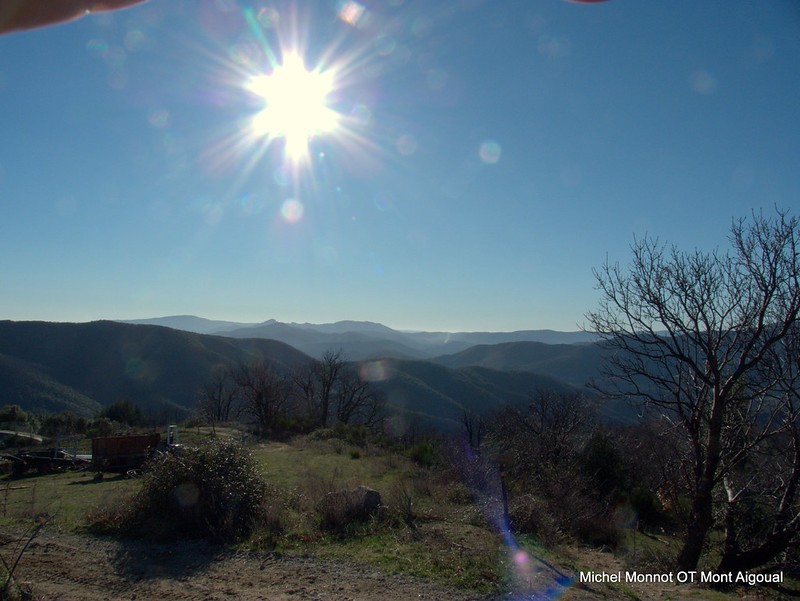
Col de Bès
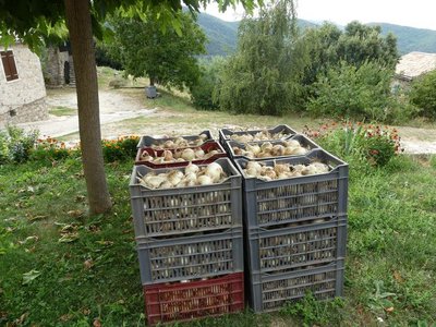
Gardens, crops – especially mild onions – orchards and flocks of sheep bear witness to the still active rural life in all seasons.
3 points of interest
Notre-Dame en fond - Michel Monnot  History
Notre-Dame-de-la-Rouvière
Notre-Dame-de-la-Rouvière (from rovière, an area planted with English oaks) is one of the few villages in the Protestant Cévennes that remained entirely Catholic during the Camisard War, despite acts of intimidation. In the early 17th century, a Huguenot leader, the Duke of Rohan, wanted to force Catholic communities to convert to Protestantism. He rounded up the notables of Saint-Martial, Saint-André-de-Majencoules and Notre-Dame-de-la-Rouvière to make them renounce their faith. Terrified, they accepted the Duke’s proposal but only on condition of a pact of "recobre" (redemption). The duke, unaware of the meaning of the word, signed the treaty.
After the Peace of Nîmes, the three communities thus returned to the bosom of the Catholic Church in accordance with the condition that they had imposed. (Ici en Cévennes, joint publication with the state school in Notre Dame de la Rouvière, 1994)
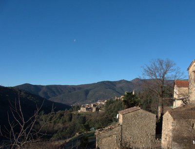
Le hameau du Puech sigal - Nathalie Thomas HistoryBelvédère of Le Puech Sigal
From the Puech Sigal belvedere, you have amazing views over the upper Hérault valley. The fact that the name Sigal is close to séguéla, Occitan for rye, suggests that rye was grown here. There are believed to have been Benedictine months in the area. The cobblestoned path (calade) leading via the great drovers’ road to the Col de l’Homme Mort pass makes this hypothesis plausible...
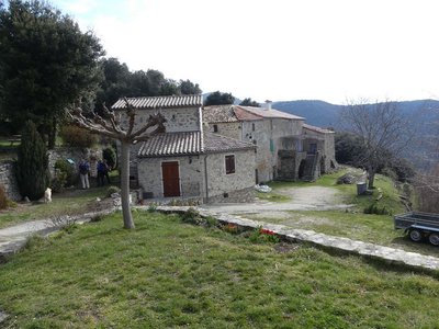
La culture de l'Oignon - Nathalie Thomas HistoryPuech Sigal
At Puech Sigal (from the Occitan for “rye”), the land has been farmed since the Middle Ages. Some believe that there were local Benedictine monks at the time. Certainly, many areas were cleared and enhanced by monks during that period. This sunny belvedere gives superb views onto the Aigoual massif and the upper Hérault valley. Around the egde of this hamlet with its granite houses are vegetable gardens, meadows and orchards, giving the site the feel of an island amidst a sea of holm oaks and chestnut trees.
Description
Signposts will guide you all along this route, as well as yellow painted waymarks. In the description below, the signposted place names and/or directions are given in bold italics between quotation marks :
From the the car park "Notre Dame de La Rouvière", , walk towards
- "Col de la Tribale" along the D152, at the start. At the Col, take the path on the left to "col de Bès".
- At “col de Bès”, in the gap across the ridge, go to "Mas de Mourgues".
- At "Mas de Mourgues", head to “Valnières”
- At "Valnières", continue along the GR®6b trail toward “Puech Sigal”.
- At "Puech Sigal", continue toward "Orlut".
- At “Orlut” head down toward “NotreDame de La Rouvière”. Return to the parking area.
- Departure : Notre-Dame-de-la-Rouvière
- Arrival : Notre-Dame-de-la-Rouvière
- Towns crossed : Val-d'Aigoual and Saint-Martial
Forecast
Altimetric profile
Recommandations
Before committing yourself to a circuit, ensure that it is suitable for your activity level and ability. Remember that the weather changes quickly in the mountains. Take enough water.
Information desks

Tourism & national parc'house
Col de la Serreyrède, 30570 Val d'Aigoual
The Maison de l'Aigoual houses the tourism office Mont Aigoual Causses Cévennes and the Maison du Parc national. This visitor centre provides information on and raises awareness of the Cévennes National Park, its sites and events as well as the rules that must be observed in the National Park's central zone.
On site: changing exhibitions, video projections, Festival Nature events and shop Open year-round

Tourism office Mont Aigoual Causses Cévennes, Valleraugue
7 quartier des Horts, 30570 Valleraugue
This office is part of the National Park's associated tourist-information network, whose mission is to provide information on, and raise awareness of, the sites and events as well as the rules that must be observed in the National Park's central zone. : Open year-round
Transport
LiO is the regional public transport service of the Occitanie/ Pyrénées – Méditerranée region. It facilitates everyone’s movements by prioritising public transport. For more information, go to the lio Occitanie app or visit : https://www.mestrajets.lio.laregion.fr
(in term time)
Access and parking
At the bridge over the Hérault river, take the D986 towards Valleraugue, then the D323 to Notre-Dame-de-la-Rouvière.
Parking :
Calculateur d'itinéraire Lio
Utilisez le calculateur liO pour organiser votre trajet en région Occitanie.
Autres régions
Calculez votre itinéraire en Auvergne Rhône Alpes sur Oùra
Biodiversité autour de l'itinéraire
Source


Report a problem or an error
If you have found an error on this page or if you have noticed any problems during your hike, please report them to us here: