
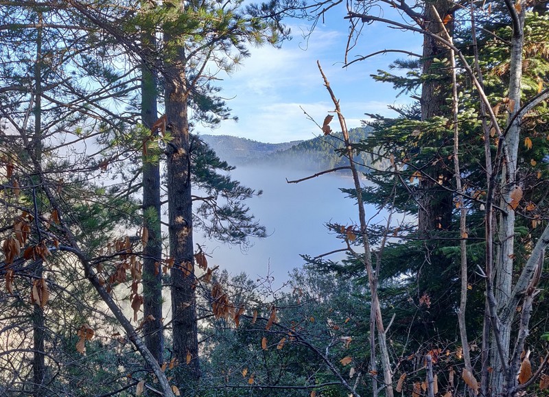
Valescure
A hike in a peaceful little valley that looks wild at first but has been shaped by human action. Explore a formerly bustling dwelling place, a heritage built stone by stone. The many low walls around the ruins of La Faysolle bear witness to the active life of the hamlet, where many families lived. The oven, clède and spring enabled them to exist in autarky. From the ridges, wide views open up over the landscapes of the surrounding mountains.
7 points of interest
Tancat sur le ruisseau de Vallongue - Béatrice Galzin  Water
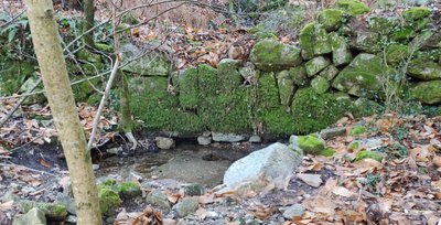
WaterHydraulic heritage
In the valley of Valescure, an integration project for the unemployed and socially disadvantaged restored over 450 hydraulic engineering structures, supervised by various institutional and scientific partners. This project helps you understand the importance of hydraulic dams in the Cévennes: tancats (small thresholds or dams built across the waterway to recover any sediment carried by rainwater runoff), païssières (thresholds, little dams), béals (irrigation channels), trancats (rainwater drains carved into the rock or constructed uphill of buildings to channel rainwater and protect the buildings).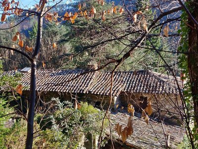
Château de Valescure - Béatrice Galzin  History
Château de Valescure
The Château de Valescure, a private property owned by the French Forestry Office (ONF) since 1922, must have been built in the 15th century by Bertrand de Valescure, whose descendants were ennobled and distinguished themselves during the French Wars of Religion. They held the seigneury of Valescure until 1618, when by alliance it became the Tourtoulon family’s, which held it until the French Revolution. Long empty, in 1941 the château came back to life when it became an advance post of the Chantiers de jeunesse (a paramilitary youth institution of the Vichy regime). Later in the Second World War, Resistance fighters found refuge here. In 1985, the ONF began renting it out.
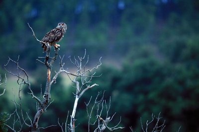
La chouette chevêche - Descamps R  Flora
FloraA preserved valley
The Vallée Obscure, a natural zone of ecological, faunal and floral interest, has a significant heritage of rare species, such as the nightjar, little owl, bee-eater, raven and honey buzzard... As for flora, almost ten varieties of orchids have been identified. In spring, snapdragon is common on the rocky slopes. In the valley, there are also Atlas cedars and tall thujas, planted by the ONF in the 1950s.
 Water
WaterA stream under surveillance
The governmental research organisation CNRS has installed a hydrometric station here that measures the stream's water levels and flow rate. You can easily see the graduated vertical scale. This is complemented by a pressure probe connected to a data recording centre. This monitoring equipment is part of a series of stations in the Vallée Borgne. The data they record have shown the important role played by tancats (cf. Precious reserves) in regulating water flow. They also confirm how effective the various measures are that have been taken to rehabilitate these structures and maintain riverbank vegetation.
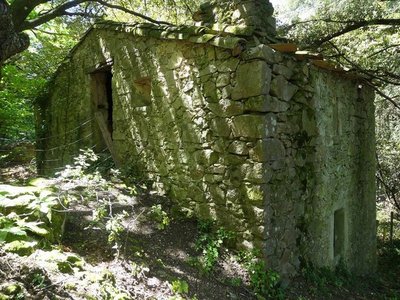
La Fayssolle - Nathalie Thomas HistoryThe ruins of La Fayssolle
The departmental archives preserve the historical traces of Mas de Faysolle in a mariage act from 20 November 1554. Notary records mention the wedding of Jeanne Mercoiret with Antoine Pascal.
- Water
Vital arteries
Besals or béals are channels that have been built to carry and distribute water where it is needed: plots of cultivated land, gardens, mills, etc. They were usually created and maintained collectively. The distribution of water to the various users was controlled by small sluice gates (esclafidors). These were opened and closed at precise times of day, which were decided according to customary law – and could be subject to disputes and legal proceedings.
- Water
Precious reserves
To store water, especially during dry periods, locals have dug and built a great number of gorgas. These reservoirs supplied gardens, fields and mills. They were fed by springs or streams, whose water was diverted by a paissièira and then transported by a besal (béal).
Description
Signposts will guide you all along this route, as well as yellow painted waymarks. In the description below, the signposted place names and/or directions are given in bold italics between quotation marks :
Starting from the car park "PEYROLLES - Serre de Clayrac", turn right onto the D road and, 200m.
- At "La Planque", turn left downhill onto the small road towards
- "Pont de l'Arénas", then continue along the road towards
- “Vallée Obscure” and
- “Château de Vallée Obscure”. Take the path on the left below the château, then continue to
- "La Jasse", then turn left towards
- “Le Gué”. From there, continue left and climb the steep path — carefully follow the yellow waymarks through the woodland. Once on the ridge, turn right to reach
- “La Jasse d’Almiras”. Follow the ridge to
- "La Rouvière", then descend towards “Le Gué” (5) and “Château de Vallée Obscure” (4). Continue along the small road to “Pont de l’Arénas” (2), then turn left towards “La Planque” (1) to return to the main road and the starting car park.
- Departure : Car park in bend in the road at La Planque - Peyrolles
- Arrival : Car park in bend in the road at La Planque - Peyrolles
- Towns crossed : Peyrolles and Saint-Jean-du-Gard
Forecast
Altimetric profile
Recommandations
Before committing yourself to a circuit, ensure that it is suitable for your activity level and ability : the descent after the ruins of La Faysolle is steep – this walk is reserved for experienced hikers. Remember that the weather changes quickly in the mountains. Take enough water. Please close all gates and barriers behind you. Caution : it is best not to attempt this walk during heavy rain.
Information desks

Tourism & national parc'house
Col de la Serreyrède, 30570 Val d'Aigoual
The Maison de l'Aigoual houses the tourism office Mont Aigoual Causses Cévennes and the Maison du Parc national. This visitor centre provides information on and raises awareness of the Cévennes National Park, its sites and events as well as the rules that must be observed in the National Park's central zone.
On site: changing exhibitions, video projections, Festival Nature events and shop Open year-round

Tourism office Mont Aigoual Causses Cévennes, Saint-André-de-Valborgne
les quais, 30940 Saint-André-de-Valborgne
This office is part of the National Park's associated tourist-information network, whose mission is to provide information on, and raise awareness of, the sites and events as well as the rules that must be observed in the National Park's central zone.
Transport
LiO is the regional public transport service of the Occitanie/ Pyrénées – Méditerranée region. It facilitates everyone’s movements by prioritising public transport. For more information, go to the lio Occitanie app or visit : https://www.mestrajets.lio.laregion.fr
Access and parking
From St-Jean du Gard on the D907 towards Florac through the Vallée Borgne, park at "La Planque" 800m further on, just after the bus shelter on the left.
Parking :
Calculateur d'itinéraire Lio
Utilisez le calculateur liO pour organiser votre trajet en région Occitanie.
Autres régions
Calculez votre itinéraire en Auvergne Rhône Alpes sur Oùra
Biodiversité autour de l'itinéraire
Source


Report a problem or an error
If you have found an error on this page or if you have noticed any problems during your hike, please report them to us here: