
Le Soult
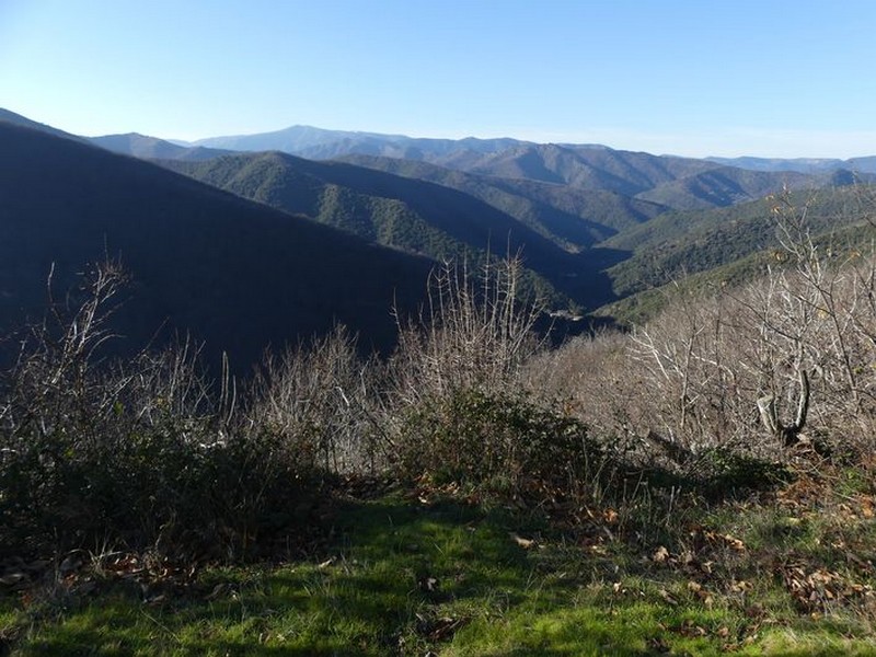
Le Soult path, from the old French word for spring, goes deep into the woods that overlook the village of L'Estréchure. It passes close to the Liron Massif and has viewpoints at over 750 m of altitude. Fir, pine, oak and especially sweet chestnut trees make up a typical local forest.
2 points of interest
Vue sur l'Estréchure - Nathalie Thomas  History
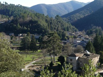
Château de L’Hom
Originally, the name of L'Hom indicates that an elm tree – the tree of justice – was planted outside the building. The massive square building is first mentioned in 1405. It has had a long painful history, emblematic of the Wars of Religion. The château was home to a garrison until 1767, when it was bought a family of industrialists, the Teissonnières. In the summer of 1944, it was the HQ of the general staff of the French Forces of the Interior (united Resistance units) of the Gard and lower Lozère, under the authority of Commandant Audibert.
The association L’Enfance Ouvrière subsequently bought it to turn it into a holiday colony. It is now a campsite.
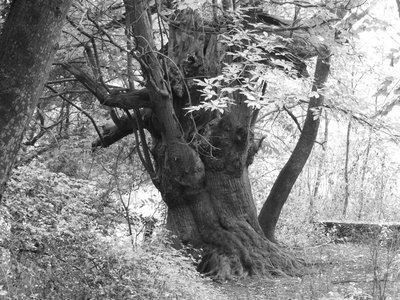
Châtaignier greffé - Béatrice Galzin  Natural environment
The sweet chestnut tree
In the old days, chestnut groves were veritable orchards. The trees were pruned and grafted to optimise yield. Different varieties were cultivated – about a hundred have been inventoried in the Cévennes alone – for their ability to adapt to the different soils or climates and for their different uses too: as well as providing food, the sweet chestnut tree supplies rot-proof wood which is used in furniture, beams, wooden floors. People still make ganivelles, rolls of stakes connected by steel wire. Along this path you will see a lot of chestnut trees with pollard heads, which is a sign that they were regularly pruned to use the young wood.
Description
Signposts will guide you all along this route. In the description below, the signposted place names and/or directions are given in bold italics between quotation marks :
On the village square, from the signpost “L’Estréchure” walk towards
- " L'Aubarède",
- “Boisserolle”. Walk around the campsite on the river bank (careful during strong rain).
- At the signpost “Château de L’Hom”, walk on the path that goes uphill opposite the château. The path climbs to a forestry track. Turn left onto it and go uphill on hairpin bends to a tarred road. Turn right onto the road and go downhill to the signpost
- “La Bécédelle”, then
- "L'Hermet". At marker 730, behind the former road mender’s shelter, descend towards "L'Estréchure" via “Boisserolle” (2) and "L'Aubarède"(1).
- Departure : L’Estréchure
- Arrival : L’Estréchure
- Towns crossed : L'Estréchure, Saumane, and Les Plantiers
Forecast
Altimetric profile
Recommandations
Caution: do not attempt this path after strong rain or during flooding.
Before committing yourself to a circuit, ensure that it is suitable for your activity level and ability. Remember that the weather changes quickly in the mountains. Take enough water.
Information desks

Tourism & national parc'house
Col de la Serreyrède, 30570 Val d'Aigoual
The Maison de l'Aigoual houses the tourism office Mont Aigoual Causses Cévennes and the Maison du Parc national. This visitor centre provides information on and raises awareness of the Cévennes National Park, its sites and events as well as the rules that must be observed in the National Park's central zone.
On site: changing exhibitions, video projections, Festival Nature events and shop Open year-round

Tourism office Mont Aigoual Causses Cévennes, Saint-André-de-Valborgne
les quais, 30940 Saint-André-de-Valborgne
This office is part of the National Park's associated tourist-information network, whose mission is to provide information on, and raise awareness of, the sites and events as well as the rules that must be observed in the National Park's central zone.
Transport
This hike is accessible by public transport.
To consult the updated schedules and plan your trip, use the route calculator below by entering the arrival stop: L'ESTRÉCHURE - Temple.
Access and parking
From St-André de Valborgne, take the D 907 towards St-Jean du Gard, through the village of Saumane. At L’Estréchure, use the car park in the village.
Parking :
Calculateur d'itinéraire Lio
Utilisez le calculateur liO pour organiser votre trajet en région Occitanie.
Autres régions
Calculez votre itinéraire en Auvergne Rhône Alpes sur Oùra
Biodiversité autour de l'itinéraire
Source


Report a problem or an error
If you have found an error on this page or if you have noticed any problems during your hike, please report them to us here: