
Château du Tournel, #10
Explore Lozerette, Mas d'Orcières and the Château du Tournel as your legs see fit. The uphill sections will hone your calf muscles and the magnificent panoramic views will fill your eyes. A large-scale adventure!
9 points of interest
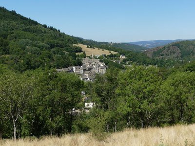
Bagnols-les-Bains - © Nathalie Thomas  History
Bagnols-les-Bains
Located close to the springs of the Lot, Bagnols-les-Bains has been favoured since Roman times for relaxing and getting back in shape. At an altitude of 900 m, this people-friendly health and spa resort has a hot spring, which gushes out of the mountain at a temperature of 41.5°C. It is a place for recharging your batteries surrounded by a protected natural environment, alternating outdoor activities and wellness treatments.
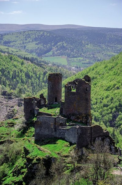
Château de Saint-Julien-du-Tournel - © Guy Grégoire  Architecture
One-road village
Marker 3
Gradually, the village re-established itself alongside the cart track that crossed the rocky spur and made trade possible, taking on the appearance of a “one-road village”. The track was paved with schist in places and followed the Lot valley to the neighbouring parishes and hamlets. The houses are arranged in a crown shape; their gable ends face out over the cliff. They are separated by enclosed gardens and small squares of sorts. These block-like houses – large and austere two-storey buildings – only have very few openings that always face south and are built to the same model: narrow slits with a simple inward splay, topped by a lintel.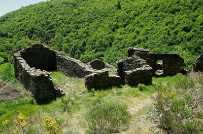
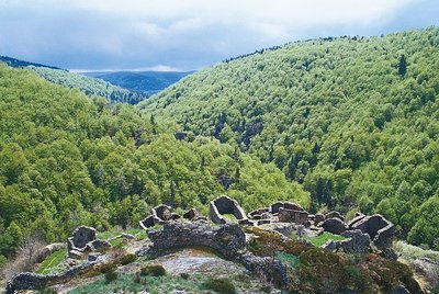
Ruines - © Brigitte Mathieu ArchitectureEstablishing the original village
The first village was built at the foot of the castle, on the narrow strip of the ridge between the castle and the block of rock that closes off the spur to the south. Thus protected by its inaccessibility, the village was never surrounded by an internal rampart. Its buildings can still be made out in some places, where the rock is shaped into anchorage points, and consisted of small houses built in parallel to the rock faces so as integrate them in the construction. This original accommodation was abandoned in the 13th century, badly served by its inacccessibility and the strong winds buffeting it. The houses were levelled off, their walls becoming terrace walls.
@ Olivier Prohin HistoryDefensive choices
Marker 2
In the 11th century, the King's authority was declining. Secular land-owning lords built fortresses to protect their assets and the people for whom they were responsible. The castrum or castle of Le Tournel was built at an altitude of 1,080 m, surrounded by a loop in the river Lot that is impossible to skirt. It occupies a rocky spur surrounded by sheer drops on all sides except the north. The vertical rock faces of the east and west sides make accessing the castle extremely dangerous. The site itself was the mainstay of the castle's defences, and enabled it to dominate and survey the Lot valley.
 Geology
Schist: bedrock and material
Marker 1
At Le Tournel, mica schist is ever-present. Between 220 and 200 million BC, when the Hercynian mountain chain emerged, rock was dragged into the depths by folding and subjected to high temperatures and pressure, which transformed it into schist and mica schist. These finely foliated rocks are made of quartz and mica, and break off in slabs that resist the cold, water and frost, making them excellent construction materials. They provided the raw materials for building both castle and village. Several quarries are still in use locally and supply wall, flooring and roofing materials.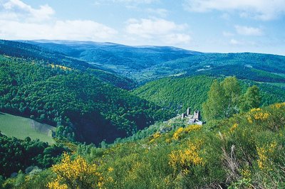
Vue sur le mont Lozère et sur le château du Tournel - @ Guy Grégoire  Landscape
Panorama
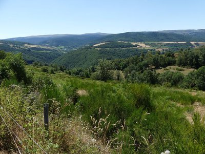
Scots Pines, which have replaced oaks on limestone soils and beech on siliceous soils, cover vast areas. With birches, they are the first to invade abandoned farm land. As a result of agricultural decline, vast heaths of broom – which can live on poor soils – have formed. They are periodically subjected to controlled burns by farmers. This landscape evolves over time, and according to natural and human factors.
- Landscape
Panorama
Marker 10
From this high point (above which short-toed snake eagles are often seen), the site of Le Tournel on the rocky spur dominating the Lot Valley, showcases all its strategic power. The surrounding landscape was slowly shaped by human activity, the dispersed settlements favouring the human hold over nature. Mont Lozère’s denuded rounded tops are maintained by the flocks of transhumant sheep that graze here. Crops take up the fertile dips near villages, where farming can be mechanised. 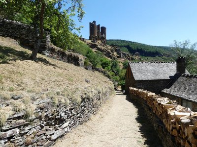
Le Tournel - © Nathalie Thomas HistoryChâteau du Tournel
A discovery path leads visitors through the history of the château and the configuration of the former village, today in ruins. Nobody knows what noble knight long ago chose this hill bordered by gullies to build his castrum. The first homage to Le Tournel was paid in 1219, by Odilon Guérin to the bishop and lord of Mende, Guillaume de Peyre.
Montée sur Malmmont - Nathalie Thomas  Flora
FloraFlora
Along the paths, many flowers tell us that the sloping bedrock under our feet is schist (slate). The star-of-Bethlehem freshens up for 11 a.m.; the foxgloves raise their purple bell-shaped flowers; tufts of sheep’s fescue seem to have escaped from a summer pasture; biting stonecrop delights in the sunshine; yarrow hems the path in lace; the wild thyme you step on releases its fragrance...
Description
Signposts will guide you all along this route: follow the waymarks for trail #10
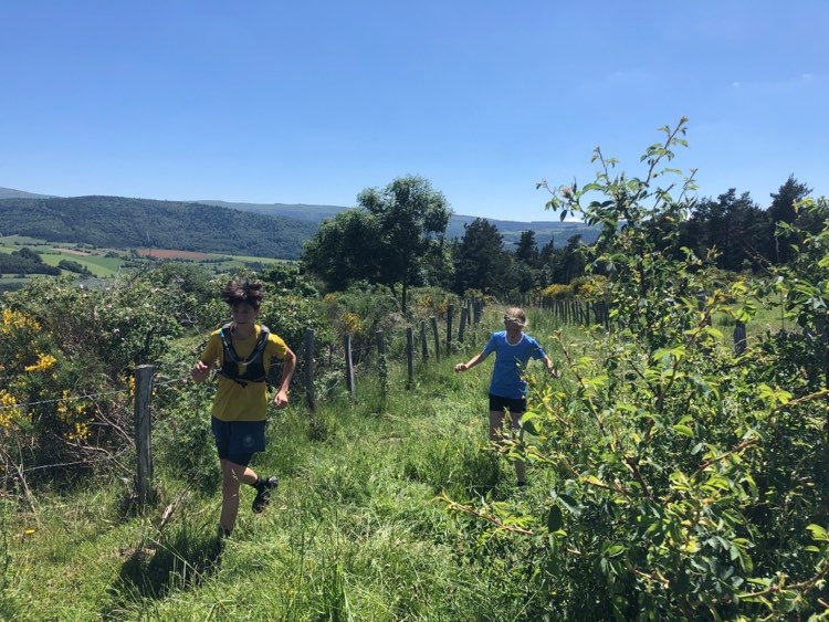
The circuit starts with a fairly steep but pleasant uphill section, on a pretty path in the forest, leading to the typical Mont Lozère village of Oultet, with its blizzard bell-tower, stone houses and old bread oven. Once you have crossed the village, you start again on a magnificent path, initially between meadows and forest, with the river nearby (the ground is often slippery). Then you start a beautiful climb with superb views throughout. This takes you to Lozerette, a village that rarely leave visitors indifferent. Here you take a track that descends gently to the hamlets of Cheyroux and Le Mas. A few steps on tar to reach Orcières, then a great, almost flat section on a path between forest and pastureland. A slightly steep descent takes you to the Lot river, which you cross to begin the climb to the Château du Tournel. Take the time to visit the castle before getting started on the climb to Malmont, which is very pretty but steep. Once you have arrived at the road and the hamlet, you’ll have finished climbing! A great zigzagging path with handsome views of the castle takes you down to Saint-Julien-du-Tournel. Go through the village to reach a path that goes back downhill to the starting-point (there is one last hump – prepare yourself mentally!).
Signposts will guide you all along this route, as well as yellow painted waymarks. In the description below, the signposted place names and/or directions are given in bold italics between quotation marks:
At "Bagnols-les-Bains » ", go to « Oultet » via :
- « Avenue de la Gare »,
- « Route de la Loubière »,
- « La Destourbe »,
- « La Montagnac »,
- « Lou Peyrou » .
- À « Oultet » continuer sur
- « Lozerette », puis direction
- « Les Quincos »,
- « Village »,
- « Orcières » . Descendre sur « Château du Tournel » par /
- « Bois Dario »,
- « Le Tournel »,
- « Sous le Château ».
- Au « Château du Tournel » monter au village de Malmont par
- « Les Parets »,
- « La Combe », puis descendre à « Saint-Julien du Tournel » par
- « Lavignolles » (attention traversée de route).
- À « Saint-Julien du Tournel » retour à « Bagnols-les-Bains » par
- « La Dabalade »,
- « Lou Mapas »,
- « La Destourbe », « Route de la Loubière », « Avenue de la Gare ».
This hike is taken from the guidebook Mont Lozère – Pays des sources, de la montagne du Goulet aux gorges du Bramont, published by the Pôle de pleine nature du Mont Lozère.
- Departure : Bagnols-les-Bains
- Arrival : Bagnols-les-Bains
- Towns crossed : Mont Lozère et Goulet
Forecast
Altimetric profile
Recommandations
Before committing yourself to a circuit, ensure that it is suitable for your activity level and ability. Remember that the weather changes quickly in the mountains. Please close all gates and barriers behind you. Stay on the marked path.
Information desks

Office de tourisme Des Cévennes au mont Lozère
le Quai, 48220 Le Pont de Montvert sud mont-Lozère

Tourism office Mont-Lozère, Bagnols-les-Bains
avenue de la gare, 48190 Bagnols-les-Bains Mont-Lozere et Goulet
This office is part of the National Park's associated tourist-information network, whose mission is to provide information on, and raise awareness of, the sites and events as well as the rules that must be observed in the National Park's central zone. Open from mid-April to late September
Access and parking
From Le Bleymard, on the D901.
From Mende, towards Badaroux on the N88, then to Ste-Hélène / Bagnols-les-Bains on the D901.
Parking :
Calculateur d'itinéraire Lio
Utilisez le calculateur liO pour organiser votre trajet en région Occitanie.
Autres régions
Calculez votre itinéraire en Auvergne Rhône Alpes sur Oùra
Biodiversité autour de l'itinéraire
Source


Report a problem or an error
If you have found an error on this page or if you have noticed any problems during your hike, please report them to us here: