3. From Le Vigan to Mont Aigoual – Day 3
10 points of interest

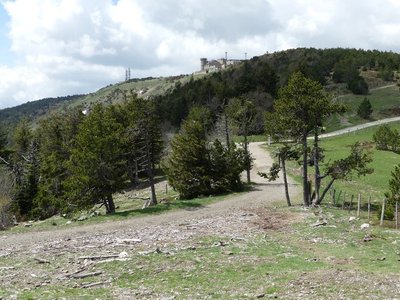
 Natural environment
Irregular forest
This tree population consists of trees of very different diameters, ages and heights. Species are mixed: mainly pine, but also beech, rowan and whitebeam. This is an irregular mature forest, a forestry dynamic that is interesting for several reasons: it creates permanent forest cover; resistance to soil erosion; better resilience against storms or parasite attacks; regular production, etc. In the small clearing to the left of the path, the sunlight now penetrating to the forest floor has made natural regeneration of beech and fir possible, ensuring the renewal of the forest.
 Know-how
Productive forest
Marker 2
Another method of creating a durable forest cover is to plant or sow. This work is carried out either on bare soil or among existing tree stands. The Aigoual reforestation programme was a gigantic effort, requiring 900,000 days of work, the planting of 60 million conifers and 7 million deciduous trees, and sowing of 38 tonnes of seeds. Spruces and pines, which can be planted in full sunlight and grow quite quickly, were widely used. Under the forest canopy, preference was given to firs. History
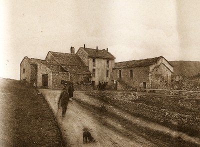
From beech copse to mature plantation
Marker 1
Around 1850, before reforestation began, the inhabitants of the Cevennes were using local wood resources on a massive scale for heating and in industry, especially spinning-mills. Gradually, only a few beech copses remained, which were cut every 25 to 40 years. Grazing by tens of thousands of sheep further reduced the herbaceous plant cover. Much weakened, the plant cover was then also subjected to heavy precipitation, the so-called Cevenol episodes. It is against this backdrop that the lengthy work of the foresters began. To reduce risks and establish a lasting forest cover, the first technique was to make use of what was already present by converting the disused copses into mature plantations.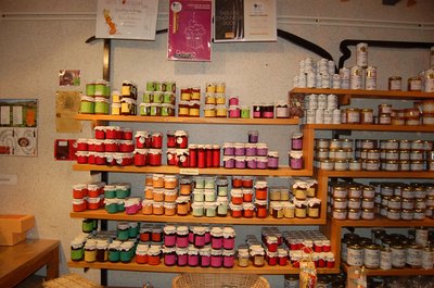
Boutique des producteurs - © Nathalie Thomas AgricultureThe association "Terres d'Aigoual"
The Cévennes National Park rents out part of the building to the association, enabling local farmers to sell their products directly to the public. The association brings together farmers who wish to promote what they produce and share their know-how. They also enjoy sharing their vision of farming- high quality produce and products,
- human-sized farms,
- mutual aid.
Come and discover their products!
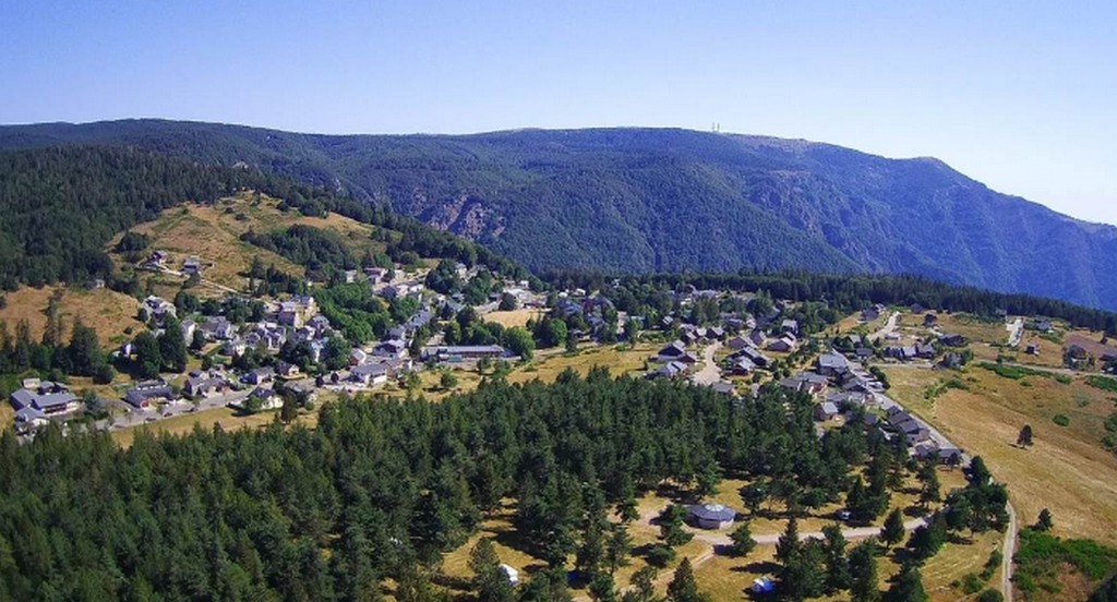
Maison forestière de la Serreyrède - © Jacques de Joly AgricultureLa Serreyrède
Before 1861, the house at the Col de la Serreyrède was inhabited by two families of farmers. They owned some livestock and had a vegetable garden, whose terraces you can still see above the La Caumette track. From 1861 on, the farm was inhabited by a forest ranger. It was only bought by the state body Eaux et Forêts in 1883, to be turned into a forester's house. It became one of Georges Fabre's headquarters during the reforestation of the Aigoual massif. The Cévennes National Park, tourism office and Terres d'Aigoual growers have now joined forces to revive La Serreyrède with the help of the Communauté de Communes Causses Aigoual Cévennes – Terres solidaires.
© R. Descamps  Water
WaterTwo waterfalls... Find the Hérault!
Faced with these two threads of rivers, geographers hesitated between flow rate and length, and finally designated the waterway below you the Hérault while the waterfall opposite you was named the Dauphine. Two remarkable plants can be seen here: orpine (Hylotelephium telephium) with its succulent leaves, a food source for the larvae of a butterfly that is in strong decline all over the Massif central: the Apollo (which may be seen from mid-July to mid-August); and Prost saxifrage, which forms regular cushions that are easy to recognise. They enable it better to store what little water is available. It is a plant endemic to the Cévennes.
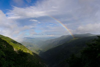
Vue plongeante sur la vallée de l'Hérault - Arnaud.Bouissou WaterRiver capture
Violent precipitation and the steep gradient of Mediterranean torrents cause regressive (i.e. upstream) erosion of the valleys through which they flow. This erosion can invert the sense of flow and thus “capture” for the Mediterranean a waterway that had, until then, flowed into the Atlantic. One example is the Hérault with its waterfalls, the capture being located at the falls. The Hérault and the Dauphine brook used to flow via L'Espérou into the Dourbie... River pebbles found around the village by geologists attest to the existence of a waterway in the past.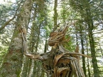
Gardien des bois (Raphaël Daynié) - © Filature du Mazel  Flora
FloraGuardian of the Woods (Raphaël Daynié)
The Guardian evokes a possible connection, a dream connection, in which humans consider themselves a part of nature, developing in close union with their environment. This Guardian of the Woods overlooking the Aigoual valley was built with natural materials found on site, and gently touches a tree that is still alive.
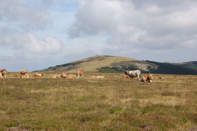
Troupeau au sommet de l'Aigoual - © Nathalie Thomas FloraSummit of Mont Aigoual
At an altitude of 1,565 m, the climate is harsh: weather conditions are the same as they would be at 2,000 m elsewhere, with only four “frost-free” months a year. Winds of above 60 kph blow on 265 days a year, and the average annual temperature is 4.8°C. Trees do not have enough time to complete their life cycle. Local plant formations are those of the montane zone: subalpine short-grass prairies.
Observatoire de l'Aigoual - nathalie.thomas HistoryThe meteorological observatory
Inaugurated in 1824, the meteorological observatory was built on the initiative of Georges Fabre, one of the pioneers of the reforestation of Mont Aigoual. His work with the botanist Charles Flahault enabled the creation of the arboretum of L’Hort de Dieu. The first meteorological data were gathered by agents from the French National Water and Forestry Commission. Since 1943, the observatory has been managed by the National Meteorological Office. It is France’s last mountain weather station that is inhabited year-round.
Description
Signposts will guide you all along this route. In the description below, the signposted place names and/or directions are given in bold italics between quotation marks :
- Starting from "HALLE DE L’ESPEROU", walk to "COL DE LA SERREYREDE " via “Carrefour”, “COL DE L’ESPEROU”, “Serre de Favatel”.
- At “COL DE LA SERREYREDE” go to “Virage de Barrot”, “L’Hérault” and “Valat de la Dauphine”.
- You can do a detour to the belvedere overlooking the Hérault waterfall (there-and-back).
- At “Valat de la Dauphine” climb to “STATION DE PRAT PEYROT” via “Stèle de C. Flahaut”.
- At “STATION DE PRAT PEYROT” walk to “Balcons de l’Aigoual” then to “LA DRAILHE” (GR®60).
- At “LA DRAILHE” continue on the GR®60 to “Les Antennes”, “Carrefour”, "SOMMET DE L’AIGOUAL”.
While at the summit of Mont Aigoual, do enjoy the Climatographe, a visitor centre specialising in raising awareness of climate evolution and climate change.
- Departure : L'Espérou
- Arrival : Mont Aigoual
- Towns crossed : Dourbies, Val-d'Aigoual, Saint-Sauveur-Camprieu, Meyrueis, and Bassurels
Forecast
Altimetric profile
Recommandations
Make sure your equipment is appropriate for the day’s weather conditions. Remember that the weather changes quickly in the mountains. Take enough water, wear sturdy shoes and put on a hat.
Information desks

Tourism office Cévennes and Navacelles, Le Vigan
Maison de pays, place du Marché, BP 21, 30120 Le Vigan
This office is part of the National Park's associated tourist-information network, whose mission is to provide information on, and raise awareness of, the sites and events as well as the rules that must be observed in the National Park's central zone.
Open year-round
Calculateur d'itinéraire Lio
Utilisez le calculateur liO pour organiser votre trajet en région Occitanie.
Autres régions
Calculez votre itinéraire en Auvergne Rhône Alpes sur Oùra
Biodiversité autour de l'itinéraire
Source

Report a problem or an error
If you have found an error on this page or if you have noticed any problems during your hike, please report them to us here: