4. From Le Vigan to Mont Aigoual – Day 4
The Maison des Cévennes was once an estate combining livestock farming with various crop cultures grown on terraces. In the late 19th century, with the large reforestation programme on Mont Aigoual, the estate became an arboretum associated with the forester’s house, which was subsequently restored as an inn.
6 points of interest
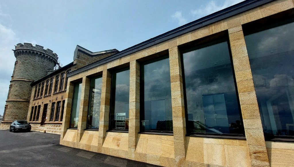
Observatoire de l'Aigoual - nathalie.thomas  History
The meteorological observatory
Inaugurated in 1824, the meteorological observatory was built on the initiative of Georges Fabre, one of the pioneers of the reforestation of Mont Aigoual. His work with the botanist Charles Flahault enabled the creation of the arboretum of L’Hort de Dieu. The first meteorological data were gathered by agents from the French National Water and Forestry Commission. Since 1943, the observatory has been managed by the National Meteorological Office. It is France’s last mountain weather station that is inhabited year-round.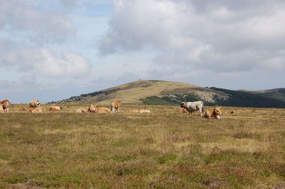
Troupeau au sommet de l'Aigoual - © Nathalie Thomas  Flora
FloraSummit of Mont Aigoual
At an altitude of 1,565 m, the climate is harsh: weather conditions are the same as they would be at 2,000 m elsewhere, with only four “frost-free” months a year. Winds of above 60 kph blow on 265 days a year, and the average annual temperature is 4.8°C. Trees do not have enough time to complete their life cycle. Local plant formations are those of the montane zone: subalpine short-grass prairies.
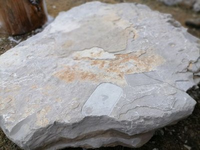
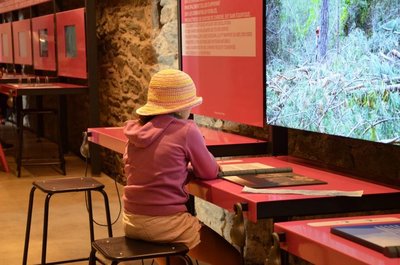
Archéosmart (Marc Limousin) - © Filature du Mazel  Archaeology
Archeosmart (Marc Limousin)
Smartphone imprints appear on the rocks: fossils of the present that will become mysterious in the future. This carved stone, like the cup-shaped marks and other rock art of the region, discloses history revealed in matter and resonates with Malraux’s phrase: “The future is a present given to us by the past”.
le Pole Nature de l'Aigoual - Béatrice Galzin  Natural environment
Pôle Nature 4 Saisons
The Pôle Nature 4 Saisons of the Aigoual massif offers outdoor activities in all seasons in the central zone of the Cévennes National Park, overlooked by the legendary summit of Mont Aigoual (1,570 m). Discover our network of trails on foot, on horseback, by bike, or else by mountain-bike or with a donkey, as the fancy takes you!
Children can explore the orienteering circuit or geocaching.
For the sportier among you we have laid out trail running circuits!
Prefer road biking? We have created circuits of varying difficulty levels so you can discover our villages and valleys.
Try not to make any noise! Wildlife enthusiasts can spot mouflons and other animals.
And if you would just like a gentle walk on the massif, the discovery trail “The cliffs of Mont Aigoual” is for you. There are various rest stops over its 4.5 km, with only 150 m in height difference.
We look forward to seeing you on our paths.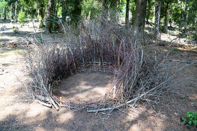
Nids (Céline Pialot) - © E. Fréget  Fauna
FaunaThe Nests (Céline Pialot)
Little by little, the bird makes its nest, its cosy nest, baby cocoon, wasps’ nest…
Like a bird, the artist has gathered materials offered by nature and has arranged them to build three nests, three refuges, three circles that reference perfection and invite meditation.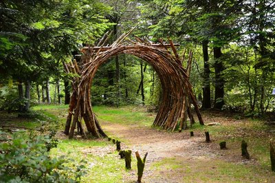
L'Orée (Yoann Crépin) - © Filature du Mazel  Know-how
On the Verge (Yoann Crépin)
A doorway to a circuit of art within the natural environment.
To fuse and interact with the environment and play with the seasons, time, light and weightlessness. To let humanity express itself through nature and nature express itself through humanity – a necessary interaction, a symbiotic interaction that inspires us to discover another world.
Description
Signposts will guide you all along this route. In the description below, the signposted place names and/or directions are given in bold italics between quotation marks :
- Starting at “SOMMET DE L’AIGOUAL”, walk to “STATION DE PRAT PEYROT” via “La Source”, “Le Pontet”, “La Baraquette”, “La Sapinière”, “Balcons de L’Aigoual – Parking” (GR®7 long-distance hiking path)
- At “STATION DE PRAT PEYROT” continue on the GR®7 to reach “COL DE LA SERREYDE” via “Le Fangas”
- At “COL DE LA SERREYREDE” go to “Les Mines” (GR®62),
- Fork onto the road to “le château”, “Carrefour” (yellow waymarks),
- At “Carrefour” walk to “La Bascule” (GR®60),
- At “La Bascule” turn left to “Route Dhombres”, then right to “Bois du MasMéjean” (yellow waymarks).
- From “Bois du MasMéjean” walk to “PUEYLONG” on the road,
- At “PUEYLONG” go to “Bois de Montals”, then to “Pont double”, “Le Camping”, “Col de la Broue”, “Col de la sablière” and “PUECHAGUT Maison des Cévennes” (GR®7).
- Departure : Mont Aigoual
- Arrival : Maison des Cévennes - Puechagut
- Towns crossed : Val-d'Aigoual, Bassurels, Meyrueis, Dourbies, Arphy, and Bréau-Mars
Forecast
Altimetric profile
Recommandations
Make sure your equipment is appropriate for the day’s weather conditions. Remember that the weather changes quickly in the mountains. Take enough water, wear sturdy shoes and put on a hat.
Information desks

Tourism office Cévennes and Navacelles, Le Vigan
Maison de pays, place du Marché, BP 21, 30120 Le Vigan
This office is part of the National Park's associated tourist-information network, whose mission is to provide information on, and raise awareness of, the sites and events as well as the rules that must be observed in the National Park's central zone.
Open year-round
Calculateur d'itinéraire Lio
Utilisez le calculateur liO pour organiser votre trajet en région Occitanie.
Autres régions
Calculez votre itinéraire en Auvergne Rhône Alpes sur Oùra
Biodiversité autour de l'itinéraire
Source

Report a problem or an error
If you have found an error on this page or if you have noticed any problems during your hike, please report them to us here: